Alert

Alerts

To see around
See more
Open
Close
Show
Show
Show
Show
Show
Show
Show
Show
Show
Show
Show

Oups... It would appear that Cirkwi does not have permission to use your location.

Presentation
Description
Map
Points of interest
Ratings and reviews
See around

Summer hike : Grand Beau Rocher

Summer hike : Grand Beau Rocher

Description

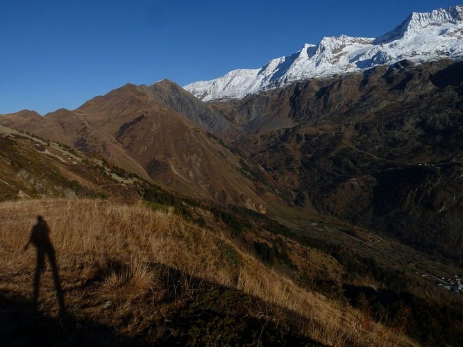
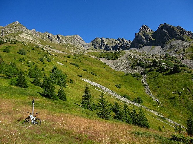
This route is an invitation to the wild. Once out of the vegetation cover you will enjoy breathtaking views of the mountains all along your progression on the eastern flank of the Rissiou massif.

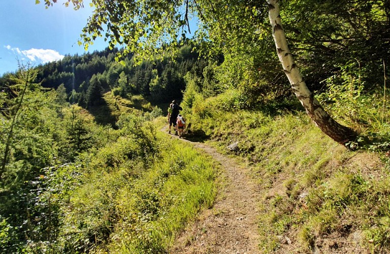
TO SEE ON THE ROUTE: In the heart of the forest, discover the vegetation of the undergrowth; the progressive change of the flora during the ascent to the Grand Beau Rocher.

NOTE: The return to Vaujany can be done by the same path or by a loop to La Villette. This hike requires a good physical condition and technical knowledge given the relief and the difference in altitude.

Technical Information

Walking
Difficulty
Medium
Duration
4h30mn
Dist.
8.5 km
Show more

Altimetric profile

Starting point

598 Départ Office de Tourisme de Vaujany , 38114   Vaujany
Lat : 45.157789Lng : 6.078987

Points of interest

image du object

"Grand Maison" history

In the 1970s, the first engineers arrived to survey the site and the possibilities. The worried inhabitants had many questions about what was to become of their village.The land offers the possibility of building the largest dam in France, which will be named Grand Maison after the big house that existed in this valley in the past. In the 1970s, the first engineers arrived to identify the site and the possibilities. The worried inhabitants had many questions about what was going to happen to their village. The land offered the possibility of building the largest dam in France, which was named Grand Maison after the big house that used to exist in this valley. Behind the Sabot pass, the Grand Maison lake, named after the big house that existed in the valley at the time, is now covered by water. The work will take place from 1980 to 1985, and will involve connecting the future Grand Maison reservoir to the Verney lake, via the Rissiou massif. To do this, a tunnel boring machine will work to dig a gallery in the heart of the massif. A pipe will be installed in this gallery. The titanic undertaking will bring in the "work mercenaries", people of different nationalities living side by side. Vaujany was transformed into a city where workers were welcomed. The Vaujaniats will participate in the work for some, others will work to feed them thanks to a canteen that will provide meals for all these people. It was the time of the Far West, as the dust replaced the quietness of this small rural village. A train will be built during the time of the work to bring the rubble from the mountain to the place (below) called today the Collet. You can see the tennis courts which are situated on a flat area, all the embankment of the dam was stored there changing the original structure of the place. At one time this place was called près des près and was marshy.

- Office de Tourisme Vaujany -
Consulter

Additional information

Contact

Phone : 04 76 80 72 37

Email : info@vaujany.com

Website : https://www.vaujany.com/fr/

Environments

Mountain location

Topo guides and map references

Topo guides references :
Lien carte OBP n°2 : 295

Map references :
IGN TOP 25 n°3335 EST

Updated by

Office de Tourisme de Vaujany - 12/06/2025
www.vaujany.com/fr/
Report a problem

Open period

From 01/05 to 31/10/2025.

Subject to favorable weather.

Reception complements

Advice :
- Check the weather conditions before you leave.
- In case of emergency call 112.
- Adapt your clothing to the activity: bring good walking shoes, a windbreaker and a cap ....
- Bring snacks and water.

Tricky passages

A wild route that is rarely used. NOTE: The return to Vaujany is by the same path or by a loop to La Villette. This hike requires a good physical condition and technical knowledge given the relief and the difference in altitude.

Guidebook with maps/step-by-step

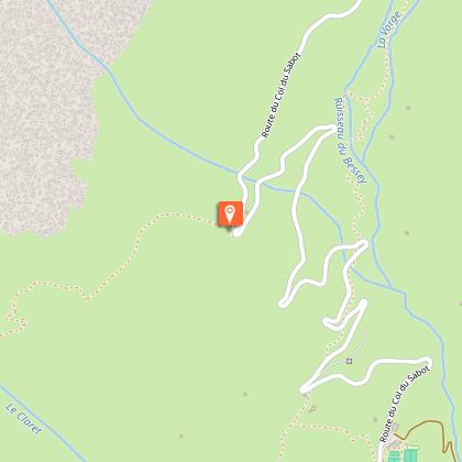
From the Tourist Office go towards the bakery, a little before on the right a lane rises, take it, climb steeply and always to the left until you see the sign indicating chemin de l'étendard. Turn left this time and you are on the path that starts out in the forest. The signs indicate the Collet. Continue to climb through the undergrowth, following the collet, then turn right to follow the direction of the col du sabot and the large beautiful rock. At point 1745, crossroads, go up through the blueberries to the viewpoint 1906m, take the same route to go down and continue towards the Col du Sabot. Descend by the ruins of Cressin, then join the road and descend by the road, until you find the yellow marked route and follow it. Always follow the yellow marked itinerary which alternates between road and path to reach La Villette, then the top of the village Le Rochas, then Vaujany.

Animals

Yes

Data author

5 Place du Téléphérique 38114 Vaujany France

Ratings and reviews

To see around
See more
Open
Close
Show
Show
Show
Show
Show
Show
Show
Show
Show
Show
Show
Caution!
We have no information on the difficulty of this circuit. You may encounter some surprises along the way. Before you go, please feel free to inquire more and take all necessary precautions. Have a good trip! 🌳🥾