Alert
Alerts
Snowshoeing up to the Buffère Refuge


Description
The ascent to the Refuge de Buffère is a classic snowshoeing route, well signposted and well used.
Park in the Névache Ville-Haute parking lot opposite the Tourist Office.
The hike begins on the snow-covered upper valley road for 2 km.
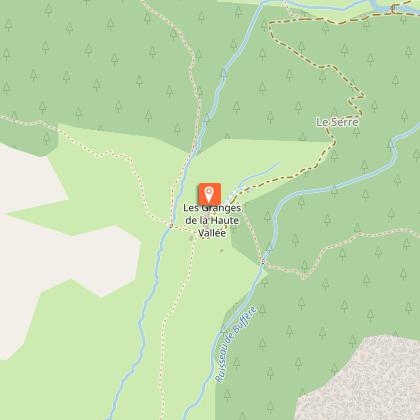
Once you've passed the two chapels of Notre Dame de Bon Secours and St Barbe, about 100 m further on, a sign on the left indicates the route to the Refuge de Buffère: cross the Clarée at the Pont du Rately, and the path climbs steeply through the larch forest to the Chalets du Serre. Don't be put off by the view from the top of this climb, which offers a fine view over the valley and the village of Névache.
You're now just fifteen minutes from the Buffère refuge.
Warning: in summer, this route leaves Névache on the right bank from the Outre bridge, on the left just after the church; it is avalanche-prone and totally inadvisable in winter.
Technical Information
Altimetric profile
Starting point
Points of interest


Date and time
- From 01/12/2026 to 30/04/2027
- From 01/12/2027 to 30/04/2028
Additional information
Updated by
Office de tourisme des Hautes Vallées - La Grave - La Clarée - L'Izoard - 10/03/2026
www.hautesvallees.com/la-grave/
Report a problem
Environments
Mountain location
Open period
From 01/12 to 30/04 daily.
Subject to favorable snow and weather conditions.
Contact
Phone : 04 92 20 02 20
Email : claree@hautesvallees.com
Website : https://www.hautesvallees.com/la-claree/
Facebook : https://www.facebook.com/ClareeTourisme
Location complements
From Briançon, take the N94 towards Montgenèvre, then the D994G towards Vallée de la Clarée for 20km to reach the village of Névache. Park at the Ville-Haute parking lot, the last hamlet in the village, at the end of the road in winter.
Topo guides and map references
Map references :
Top 25 IGN n° 3535 OT Nevache Mont Thabor
Reception complements
Find out when the refuge is open and remember to book.
Stay alert :
be aware of changing weather and snow conditions. The G.R. and other itineraries used in summer are not always the same as those used in winter - The right bank itinerary between Ville Haute and the Rately bridge is not recommended.
Stay alert to avalanche risks. Our mountain guides are there to guide you on this winter terrain, which they know well.
Due to the risk of avalanches, wearing complete safety equipment (avalanche transceiver, probe, and shovel) is strongly recommended.
Animals
Yes
Data author
