Alert
Alerts
To the Golèse refuge


Description
This mountain bike route to the Golèse refuge is an unmissable classic around Samoëns: a steady climb, an unspoilt natural setting and a panoramic reward at the finish. Perfect for a sporty outing with a real mountain atmosphere.
Departing from the Plan des Arches parking lot, above the village of Samoëns, this mountain bike route takes you to the heart of an unspoilt Alpine environment, between forests, streams and mountain pastures. Accessible but sporty, it's a great way to discover the Haut-Giffre valley from a different angle.
From the Plan des Arches parking lot, take a well-marked forest track that gradually rises towards the Col de la Golèse.
The climb begins in the forest, on rolling but steady terrain, ideal for finding your rhythm. Before long, you're skirting the Clévieux torrent, bringing coolness and a typically alpine soundscape.
As the climb progresses, the vegetation opens up, giving way to alpine pastures. The landscape becomes more open, offering superb views over the Giffre valley. The slope remains constant all the way to the pass, requiring a good physical effort but no major technical difficulties.
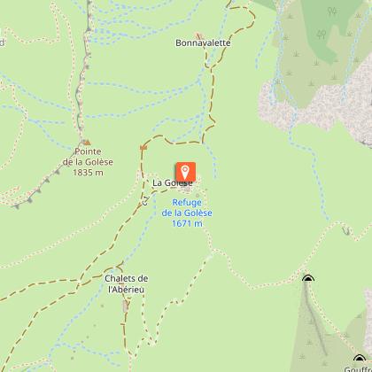
The arrival at the Refuge de la Golèse (altitude approx. 1650 m) is well worth the effort:
panoramic view of the Giffre valley to the south
opening onto the Manche valley (Morzine) on the north side
Short stop at the Golèse refuge
Located right in the heart of the alpine pastures, the refuge is an ideal place to take a break, have something to eat or even spend the night.
Warm, authentic atmosphere
Mountain cuisine (hot dishes, Savoyard specialties)
Accommodation in dormitory or room
It's also a major hiking crossroads, crossed by several major itineraries such as the GR5.
Technical Information
Altimetric profile
Starting point
Points of interest

Date and time
- From 01/05/2026 to 01/10/2026
- From 01/05/2027 to 01/10/2027
Additional information
Open period
From 01/05 to 01/10 daily.
Subject to favorable snow and weather conditions.
Tips
You can make a 12 km loop by continuing in the direction of the Bostan refuge, count on about 3 hours.
Updated by
Office de Tourisme de Samoëns - 29/04/2026
www.samoens.com
Report a problem
Contact
Phone : 04 50 34 40 28
Email : infos@samoens.com
Type of land
Stone
Ground
Location complements
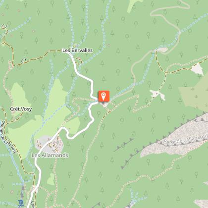
Departure point: Parking Le Plan aux Arches. From Samoëns, drive to "Les Moulins", then turn right onto the road to "Les Allamands". The parking lot is 800m after this village.
Topo guides and map references
Map references :
There is no specific map. Downloadable routes and GPX tracks are available on the destination website.
Reception complements
Gpx layouts given for information only.
Animals
No
Data author
