Bacounis' hike
Description
This route takes hikers in the footsteps of the famous Meillerie stones which were transported from Meillerie to Lausanne or Geneva on Savoy boats. The "bacounis" were the men whose profession was to load the boats.
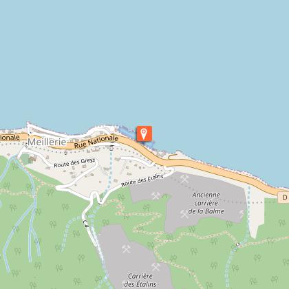
Departure at the pier of Meillerie.
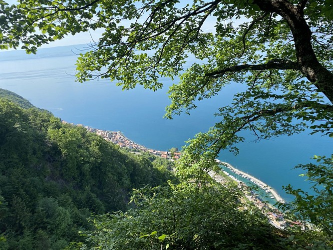
Starting from the Meillerie landing stage, the Bacounis loop will allow you to discover a part of the local history through its quarry.
The quarry was in operation from the end of the 16th century and employed up to 450 workers to supply stone for buildings in Geneva and Lausanne.
They closed in 1939 with the great strikes and the arrival of concrete.
Take the time to visit the Prieuré de Meillerie, founded by the canons of St Augustine. You can admire the gothic chapel, as well as the defence tower, transformed into a bell tower.
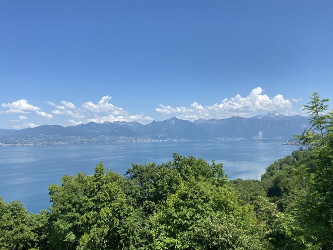
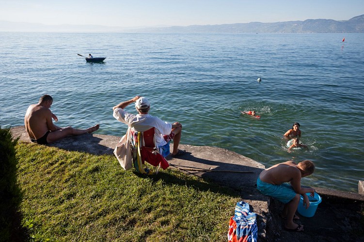
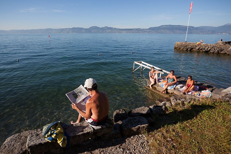
Following the lake on the last stretch to the Locum beach, this easy walk combines local history and views of the lake.
Take advantage of the return journey to swim in Lake Geneva!
Technical informations
7.9 km
|
min. 99999 m
530 m
400 m
| |||
Style : Hiking Public : SportsmenExperienced hikers | ||||
Altimetric profile
Starting point
Points of interest
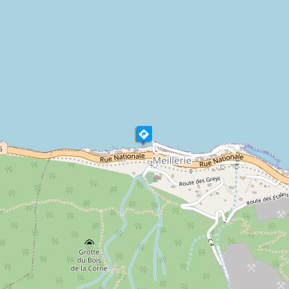
Meillerie pier
Locum Beach
Plage de Meillerie
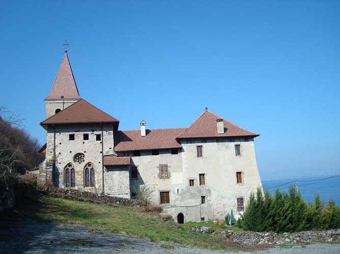
Meillerie Priory
Where the Meillerie parish church stands today a priory was founded by Saint-Augustin canons in the Middle Ages, dependent on the Grand Saint-Bernard Hospice. The bell tower and church chancel are registered as historic monuments.The priory of Meillerie, whose foundation date remains unknown, is first mentioned in 1133. It was founded by Canons Regular of St. Augustine, who in the course of the 13th century became part of the Order of the Great St. Bernard. In the 1220s, the priory was completely rebuilt and fortified. It became the centre of a vast religious and temporal seigniory, as well as the main residence of the provosts, leaders of the congregation. The priory was abolished in 1752. Although some of the medieval buildings were destroyed in the 19th century, visitors can still admire the priory's Gothic chapel, the defence tower (now a bell tower) and part of the dwelling, which still has beautiful Gothic doors. In the heart of the priory, an old restored room called "Salle du Logis du Prieuré" houses archives on this historic monument, on the history of the village of Meillerie - its fishermen - its quarries - its boats. And on the famous writers who have described the particularities of this village, including Jean-Jacques Rousseau in La Nouvelle Eloise.
Marina
Additional information
Reception conditions for animals
Dogs allowed, on leash only (several passages and road crossings).
Updated by
Conseil Départemental de la Haute-Savoie - 16/04/2024
www.hautesavoiexperience.fr
Report a problem
Guidebook with maps/step-by-step
0/ Departure from landing stage of Meillerie. 1/ Take the direction of "Locum" by the Fauconnière. Then follow the direction of "Locum" at the successive intersections "Bois Coment", "Pierre Jean Jacques Rousseau", "Carrière des Etalins". Then follow the direction of "Pré Fournet" followed by "La Fauconnière", and its panorama, the "Rocher du Balairon" and to finish, the hamlet "les Plantés".
2/ Go back down towards Locum, a small village on the edge of the lake. You will have to cross the D1005 (be careful) to reach the village. When you arrive at "Locum (Plage)", take the direction of Meillerie (Débarcadère) in order to return to your starting point via "la Tronche (Parking)".
Environments
Lakeside or by stretch of water
Close to pleasure port
Lake view
Mountain view
Open period
All year round.
Accessible outside the snowy period and depending on the weather conditions. Please check with the Tourist Office beforehand to find out the current access conditions.
Contact
Phone : 04 80 16 10 64
Email : saintgingolph@ot-peva.com
Website : leman-mountains-explore.com
Location complements
Departure from landting stage of Meillerie
Tricky passages
This hike includes steep passages that require the utmost caution. It is therefore not recommended for people prone to vertigo. Be particularly vigilant in the presence of children.
Topo guides and map references
Topo guides references :
On sale in the tourist offices of the pays d’Évian.
Map references :
TOP 25 N°3528 ET Morzine Massif du Chablais Les Portes du Soleil
Type of land
Stone
Ground
Reception complements
Hiking shoes are required. Forest paths can be muddy in wet weather. Due to steep slopes, hiking poles may be useful.
Data author
