Alert
Alerts
From Névache to Col de l'Izoard

IGN cards


Description
Conquer one of the Tour de France's legendary passes: the Col de l'Izoard!
Detailed itinerary :
- From the parking lot, turn right onto the RD 994g towards Val-des-Prés, to descend the Clarée valley for 15 km.
- On leaving the village of La Vachette, at the junction with the RN 94, turn right towards Briançon.
- Once in Briançon, pass the Champs de Mars. Then take the 3rd exit at the traffic circle, direction "Centre Ville".
- At the next crossroads, get into the left-hand lane towards "Centre Ville" and turn left.
- Drive down Avenue de la République and take the left-most exit at the traffic circle at the bottom of the avenue, onto Rue Centrale.
- At the end of Rue Centrale, at the traffic circle, follow signs for Col de l'Izoard.
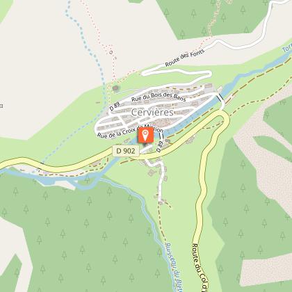
- Go through the hamlet of Fontchristianne and continue towards Cervières.
- Once in Cervières, stay on the RD 902 towards Le Laus and Col de l'Izoard.
- After Le Laus, start climbing the Col de l'Izaord. The summit is 7km away.
- At the top of the pass, turn around and take the same road back to Névache.
- In Briançon, at the Izoard traffic circle, take the 4th exit on the left. Then take the 1st road on the right, following the sign "Toutes directions - Gap". At the traffic circle in front of E.Leclerc, take the 1st exit on the right and cross the bridge. At the next traffic circle, take the 1st exit on the right, then continue straight ahead up Avenue de la République. At the yield sign, turn right towards "Turin - Montgenèvre - Névache" and return to Névache.
Technical Information
Altimetric profile
Starting point
Points of interest

Date and time
- From 15/05/2026 to 31/10/2026
Additional information
Updated by
Office de tourisme des Hautes Vallées - La Grave - La Clarée - L'Izoard - 24/06/2025
www.hautesvallees.com/la-grave/
Report a problem
Open period
From 15/05 to 31/10 daily.
Subject to favorable snow and weather conditions.
Contact
Phone : 06 07 07 31 08
Email : izoard@hautesvallees.com
Website : www.hautesvallees.com/lizoard/
Facebook : www.facebook.com/izoardtourisme/
Type of land
Hard coating (tar, cement, flooring)
Reception complements
Kilometres, altitude difference and time correspond to the complete round trip Névache > Briançon > Col de l'Izoard > Briançon > Névache.
Data author
