Alert
Alerts
The Hermits Circuit
Description
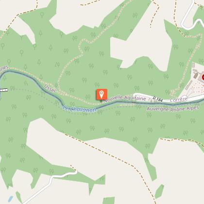
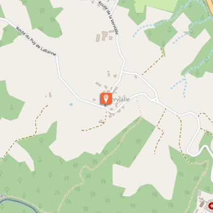
Enjoy the view of the Puys d'Auvergne, walk alongside the Chavanon, through the woodland undergrowth and explore the village of Monestier-Merlines! A complete circuit between water and woods.At the exit from the Sully airfield, take the road on the left, then the one on the right. Leaving paths and roads to the left and right, go straight on slightly uphill.Pass to the right of a cross called "de la Martine" and opposite, take an earth path that goes downhill.At the crossroads, head down the grassy path towards the valley.In a bend, leave the main path and go straight ahead. At the next turn, follow the same trail. At the crossroads, climb the winding path through the heather, then descend. Pass to the right of the statue of the Virgin. Further down, at the crossroads, take the path on the left towards the buildingsat the bottom of the valley.Take the road to the right. It is extended by a trail alongside the Chavanon. Then pass under the SNCF viaduct and follow the trail.At the Raby mill (on the other bank), the path goes up. Take then the path that goes downhill. Pass to the right of a small house, and cross the Serre stream. The road goes up to join the D110.Take the road to the left. Without crossing the Raby bridge, follow the small road on the right that runs alongside the river. Go through the hamlet of Moulin-de-Lagarde, past the house and along the mill canal.In a bend in the road, take the earth path on the left.Do not go through the tunnel; go up the embankment to reach the old railway line, which you follow for 1 km.Cross the road to take an earth path. Take the next road on the right towards Monestier. Passing under the railway tunnel, the road climbs to join the D110. Turn to the right.Then take a path to the left after the last houses. The path leads to the edge of the wood. Take a path to the left in the woods, follow the tracks on the ground: beware, it’s a tricky part.Cross two stone bridges in succession. After the second one, go up the path on the left. Pass a path on the right and continue uphill. At the top of the hill, take a track opposite.Take the road to the right and reach La Vervialle opposite. Go through the hamlet to the left and return to the Sully area.
Technical Information
Altimetric profile
Starting point
Steps
Points of interest


Additional information
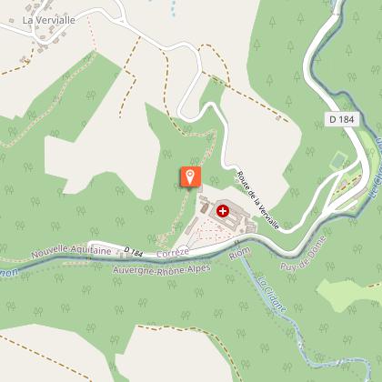
Advised parking
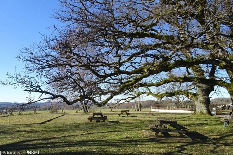
Sully Area, Merlines
Advice
Shortcut to point 5: go up the path to the right, cross the railway line and, at the fork, go up to the right to join the circuit track which you take on the right.
Access
From Merlines, follow the N89 towards Clermont-Ferrand. At the end of the village of Veyrières, head towards La Vervialle.
Ambiance
Although the area was once the favourite place of several hermits, offering refuge and isolation, it has not lost its interest. Today it is home to rare and protected plant species and some amazing birds of prey, hermits in their own way, so sensitive are they to the disturbance caused by human activity.
Arrival
Sully Area, Merlines
Departure
Sully Area, Merlines
Data author
