Alert
Alerts
Tour of Tête de Romme - Hike
Description
A walk to explore forest life and a hamlet like Romme. Starting in the center of the village, this hike is accessible in both summer and winter. Snowshoes are recommended when there is snow on the ground.
Step-by-step guide:
From the ski center to the forest: 20 minutes. Walk through the village to the chapel, located in the center of the hamlet. At the chapel, turn right toward “Tour de Romme”—1 hour. The road climbs and passes by the restaurant “La Rebloche.” 200 meters further up, take the road to the right at the intersection, then immediately take the trail that branches off to the left, following the signs for “Tour de la Tête de Romme.” The trail is marked with blue-painted wooden posts. Cross the fields, following the trail. Before reaching the forest, follow the sign on your right for “Tour de la Tête de Romme via Charvet.” Circumnavigation of Tête de Romme via Charvet: 20 minutes The trail leads you into the forest, and from there, the climb becomes easier. The trail then veers to the left to circle around Tête de Romme and go around the mountain. Follow the blue arrows and the blue and red paint marks on the trees. Enjoy the unobstructed view of the Cluses Valley. At the next intersection, continue down the path to the right, following the sign for “Tour de la Tête de Romme” (the trees are marked with the numbers 12–13). You are now at a place called Barme Rousse. Return to the lodge via Les Sangles: 40 minutes. The descent then becomes steep for 300 meters until the next intersection. This is the most challenging part of this hike. Then turn left onto the trail marked “Tour de Romme via Les Sangles” (tree marked with the number 14). The trail is flat and climbs several times. Follow it; it then narrows and descends. You’ll have a beautiful view of the village of Le Reposoir before reaching the upper part of the village of Romme. At the wooden post marked “Tour de Romme via Les Sangles,” continue straight ahead, crossing the fields to reach the village.
Technical Information
Altimetric profile
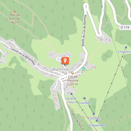
Starting point
Additional information
Updated by
Cluses Arve & montagnes Tourisme - 18/09/2026
www.cluses-montagnes-tourisme.com
Report a problem
Environments
Forest location
Mountain view
Mountain location
Village -2 km away
Open period
From 01/04 to 15/11 daily.
Contact
Phone :
04 57 54 22 40
04 50 96 69 69
Email : tourisme@cluses-montagnes.com
Website : https://espacestrail.run/fr/flaine-carroz-2ccam/parcours/145819
Facebook : https://www.facebook.com/Cluses-Arve-montagnes-Tourisme-104007097700091/
Type of land
Ground
Grit
Not suitable for strollers
Location complements
From Cluses, take the D119 toward Nancy-sur-Cluses. Drive through the town center and continue on the D119 to the Col de Romme. At the entrance to Romme, park in the lot across from the ski center.
Animals
Yes. Keep your dog on a leash, he can scare off herds and wild animals.
Data author
