Alert

Alerts

To see around
See more
Open
Close
Show
Show
Show
Show
Show
Show
Show
Show
Show
Show
Show

Oups... It would appear that Cirkwi does not have permission to use your location.

Presentation
Description
Map
Steps
Ratings and reviews
See around

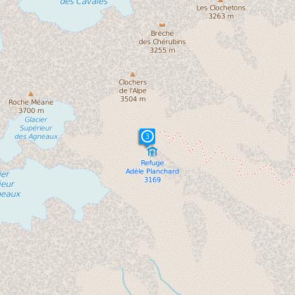
Refuge Adèle Planchard

IGN cards

3435ETR - VALLOIRE RESISTANTE AIGUILLES D'ARVES COL DU GALIBIER
Editor : IGN
Collection : TOP 25 RÉSISTANTE
Scale : 1:25 000
17.20€
3436ETR - MEIJE PELVOUX RESISTANTE PARC NATIONAL DES ÉCRINS
Editor : IGN
Collection : TOP 25 RÉSISTANTE
Scale : 1:25 000
17.20€
3436ET - MEIJE PELVOUX PARC NATIONAL DES ÉCRINS
Editor : IGN
Collection : TOP 25 ET SÉRIE BLEUE
Scale : 1:25 000
13.90€
3435ET - VALLOIRE AIGUILLES D'ARVES COL DU GALIBIER
Editor : IGN
Collection : TOP 25 ET SÉRIE BLEUE
Scale : 1:25 000
13.90€
TOP75005 - BRIANCONNAIS QUEYRAS
Editor : IGN
Collection : TOP 75
Scale : 1:75 000
9.80€
TOP75006 - MASSIF DES ECRINS OISANS CHAMPSAUR
Editor : IGN
Collection : TOP 75
Scale : 1:75 000
9.80€
TOP100D38 - ISÈRE GRENOBLE VIENNE PARC NATIONAL DES ÉCRINS PARC NATUREL RÉGIONAL DU VERCORS
Editor : IGN
Collection : TOP 100
Scale : 1:100 000
8.40€
202 JURA ALPES DU NORD
Editor : IGN
Collection : TOP 200
Scale : 1:200 000
6.80€
D04-05 ALPES-DE-HAUTE-PROVENCE HAUTES-ALPES
Editor : IGN
Collection : CARTES DÉPARTEMENTALES IGN
Scale : 1:150 000
5.90€
D38 ISÈRE
Editor : IGN
Collection : CARTES DÉPARTEMENTALES IGN
Scale : 1:150 000
5.90€
NR16 PROVENCE-ALPES-CÔTE D'AZUR
Editor : IGN
Collection : CARTES RÉGIONALES IGN
Scale : 1:250 000
6.80€
NR15 AUVERGNE-RHÔNE-ALPES RECTO/VERSO MASSIF ALPIN
Editor : IGN
Collection : CARTES RÉGIONALES IGN
Scale : 1:250 000
6.80€
NR14 AUVERGNE-RHÔNE-ALPES RECTO/VERSO MASSIF CENTRAL
Editor : IGN
Collection : CARTES RÉGIONALES IGN
Scale : 1:250 000
6.80€
EUROPE
Editor : IGN
Collection : DÉCOUVERTE DES PAYS DU MONDE IGN
Scale : 1:2 500 000
7.00€

Description

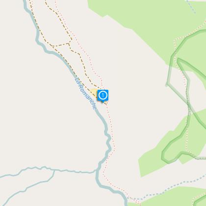
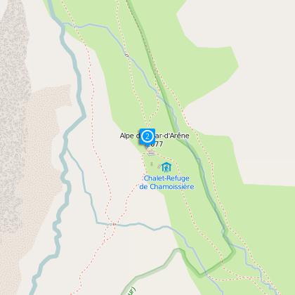
The path starts below the hamlet of Le Pied du Col, where you have to take the paved road (not cleared in winter) that starts after the gite called Le Pas de l’Ane, the car park being at the bottom of the valley. The path starts off on the famous path GR 54 (Tour de l’Oisans), and then quickly forks off to the right towards the Plan de Valfourche. The place is wonderful, almost flat, where the Romanche river draws long meanderings along which it is good to lie in the grass, contemplating Les Agneaux away. Ignoring the right-hand fork for Le Pavé, the path passes near the springs of the Romanche then it quickly climbs to the
right in the bends, where cables will help you in difficult passages. A few hundred meters in altitude further will allow you to reach the refuge, located downstream from the upper Glacier des Agneaux. In winter, access on skis is slightly different: once arrived near the source of La Romanche, the road continues to the end of the valley via the Glacier de la Plate des Agneaux, before forking right towards the Col de Casse Déserte. You will have to go over the Col des Neiges to the right, before redescending to the refuge.

Altitude: 3 169 m
IGN map n° 3436 ET
Path OBP n° 400, 402, 403

From the hut :

Mountaineering and ski touring
--La Grande Ruine (3765m – PD)
--Stage of the Tour de la Meije (ski touring).

Climbing
--Roche Méane (3711m)
--The East Arête of La Grande Ruine
--Pic Bourcet and Tour Choisy (3712m)

Technical Information

Walking
Difficulty
Hard
Duration
5h30mn (1d)
Dist.
11 km
Show more

Altimetric profile

Starting point

05480   Villar-d'Arène
Lat : 45.01973Lng : 6.37114

Data author

Image Oisans Tourisme
proposed by Oisans Tourisme
1 bis rue Humbert 38529 Le Bourg-d'oisans France

Ratings and reviews

To see around
See more
Open
Close
Show
Show
Show
Show
Show
Show
Show
Show
Show
Show
Show
Caution!
We have no information on the difficulty of this circuit. You may encounter some surprises along the way. Before you go, please feel free to inquire more and take all necessary precautions. Have a good trip! 🌳🥾