Alert
Alerts
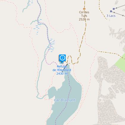
Refuge de l'Etendard
Description
From the mountain pass, take the track (closed to vehicles) off to the right. Follow the bends up to the northern pass before you descend to the refuge which is located at the foot of the dam at the Lac Bramant. Accessible to everyone, the path has no particular danger. As the main refuge of Les Grandes Rousses, it offers an access to the glacier and the summit of the Etendard, in a beautiful alpine lakes setting.
Altitude: 2 430 m
IGN map n°3335 ET or n°3435 ET
From the hut :
Hiking, ski touring
- Dôme de la Cochette (3041m): 3 hours
- Aiguille de la Laisse (2879m): 2 hours
- Crossing to Clavans, and the Alpe d’Huez.
Montaineering and ski touring
- L’Etendard (3464m): 4-5 hours of PD glacier climbing
- Cîme de la Valette (2858m) : 3 hours
F climbPic du Grand Sauvage (3216m) : 3 ½ hours
Technical Information
Altimetric profile
Starting point
Steps
Data author
