Alert
Alerts
Hiking Trail: Le Déramey via Burzier

Description
Very nice variation on the Mayères forest path to access Le Déramey, where beautiful clearings allow you to admire Mont-Blanc.
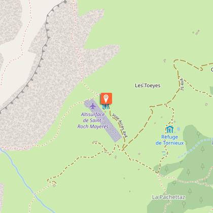
Departure: Burzier Parking
1. At the end of the car park, take the small pedestrian trail that climbs through the forest
2. You will cross the little creek of the cornach a few times during this little hike
3. Then at the intersection of the Combes Continue the path that goes straight towards the deramey
4. Continue a long time without too much turns then at the next bifurcation, take the trail that goes up right to join the rural road of the deramey
5. After 3 beautiful turns you arrive at the deramey where pretty mountain chalets overlook the city of Sallanches and face the chain of Mont Blanc.
6. A stop is needed to admire this grandiose show that is offered to you
7. To continue the loop, take the path on the right above the chalets and continue towards the carbonnet where a bifurcation occurs at the level of the creek
8. It will take the right path that descends
9. Then still right at the next bifurcation, the trail descends to the Combes
10. This time it is left at the bifurcation of the Combes, then always all right to reach the car park.
The walking time is approximate and does not count the pause times.
Go on a safe hike!
This description allows you to orient you overall but does not replace a 1/25000 hiking card or other topoguides that you can find in your tourist office! In Sallanches, our office of guides & guides also offers a wide selection of outings accompanied by mountain professionals bringing you a complete expertise on the environment and the alpine nature, think about it!
Whatever your hike, check the weather before you leave.
Remember to take in your backpack cereal bars, water in sufficient quantity, sunglasses, sunscreen, a small pharmacy kit, as well as clothes adapted to your exit according to the season and the weather announced.
Technical Information
Altimetric profile
Starting point
Points of interest


Date and time
- From 15/04/2026 to 31/10/2026
Additional information
Environments
Mountain view
Mountain location
Panoramic view
Updated by
Office de Tourisme de Sallanches - 15/01/2026
www.sallanchesmontblanc.com
Report a problem
Open period
From 15/04 to 31/10.
Subject to favorable snow and weather conditions.
Contact
Phone : 04 50 58 04 25
Email : tourisme@sallanches.com
Website : http://www.sallanchesmontblanc.com
Facebook : https://www.facebook.com/SallanchesMontBlanc
Type of land
Stone
Ground
Grit
Not suitable for strollers
Animals
Yes
Data author
