Hiking Trail: Véran via Le Grand Arvet
Description
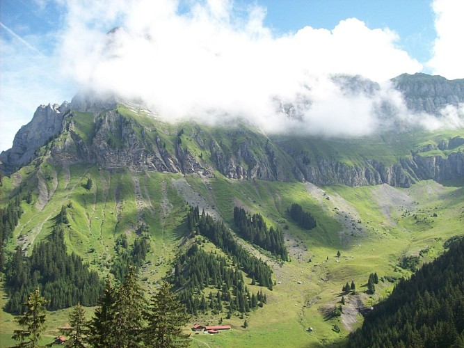
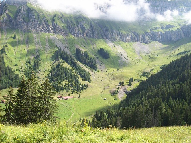
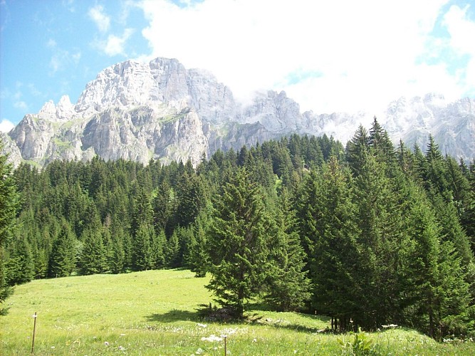
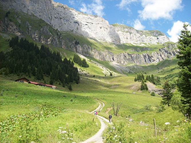
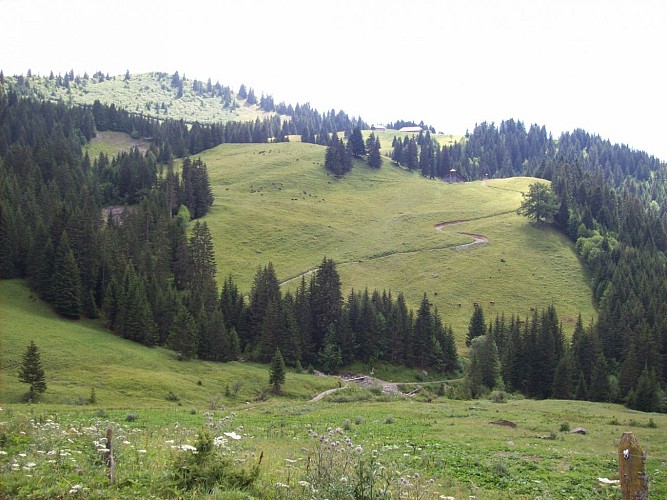
Shorter version of the classic Sallanche route, accessible via a forest trail ending at the Véran mountain pasture dominated by the steep peaks of the Croix de Fer and home to the Cascade d'Arpenaz (waterfalls).
Go hiking safely!
Walking time is approximate and does not take into account break times.
The topo/step-by-step description guides you generally but does not replace a 1/25,000 hiking map or other topoguides available in our tourist office!
In Sallanches, our Office of Guides & Leaders also offers a wide choice of outings accompanied by mountain professionals providing you with complete expertise on the environment and alpine nature, inquire at the tourist office to register.
Whatever your hike, check the weather before you go. Remember to take cereal bars, sufficient water, sunglasses, sunscreen, a cap or hat, a small first aid kit, as well as clothing suitable for your outing in your backpack. depending on the season and the forecast weather.
The CAF refuge is guarded in summer where it welcomes hikers wishing to spend a night in the mountains.
* Departures to other possible hikes:
- La Tête de Lassy: It will be beneficial to continue the hike to the Tête de Lassy (+ 100 m) which offers a magnificent view of this always flowery valley.
- Cheminée de Monthieu and Tête du Colonney: obligatory passage before the climb to Colonney, Véran precedes the delicate passage of the Cheminée de Monthieu.
Technical informations
9.4 km
|
min. 99999 m
879 m
876 m
| |||
Altimetric profile
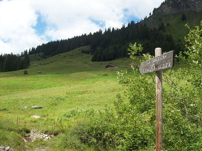
Starting point
Points of interest
La Cascade de Reninge (waterfall)
Charming small waterfall on the hillside of St Martin, very visible in the spring. Taking its source in the Fiz mountain range, it continues its course in the Torrent de Reninge, then in the Arve.
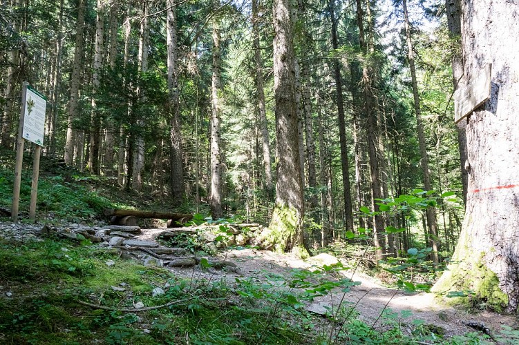
Le Sapin Président (President Fir)
Superb coniferous tree aged 275 years old (in 2021), with remarkable measurements: it is 47 m high and has a 4.10 m circumference (in 2011). It flourishes in the middle of the forest on the St Martin hillside, at about 1000 m altitude. This is a very pleasant place to visit with children.
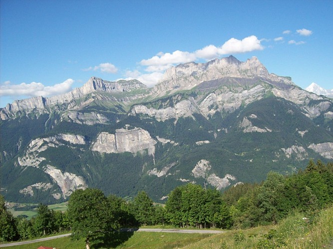
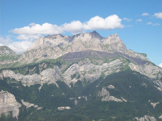
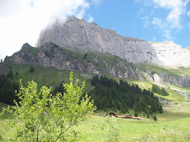
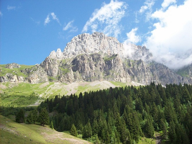
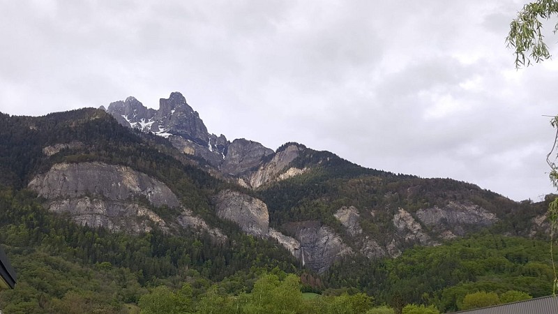
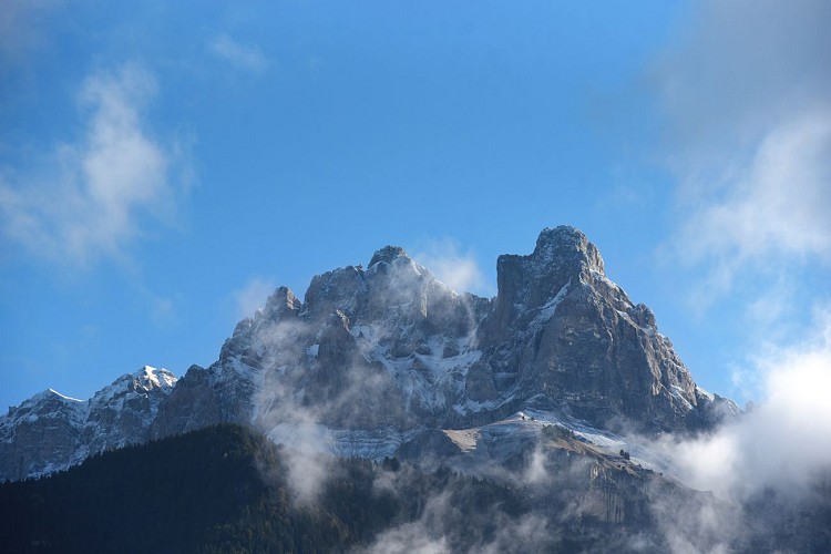
La Croix de Fer
At 2337m altitude, this superb, tranquil site overlooks the Véran mountain pasture in the Fiz range and is part of the peaks that dominate Sallanches. This magnificent limestone pass at altitude is similar to the one at Tours d'Areu that is so popular with climbing enthusiasts.
site d'escalade : la Croix de Fer
La Croix de Fer se trouve à 2337m, en surplomb de Véran dans le massif des Fiz et fait partie des sommets qui dominent Sallanches. Magnifique calcaire d'altitude semblable à celui des Tours d'Areu, par exemple.Deux magnifiques voies d'escalade parcourent le pilier bien visible depuis la vallée : La classique du "Pilier SW" (rééquipée) et "Ni Dieu, ni maître". Ce n'est pas le même style, mais les deux valent largement le détour. Très belle escalade dans un site superbe et calme. Très beau calcaire d'altitude. La Croix de Fer fait partie des sommets qui dominent Sallanches. Deux magnifiques voies parcourent le pilier bien visible depuis la vallée. Le pilier comporte deux voies : La classique du "Pilier SW" (rééquipée) et "Ni Dieu, ni maître". Ce n'est pas le même style, mais les deux valent largement le détour. Environnement : Du fait de l'altitude, l'escalade n'est possible que durant la saison estivale. L'approche est assez compliquée dans un terrain raide d'une manière générale. Rocher : Magnifique calcaire d'altitude semblable à celui des Tours d'Areu. Équipement : La voie classique a été rééquipée : les points sont assez proches dans les longueurs clés. "Ni Dieu, ni maître" est un peu plus sportive mais bien équipée. Accès pédestre : De Sallanches, suivre la route forestière qui monte au refuge de Véran. Continuer à suivre cette piste après le refuge. Monter ensuite à l'aplomb de la Croix de Fer dans l'herbe, jusqu'à une succession de couloirs qui permettent de rejoindre la base du pilier. Ces couloirs sont en herbe raide et demandent de l'attention, notamment à la descente ou lorsque l'herbe est mouillée. Le Pilier SW est tout de suite au-dessus (quand on débouche de l'approche, à l'aplomb du beau pilier). "Ni Dieu, ni maître" est un peu plus loin sur la droite. La voie démarre dans un beau mur gris.
Les Aiguilles de Warens
Les Aiguilles de Warens are part of the beautiful Fiz rocky range, on the right side of the Sallanches valley. The summit is the famous Aiguille Rouge at 2,636 m altitude. They are reminiscent of the Italian Dolomites.
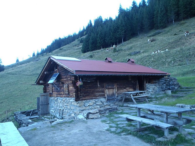
Refuge de Véran
Refuge non gardé. Réservations et clefs auprès de M. Michel Coudray au 06 88 63 15 28. L'été le refuge est surveillé par des bénévoles. Seuls couchages et utilisation de la cuisine sont possibles. Pas de ravitaillement.
Date and time
- From 15/04/2024 to 15/10/2024
- From 15/04/2025 to 15/10/2025
Additional information
Updated by
Office de Tourisme de Sallanches - 22/04/2024
www.sallanchesmontblanc.com
Report a problem
Environments
Panoramic view
Forest location
Mountain view
Open period
Closed temporarily.
Contact
Phone : 04 50 58 04 25
Email : tourisme@sallanches.com
Website : www.sallanchesmontblanc.com
Facebook : www.facebook.com/sallanchesmontblanc
Type of land
Groomed trail
Ground
Grit
Not suitable for strollers
Reception complements
Go hiking safely!
Walking time is approximate and does not take into account break times.
The topo/step-by-step description guides you generally but does not replace a 1/25,000 hiking map or other topoguides available in our tourist office!
In Sallanches, our Office of Guides & Leaders also offers a wide choice of outings accompanied by mountain professionals providing you with complete expertise on the environment and alpine nature, inquire at the tourist office to register.
Whatever your hike, check the weather before you go. Remember to take cereal bars, sufficient water, sunglasses, sunscreen, a cap or hat, a small first aid kit, as well as clothing suitable for your outing in your backpack. depending on the season and the forecast weather.
Data author
