Hiking Trail: Le Déramey via the Circuit des Coteaux
Description
To complete the Circuit des Coteaux, you can walk up to Le Déramey, passing in front of the Chapelle des Houches and then via Les Combes.
This is a nice hike for the beginning of the season.
Departure: Château des Rubins car park to start with the hillside circuit
1.Go down to the church square
2.Then take the Route de St Joseph to the left and follow it until the junction with the Route de la Provence
3. Turn left then take the Chemin de Bellegarde where you will find the Sentier de la Torche skirting the houses and which joins the Route de St Roch.
4. Cross the road and to the right of the containers you will climb along a marked path which goes to the place called La Torche.
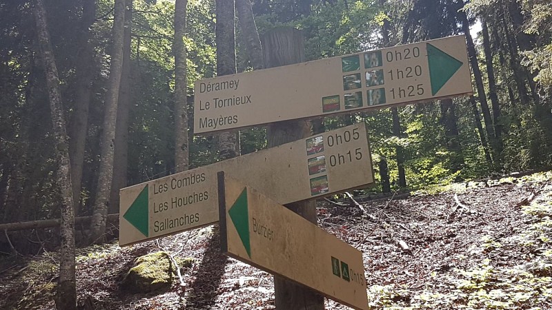
5. Be sure to follow the arrow signs which indicate the direction of Burzier.
6. sometimes the road takes over on the trail but for a short time, the time to find the trail a little further.
7. instead of "Les Murets" be careful not to continue towards the houses (there is a special sign indicating not to go there), you have to follow the road on 2 bends then after a long straight line at the 3rd bend you will have to take a path on your right along a stone wall
8.you will pass in front of a farm and then arrive near the route de Burzier
9. arriving below the Burzier bus stop, continue on the road to the hamlet of Les Houches
10. take the road that goes up to the right towards the chapel of Les Houches
11. on the top of the chapel, take the path that goes up to Les Combes
12. follow the direction of Déramey by taking the path that goes to the left and leaving those on the right that would bring you back to the Burzier car park
13. arrived at this magnificent hamlet which faces the Mont-Blanc, make a little stop to admire the panorama or to take your picnic
14. the return will be looped down on the right path towards Le Chable
15. you will thus reach the hamlet of Champ Devant
16. at Champ Devant, take the path that goes down to the right of the cross
17. at the fork, take the path that descends the furthest to the left and rejoins the route de la Balme
18. arrived at the road, turn left and cross the path between houses that goes down to the route du Bardet
19. turn right and continue the road for a few meters to find a path by the side of the road on your left which goes down to the road to Lachat
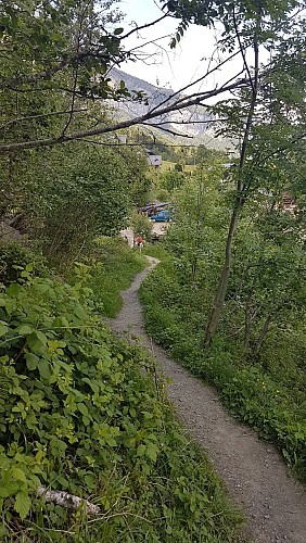
20. Take the road to Lachat to the right then a few meters find another path that goes down to the right twice to Mernex
21. at the Croix de Mernex, turn left on the path that spans the Bellegarde stream to join the Chemin de Monargue
22. at the cross at the end of the path, follow the road to Doran until the junction of Lévaud where you will turn right to reach the chapel of the Immaculate Conception
23. a short stop at the chapel overlooking Sallanches where you will have a breathtaking view of our beautiful city and its magnificent panorama in the background
24. Go back down the small path under the chapel which takes you in 10 minutes to the Château des Rubins where you can stop for a cultural visit.
25. you will then reach the starting car park.
Walking time is approximate and does not include break times.
Go on a safe hike!
This description allows you to orient yourself globally but does not replace a hiking map at 1/25000 or other topoguides that you can find in your tourist office! In Sallanches, our Office of Guides & Accompanists also offers a wide choice of outings accompanied by mountain professionals providing you with complete expertise on the environment and alpine nature, think about it!
Whatever your hike, check the weather before setting off.
Remember to take cereal bars, sufficient water, sunglasses, sunscreen, a small first-aid kit, as well as clothes suitable for your outing depending on the season in your backpack. and the forecast forecast.
Technical informations
9.9 km
|
max. 1220 m
min. 557 m
706 m
709 m
| |||
Altimetric profile
Starting point
Date and time
- From 15/04/2024 to 31/10/2024
- From 15/04/2025 to 31/10/2025
Additional information
Environments
Mountain location
Panoramic view
Mountain view
Updated by
Office de Tourisme de Sallanches - 22/04/2024
www.sallanchesmontblanc.com
Report a problem
Open period
From 15/04 to 31/10.
Subject to favorable snow and weather conditions.
Contact
Phone : 04 50 58 04 25
Email : tourisme@sallanches.com
Website : www.sallanchesmontblanc.com
Facebook : www.facebook.com/sallanchesmontblanc
Type of land
Stone
Ground
Grit
Not suitable for strollers
Data author
