Alert
Alerts
Randolière walking tour
Description
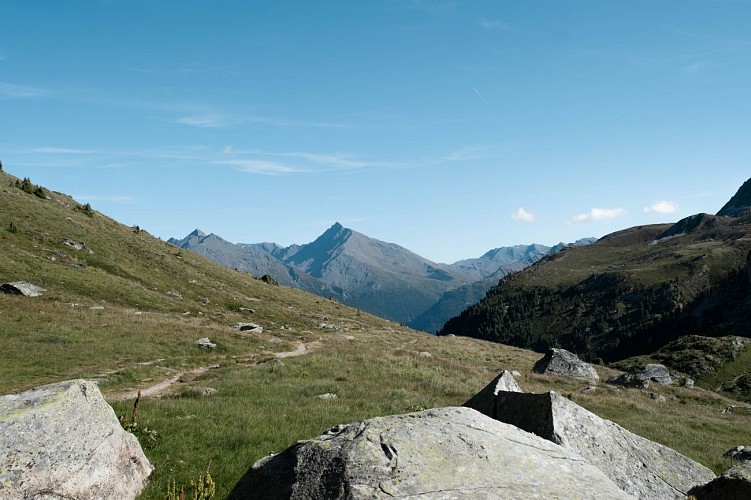
Take to the heights effortlessly for a taste of extraordinary variety Forest,
alpine pastures, valley of geological wonders and views of prestigious
peaks… Myriad landscapes await you for an easy introduction to hiking.
As the fascinating blue waters of the Plan d'Amont lake (upstream of the
dam) wink at you, Râteau d'Aussois and Pointe de l'Échelle watch over you,
unphased, lost in contemplation.
Why stop now when things are going so well? Keep going till you get to the
Fournache torrent and listen carefully... Can you hear that whistle, echoing
through the valley? That's Lady Marmot, announcing your arrival to the rest
of her crew.
Adventure is calling you and you feel like spending a night at La Fournache
refuge.
Or maybe at the Plan Sec refuge. It could be a good idea to start with a
meal there, so as to scout out the place. Just imagine waking up amid those
remote alpine pastures and imposing rocky mountains!
But, for now, you can just settle down on the soft grassy slopes and take your
time lazing in the sunshine, as you're returning via the chairlifts.
Technical Information
Altimetric profile
Starting point
Points of interest


Date and time
- From 15/05/2026 to 15/10/2026
- From 15/05/2027 to 15/10/2027
Additional information
Open period
From 15/05 to 15/10 daily.
Accessible by ski lift in summer.
Subject to favorable snow and weather conditions.
Updated by
Communauté de communes Haute Maurienne Vanoise - 19/02/2026
www.cchautemaurienne.com
Report a problem
Environments
Overview on river
Mountain view
Mountain location
Presence of livestock and guard dogs
Resort centre
Contact
Phone : 04 79 05 99 06
Email : info@hautemaurienne.com
Website :
https://www.haute-maurienne-vanoise.com
http://www.cchautemaurienne.com/jy-vais-en
Type of land
Stone
Ground
Not suitable for strollers
Location complements
The hike starts at the top of the Grand Jeu chairlift.
By bus: Line S52 - Maison d'Aussois stop
By car: park in the parking lot near the chairlift departure point.
Topo guides and map references
Topo guides references :
Map and booklet "Haute Maurienne Vanoise. 120 walks and hikes - 36 trail routes. For all levels" (sold for €12 in Tourist Offices)
Map references :
Map IGN 3534OT - Les Trois Vallées
Reception complements
The duration of hiking trails is calculated using reference paces: 300 m/h ascent, 500 m/h descent and 4 km/h on the flat.
As hazards may occur at any time on the routes, the GPX tracks provided are not contractual. They are given for information only. Riders use them at their own risk, depending on their level of technological proficiency and their understanding of the terrain.
Guidebook with maps/step-by-step
To guide you in the field, consult the "step-by-step" directional diagram provided in pdf.
Animals
Yes. Ski lift not accessible to pets.
Pets allowed on leash only
Data author
