Alert
Alerts
Cross-country mountain biking: Pré chamois

Description
The climb takes plenty of effort and patience, but if you take the time to recover at the top, the superb descent makes it all worth it.
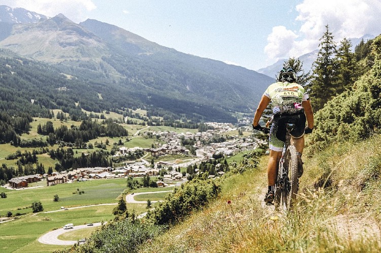
A beautiful ascent above Val Cenis, first on a track, then on a mountainside path across chamois country. In spring, the snow melts fairly quickly on these south-facing slopes, making it a good spot for animals to graze. The descent is a must for mountain-bikers who enjoy a technical challenge. Once past Termignon, the return trip to Val Cenis is via the Chemin du Petit Bonheur. From the chamois' pastureland you can admire a 180° panoramic view over the valley and surrounding mountains.
Departs from: Val Cenis Termignon
Technical Information
Altimetric profile
Starting point
Points of interest


Date and time
- From 15/05/2027 to 01/11/2027
Additional information
Open period
From 15/05 to 01/11 daily.
Subject to favorable snow and weather conditions.
Updated by
Communauté de communes Haute Maurienne Vanoise - 20/04/2026
www.cchautemaurienne.com
Report a problem
Environments
Mountain view
Forest location
Bus stop < 500 m
Close to a public transportation
Contact
Phone : 04 79 05 99 06
Email : info@hautemaurienne.com
Website :
https://www.haute-maurienne-vanoise.com
http://www.cchautemaurienne.com/jy-vais-en
Type of land
Stone
Ground
Grit
Location complements
The trail starts at the Termignon tourist office.
To get there by bus: Line S52/S53 - Maison de la Vanoise/Mairie stop (in summer, the bus is equipped with a bicycle trailer - ask about days and times).
By car: park in the parking lots near the Tourist Office (there's a charging station for electric vehicles in front of the Office building).
Topo guides and map references
Topo guides references :
Haute Maurienne Vanoise mountain bike map and booklet sold in Tourist Offices.
Reception complements
As hazards may occur at any time on the routes, the GPX tracks provided are not contractual. They are provided for information only. Riders use them at their own risk, depending on their level of technological proficiency and their understanding of the terrain.
Tricky passages
Technical difficulty: Nice descent on singletrack with a few balcony sections that can lead to the void.
Physical difficulty: A typical Haut Maurien climb, long and unremitting.
Animals
Yes. Dogs on a leash are not forbidden on this trail, but mountain bikers are advised not to use it.
Data author
