Alert
Alerts
Enduro : La déjantée
IGN cards


Description
From the Arrondaz mountain pasture, the path quickly becomes narrow and technical. The view of the Thabor mountain pastures is simply magnificent.
A word of advice: put your foot down to admire the view, as you'll need all your balance to negotiate the trail that follows. The end is quieter, and is done on a trail, which can be made more challenging if you go via the La Valdingue XC route (left bank of the Charmaix).
Why this name? We hope for your sake that the stones on the route won't throw you off your game.
Technical Information
Altimetric profile
Starting point
Points of interest

Date and time
- From 01/07/2026 to 01/10/2026
Additional information
Updated by
Communauté de communes Haute Maurienne Vanoise - 23/12/2025
www.cchautemaurienne.com
Report a problem
Environments
Mountain view
Forest location
Mountain location
Village 2 km away
Bottom of slopes
Open period
From 01/07 to 01/10.
Subject to favorable snow and weather conditions.
Contact
Phone : 04 79 05 99 06
Email : info@hautemaurienne.com
Website :
https://www.haute-maurienne-vanoise.com
http://www.cchautemaurienne.com/jy-vais-en
Location complements
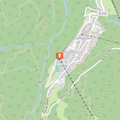
Departure from the top of the Arrondaz gondola.
Possibility to reach the starting point by enduro ascent.
By car: park in the parking lot near the Valfréjus Tourist Office.
By bus: Line 1 - Tourist Office stop (no bike transport on this line).
Topo guides and map references
Topo guides references :
Haute Maurienne Vanoise mountain bike map and booklet sold in Tourist Offices.
Reception complements
As hazards may occur at any time on the routes, the GPX tracks provided are not contractual. They are provided for information only. Riders use them at their own risk, depending on their level of technological proficiency and their understanding of the terrain.
Animals
Yes. Dogs on a leash are allowed on the trail, but are not recommended for mountain biking. Pets are not allowed on the lift.
Data author
