Alert
Alerts
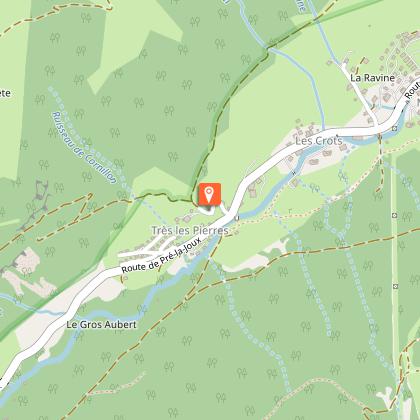
Walking route - Les Mattes
Description
A trail for experienced hikers that takes you from mountain pasture to mountain pasture through forest and clearings to Les Mattes.
Go to the left of the chapel in Très Ies Pierres and continue
along the track until it forks. Turn right onto a wide road that climbs steadily
through the forest past waterfalls until it reaches the Boudimes high pasture.
Continue on the same track through woods with occasional clearings until you reach the Torrens chalet and the GR5 (major long-distance footpath marked in red and white that runs through the Alps from Lake Geneva to the Mediterranean).
Take the GR up to the left until you reach Les Mattes where you arrive at the turning to the beautiful Grange combe. Follow the
path down past le Pron until it comes to a track that crosses it at right angles. Turn right and some yards further on fork left. Continue on this jeep track until you arrive back at your starting point in Très les Pierres.
Technical Information
Altimetric profile
Starting point
Date and time
- From 01/06/2026 to 31/10/2026
- From 01/06/2027 to 31/10/2027
Additional information
Open period
From 01/06 to 31/10 daily.
Accessible outside of snowy periods and depending on weather conditions. Please check with the Tourist Office in advance to find out the current access conditions. Recommended period for use: spring, summer, and autumn.
Updated by
Châtel Tourisme - 03/04/2026
www.chatel.com
Report a problem
Environments
Close to GR footpath
Mountain view
Mountain location
Close to a public transportation
Near shuttle stop
Contact
Phone : 04 50 73 22 44
Email : touristoffice@chatel.com
Type of land
Stone
Ground
Not suitable for strollers
Location complements
Car park Très les Pierres. Bus line 1, stop Très les Pierres (July & August).
Topo guides and map references
Topo guides references :
Châtel walking map for €3
Topo guide "Balades et randonnées en Vallée d'Abondance" (Walks and hikes in the Abondance Valley) for €5
(Maps for sale at the tourist office)
Map references :
Top 25 IGN 3528 ET
Reception complements
Whichever walk you choose, we recommend that you :
- Wear appropriate footwear and always take with you: warm clothing, preferably waterproof, plenty of water, sunglasses, sun cream and a small first-aid kit.
- Do not set off alone.
- Inform someone living in the valley of your plans.
- Do not change the planned itinerary indiscriminately. But do not hesitate to shorten it if necessary.
- Carry a map and even a torch.
- Check the weather forecast before setting off.
- In the event of a thunderstorm, move away from ridges, passes and summits as soon as possible and never take shelter under an isolated tree.
This route crosses the Mont de Grange nature reserve. To avoid disturbing wildlife and preserve its habitat, please respect the regulations in force.
Dogs are allowed and must be kept on a lead. It is forbidden to pick and gather plants, to litter and to use motor vehicles. Bivouacs are permitted from 7pm to 9am.
Here as elsewhere, nature deserves your attention
Animals
Yes. Dogs must be kept on a lead due to the presence of herds.
Data author
