Alert

Alerts

To see around
See more
Open
Close
Show
Show
Show
Show
Show
Show
Show
Show
Show
Show
Show

Oups... It would appear that Cirkwi does not have permission to use your location.

Presentation
Description
Map
Points of interest
Ratings and reviews
See around

Path of the Maquis

Description

Pedestrian circuit n° 89 of a distance of 7,7 km
Time : 2h30 - Difference in height : 200 m - Marking : Yellow

Follow the n°80. Go straight on for 2 km. On the left, go up to the Camp du Maquis. Cross it and go back down in the wood plots. At the path, turn left to the D 59b. Possibility to go back and forth with a view on the viaduct and the loop of the Ain. Go up the road, (cut the bend), cross the D 59b. At the intersection on the left, continue through the meadows to the path. Turn right to the Croix Pierre and join the D.936.

Technical Information

Walking
Difficulty
Not specified
Duration
2h30mn
Dist.
7.9 km
Show more

Altimetric profile

Starting point

Départ de la salle des fêtes, place Charles Blétel , 01250   Corveissiat
Lat : 46.241602Lng : 5.480354

Points of interest

image du object

Fontaine-Noire, ENS de l'Ain

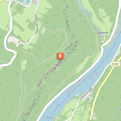
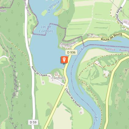
On the right bank of the Ain, in a characteristic meander between the villages of Corveissiat and Bolozon, a magnificent riverside site. Impressive color in high water. Pedestrian access from the Cize viaduct.From the viaduct, walk along the River Ain and its fishermen's huts. Next to a small stone hut just a stone's throw from the water, you'll discover a small stream that emerges from the rock to join the Ain. The "Fontaine Noire" is part of the ENS Haute Vallée de l'Ain, which will be awarded the "ENS" label by the Département de l'Ain in 2019. True natural and landscaped jewels of the Ain department, sites awarded the ENS "Espaces naturels sensibles" label are managed in such a way as to preserve the biodiversity they host, and developed for opening to the public (barring exceptions due to the fragility of the environments). Caving : During a survey of the banks of the Ain in 1976, the cave was discovered by speleologists. Robert Durand and Jean-Louis Fantoli explored 402m of drowned conduits up to a narrow laminar. On 05/06/1977, an interclub operation (Daniel Andrès, O.Bigot, Jean-Louis Fantoli and Pierre Licheron) found the continuation in the siphon and led to an open gallery ending in a hopper. The cavity is mainly composed of two parts, characterized by the existence of a siphoning branch downstream and a semi-active part upstream. The entrance basin plunges at -3 to the start of the gallery. After a low point at -7, the drowned corridor (2.5 x 5m), with its surprisingly flat, smooth floor and ceiling, rises again after some 50 m into a collapsed room, partly excavated at low water. Large boulders and slabs of rock block the passage, and thick clay deposits line the floor and walls at this point. Upstream, the conduit submerges completely, plunging to -10m. All along the way, stalagmites and stalactites testify to an exundated phase of the cavity, and remain one of La Fontaine's key sights. 170m from the entrance, a 2m-diameter shaft is carved out of the middle of the gallery, which extends into a 30m-long rolling mill. The shaft gives access at -20 to a lower gallery also linked to the rolling mill by an 8m chimney. Blades of erosion spike up the shaft to 280m, in a room at -18. There are two options: - at the back of the room, high up, a rolling mill at -10m exhales a perceptible current. - To the west, a high diaclase crosses the axis of the room at right-angles and opens out into the open. Halfway down, at -5°, a gallery extends for some 50 m to the open air, 350 m from the entrance. The gallery runs north for 284m. Overflow waters from the underlying circulation flow through it. It develops over a stratum joint (4 x 1.5m), intersected by numerous perpendicular fractures. A 6-metre drop precedes a lake with an impenetrable hopper at its end. Water temperature: 10°C.

- Bourg-en-Bresse destinations - Office de tourisme -
Consulter
image du object

Grotte et reculée de Corveissiat, ENS de l'Ain

LE SENTIER DE LA RECULÉE DE CORVEISSIAT IS TEMPORARILY CLOSED (municipal by-law attached to website). Public traffic is prohibited between the cave access path and the footbridge, until December 31, 2025.With its imposing cliffs and grotto, this retreat is one of the most remarkable sites in the Revermont region. Its porch is 30 meters high. Remarkable views. Guided tour in summer. Family-friendly mini-tour. The Corveissiat cave and retreat was awarded the "ENS" label by the Département de l'Ain in 2014. True natural and landscaped jewels of the Ain department, sites awarded the ENS "Espaces naturels sensibles" label are managed in such a way as to preserve the biodiversity they host, and developed for opening to the public (barring exceptions due to the fragility of the environments). The Ain mountains, generally limestone, are split, fractured, bent and folded on all sides. Over the centuries, run-off water has infiltrated the rock, slowly widening the cracks and gradually forming an underground network of galleries and cavities. These landscapes are one of the major features of Ain's natural heritage. On the surface, they model fissures, dolines, losses and chasms. A particularly rare fauna is associated with this type of landscape, including birds of prey and rock birds.

Garez-vous au niveau du pont, sur la D59, traversant le ruisseau de la Balme 01250 Corveissiat
- Bourg-en-Bresse destinations - Office de tourisme -
Consulter
image du object

Viaduc de Cize-Bolozon

A fine example of 19th-century civil engineering, this railway and road bridge spans the River Ain, linking the towns of Bolozon and Corveissiat. Rebuilt after the Second World War (1950), it is 273 m long and comprises eleven arches on two levels.In 1865, the Conseil Général de l'Ain wanted to create a railroad line between Bourg-en-Bresse and La Cluse. To cross the Ain, the commune of Cize was chosen. Work began in 1870, and required extensive work on the foundations, including excavations at the bottom of the river. The materials used came from the immediate surroundings: gravel and sand from the river, stone from the nearby quarries of Bolozon, Grand-Corent and Corveissiat, and lime from Virieu-le-Grand and Le Teil. Construction was completed in 1875, reaching a total length of 269 m and a height of 52 m. The two-storey structure comprises seventeen semicircular arches: eleven upper ones for rail traffic and six lower ones for road traffic. The Simandre-Cize section opened on July 6, 1876, following completion of the Racouze tunnel and the opening of the Cize-Blozon station. The bridge was opened to road traffic in 1905. The single-track Carpathian line was operated until 1884 by the Compagnie des Dombes et des chemins de fer du sud-ouest, then by the PLM until 1938, when the newly-created SNCF took over. Today, the "Bourg-Genève" TGV high-speed train crosses the river via the viaduct. On July 12, 1944, French resistance fighters launched an action on the viaduct designed to cut off rail communications and thus slow the advance of the Germans. They placed explosive charges under one arch of the road and another of the railroad. The explosions were only intended to slightly damage the viaduct, but proved fatal, destroying it almost entirely. As the viaduct has no supports at its ends, its deck is supported solely by the pillars. In barely twenty minutes, the pillars of the mined arches collapsed, destabilizing the structure and causing it to collapse completely. The impressive quantity of rubble even altered the course of the river! The new viaduct was rebuilt almost identically between 1947 and 1950. A few modifications were made, however: the stone was largely replaced by concrete, the latter being reserved for cladding. The dimensions were slightly altered, particularly on the lower level, in response to requests from some mayors to widen the arched openings in the roadway.

- Bourg-en-Bresse destinations - Office de tourisme -
Consulter

Additional information

Updated by

Bourg-en-Bresse Destinations - Office de tourisme - 10/10/2025
www.bourgenbressedestinations.fr
Report a problem

Open period

All year round.

Ratings and reviews

To see around
See more
Open
Close
Show
Show
Show
Show
Show
Show
Show
Show
Show
Show
Show
Caution!
We have no information on the difficulty of this circuit. You may encounter some surprises along the way. Before you go, please feel free to inquire more and take all necessary precautions. Have a good trip! 🌳🥾