Alert

Alerts

To see around
See more
Open
Close
Show
Show
Show
Show
Show
Show
Show
Show
Show
Show
Show

Oups... It would appear that Cirkwi does not have permission to use your location.

Presentation
Description
Map
Points of interest
Ratings and reviews
See around

Mont Grillerin lookout

Mont Grillerin lookout

Description

Emblematic hike, between the typical villages of Treffort and Meillonnas, which links the mounts of Plantaglay (460 m) and the Mont Grillerin (486 m). Passage by the passes of France and Angoulures, the wash house of Platte and the belvedere of Grillerin

Circuit n° 18.
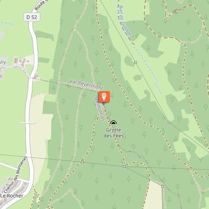
Route : Take the path in front of you and go up to a large meadow. At the top of the meadow, turn right. Start on the right of the variant 18A. Continue straight ahead until Treffort. At the foot of the D3, turn right after the fountain. Pass in front of the wash house and continue for 500m. At the small bridge on the right, go up to the Croix des Angoulures. Cross the road, take the Montmerle path for 200m then go up on the right to the pylon.
In the pasture, go south. End up on the GR59 and take it on the left. Go up to the right by the GR59, follow the crest of Mt-Charvet and go down to the Col de France. Col de France (common itinerary with n°15).

Variations and shortcuts :
- 18A : 8km - 2h : join by the circuit n°15.
- Shortcut to go to Treffort : Follow the " Tour du Revermont " to Treffort.

Technical Information

Walking
Difficulty
Medium
Duration
4h30mn
Dist.
16 km
Show more

Altimetric profile

Starting point

Chemin de Beauregard Derrière l'église , 01370   Meillonnas
Lat : 46.245476Lng : 5.352596

Points of interest

image du object

Village of Meillonnas

At the foot of the hills, along an ancient road that ran alongside the Revermont, the ancient fortified town of Meillonnas still has part of its castle and enclosure. It owes its fame to the earthenware it produced in the 18th and 19th centuries.The château was probably built around 1350 by the son of Humbert de Corgenon, bailiff of Bresse. From the 15th to the 18th century, it belonged to the La Chambre-Seyssel, a Savoyard family who sold it in 1740 to Nicolas de Marron, uncle of the founder of the earthenware factories. Since Gallic times, Meillonnas has been associated with the manufacture of ceramics ("In villa Mellionaco"... Mellona = Gallo-Roman estate), as the clays in the area are of excellent quality. At the end of the 16th c., a glazed earthenware called "green service" was distributed throughout the region and beyond Lyon. From common, utilitarian pottery made in tupinières (tupin = pot), the focus shifted to the "fabrique en fayance" founded in 1760 by the Marron family, in their château. The proximity of the local waterway, the Sevron, contributed to this activity. The Marrons owned the château until 1839, when earthenware production ceased. The finest pieces can now be seen at the Musée du Revermont in Cuisiat and the Musée de Brou in Bourg-en-Bresse. Note that the street signs are made of earthenware! The Saint-Oyen church was largely rebuilt in the 17th and 19th centuries, but the Notre-Dame chapel bears witness to its medieval past. It was founded by the knight Jean de Corgenon in 1382, as attested by the inscription engraved on the keystone. He commissioned frescoes to decorate the church, which can still be seen today and constitute the most complete ensemble in the département (classified MH). The Italian-inspired artist remains anonymous, but the influence of Giotto can easily be seen. On the outside, the bell tower is topped by an imperial-style dome. Meillonnas boasts a number of fine old houses, some of them half-timbered, such as the former presbytery opposite the church. There is even a "rue des colombages". There are also three fortified houses "hors les murs" (outside the walls) on the chemin de Beauregard, dating from the 16th century, when the second enclosure was built (the first dates from the 15th). Also worth a visit near the château is the Balland park, crossed by the Sevron river and featuring a small waterfall: a truly romantic haven of peace. And here and there, works of art adorn the green spaces: the work of artist friends of Roger Vailland, whose house can be seen in the street that bears his name since 1989 (grave in the communal cemetery). A small roadside building, which can be likened to a gazebo, originally stood at the corner of the Viriat and Treffort roads. But it was moved because it was in the way of traffic. It is linked to the house visible at the far end of the park, a 19th-century colonial Reunion-style house. On this island, the Creole name "Guétali" is given to this type of construction, meaning "look at him". It's a small corner pavilion used to watch what's going on in the street without being seen!

- Bourg-en-Bresse destinations - Office de tourisme -
Consulter
image du object

Treffort, medieval hilltop village

Treffort is the junction between the Bresse plain and the Revermont. A village of character, it has preserved its medieval layout and winegrowers' houses, and its streets are dotted with a number of interesting fountains.Treffort's history is recorded as far back as 974 (Trefortium), with the construction of the first fortified house, but there's no doubt that the site was inhabited long before that, particularly in the Gallo-Roman period. Clinging to the first ranges of the Jura, Treffort is a perched village that has retained its medieval layout. Lordship of the Counts of Burgundy, the town also belonged to the Lord of Coligny, to whom we owe the construction of the castle, and to the Lord of La Tour du Pin, who granted a charter of franchise to the inhabitants but had to cede Treffort to the Count of Savoy in 1289. The latter endowed the town with ramparts, pierced by at least six gates and defended by over thirty towers, the remains of which can still be seen today. In 1601, Treffort became part of the kingdom of France under the Treaty of Lyon. Vines also shaped the town for over a thousand years, until the arrival of Phylloxera and the First World War. Today, Comté replaces the Cavets' "p'tit vin" (nickname for the inhabitants of Revermont). Treffort was once a border town with Franche-Comté, which lies just beyond the mountain. Several times under siege, the town regained its serenity when the Comté was annexed to France in 1678. The remains of the castle (now privately owned) can still be seen from this defensive period, and you can stroll along the covered walkway that runs alongside the ancient ramparts on the valley side. Built by the Savoyards, they were pierced by at least six gates and topped by over thirty towers, and were as high as the church itself. The fortified house of the early Middle Ages was transformed in the 13th century under the impetus of the Sires de Coligny. It became a defensive castle, reinforced by eight towers, one of which served as an entrance to the south. It occupied a quadrilateral measuring 60 m x 43 m, protected to the south by a moat and drawbridge, and to the north by a trench dug into the rock, now used as a road. It was ravaged in the 16th century and transformed into a stone quarry (numerous reuses can be seen throughout the village). It was bought and partly rebuilt by Tony Ferret (1851-1923), architect of the Ain department. Rue Pelot: toponym from the Franco-Provencal ""pêl"" (hair), in connection with the skin-working industry or ""pelo"" (gruel) and the presence of grain threshing floors. The tanners found water here from the Nacaretan, an essential stream for their work away from the town, to avoid the unpleasant smell of the hides. The courtyards of the houses (on the right-hand side of the street) at the foot of the old ramparts were once used as threshing floors. Fontaine des trois jets (Three-spout fountain): this extraordinary development meant that residents no longer had to fetch water from outside the village. Legend has it that in good harvest years, wine flowed freely from this fountain. Carrouge fountain (1850): on the site of a former house (remains of a chimney, wall niches...). Carrouge, from the Latin "quadrivium", means crossroads of four roads. Rue Ferrachat: from Latin ""ferrarius"" (blacksmith) or ""ferratus"" (iron-clad). A Roman cistern lies beneath the street. Sink spouts protruding from the facades. Bridge house: this facade features mullioned windows, a basket-handle door lintel and, above all, a staircase known as a "bridge". It provided access to the house, which was elevated above the street because of the wine cellar, which was semi-buried in the rock. The other bridges were demolished in the 19th century to facilitate traffic. The hollow pillar (reused) was filled with water and used by the wheelwright to cool the metal strapping on the cartwheels and tighten them. Rue du Fiscal: led directly to the former châtellenie, where taxes were collected. Les halles: Dating from the 14th century, these were originally made of wooden pillars and wattle-and-daub walls, and hosted the market every Thursday morning. Afternoons were reserved for public audiences held by the châtelain. Destroyed by fire, they were rebuilt in the 14th century. Notre Dame de l'Assomption church (14th century) is located at the top of the village, near the castle. Its steeple was built with the help of the monks of Nantua, while the nave was left to the villagers and hastily covered. This explains the discrepancy between the nave and the bell tower. The façade was richly decorated in the 15th and 16th centuries. The Virgin and Child is sheltered by a Gothic-style canopy. On either side of the entrance portal, three coats of arms celebrate the return of Bresse and Revermont to the House of Savoy, through the marriage of Duke Emmanuel-Philibert of Savoy to François I's daughter, Marguerite de France. The cross over the gable is pierced by an oculus, and its center features fleur-de-lys branches. Inside, the Louis XIV-style stalls are remarkable. The carved medallions depict the life of Saint-Bruno, founder of the Carthusian order, from the time he took the habit to his death.

Le village 01370 Val-Revermont
- Bourg-en-Bresse destinations - Office de tourisme -
Consulter

Additional information

Environments

Mountain view
Panoramic view
Forest location
Mountain location
Lake 5 km away

Updated by

Bourg-en-Bresse Destinations - Office de tourisme - 01/04/2026
www.bourgenbressedestinations.fr
Report a problem

Open period

All year round.

Type of land

Stone
Grit
Rock
Ground

Ratings and reviews

To see around
See more
Open
Close
Show
Show
Show
Show
Show
Show
Show
Show
Show
Show
Show
Caution!
We have no information on the difficulty of this circuit. You may encounter some surprises along the way. Before you go, please feel free to inquire more and take all necessary precautions. Have a good trip! 🌳🥾