Alert
Alerts
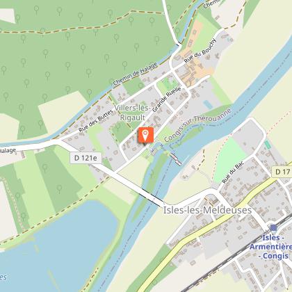
At the confluence of the Ourcq
Description
The elevatory factory of Villers-les-Rigault, the three streams, the confluence of the Ourcq and the old bridge "pont des Carreaux" on the canal, will liven up this woody trail.
This route is labelled and marked in pink by the Seine-et-Marne departmental hiking committee.
1) From the town hall, head towards the end of the car park, cross the Thérouanne and turn left into Rue du Vert-Moulin. Cross the D 121, continue opposite by the street that curves to the right and cross the D 121 again.
2) Continue on the alley parallel to the Canal de l'Ourcq for 300m.
3) At the Pont des Carreaux go down to the right, cross the D121E and continue along the path that enters a wood, then into the Grand Voyeux ornithological reserve. Turn left, pass in front of the Maury wood observatory, then continue through the undergrowth. Further on, turn right, then left and continue on the large grassy driveway, until you reach the D121E.
4) Cross the D121E, and pass in front of the lifting plant, of Villers les Rigaults.
Continue on Rue du Grand Voyeux and after the bend, take the 2nd street on the right, then slightly left a little further on. Continue through the undergrowth between the Canal de l'Ourcq and the Marne to the confluence with the Ourcq.
5) At a wastewater treatment plant, leave the path and go up gently towards the Canal de l'Ourcq. Take the towpath on the left for 1.5 km.
6) At the Villers-les-Rigault bridge, turn right. Continue along the road for 200 m, then cross the wood on the left and take the Pont des Carreaux.
7) Take the towpath on the right. Pass under the bridge of the D 121, continue along the towpath.
8) At the Pont du Gué, go down the road on the left. After the crossroads, continue opposite to reach the town hall.
Technical Information
Altimetric profile
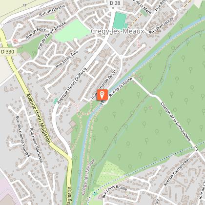
Starting point
Points of interest
Additional information
Environments
In the country
Lakeside or by stretch of water
Riverside
Village centre
Waterside
Updated by
Meaux Marne Ourcq Tourisme - 11/03/2026
www.meaux-marne-ourcq.com/
Report a problem
Open period
All year round daily.
Contact
Phone :
01 60 39 60 69
01 64 33 02 26
Email : seine-et-marne@ffrandonnee.fr
Website :
http://www.randonnee-77.com/
https://www.meaux-marne-ourcq.com/
Reception complements
Parking at the Town hall of Congis-sur-Thérouanne.
From Isles-Les-Meldeuses train station (Line P from Paris):
Possibility to start the hike at the Villers-Les-Rigault power plant.
Data author
