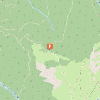
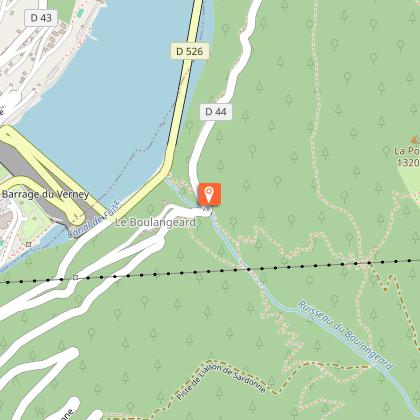
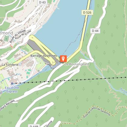
To see around
See more
Open
Close
Show
Show
Show
Show
Show
Show
Show
Show
Show
Show
Show

Oups... It would appear that Cirkwi does not have permission to use your location.

Description
Map
Steps
Points of interest
Ratings and reviews
See around

Le Boulangeard

Le Boulangeard
Le Boulangeard
Le Boulangeard
Le Boulangeard

Description

A "special enduro" ride, this route starts in pastureland and ends at Allemond at the Lac du Verney (1350 m of height loss). Although not very technical, it can be very fast for experienced riders and good practice for the less experienced.

Route in the “MTB in Oisans” guide (Oisans Tourisme)

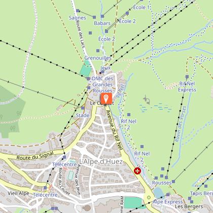
Departure: Alpe d'Huez, 1 850 m
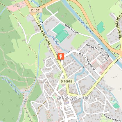
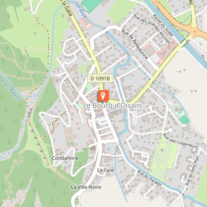
Arrival: Le Bourg-d'Oisans, 720 m
Time: 2 hours
Distance: 19 km
Highest point: 1 995 m
Lowest point: 712 m
Total ascent: + 220 m
Total descent: - 1 350 m
Technique: 3/4
Endurance: 2/4

Map: Top 25 Bourg d'Oisans et l'Alpe d'Huez 3335 ET

ROUTE
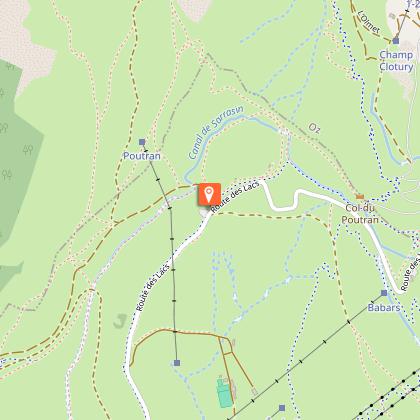
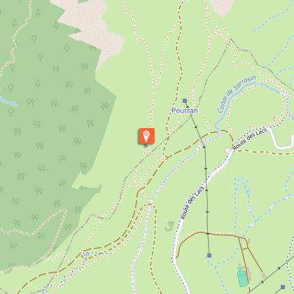
> Starting at the «Rond Point des Pistes» roundabout in Alpe d’Huez, follow the Route des Lacs road up to the Col du Poutran. At La Fontaine du Poutran, take the track on the left (signposted «EN3»).
> Once at the Crête de la Sure (1995 m), you are at the highest point of the route. The path goes down to the right, crossing pastureland before passing under avalanche shelters and then winding its way along the edge of a forest. This section can be very fast for skillful riders and is a good exercise for those
with less experience.
> Lower down, the path suddenly becomes calmer and you arrive at the Sardonne/Oz junction. Carry straight on towards Oz. This is a small, transverse path that then turns into an off-road vehicle track. Stay on this track for just under 1 km until you get to a right-hand bend. At this bend, follow the path going off
to the left towards “Pré Raynaud”. This section, which is also part of the Megavalanche, is quite fast and technical.
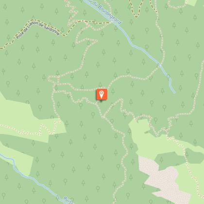
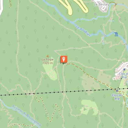
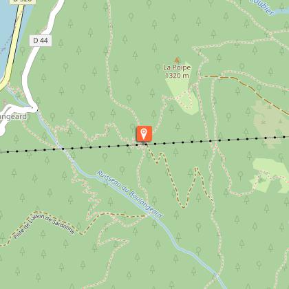
> After this somewhat intense section, you arrive on an off-road vehicle track. Carry on down it, past the hairpin bend and just 10 m further on, the Chemin du Boulangeard goes off to the right (signposted “EN 4”). You are now getting to the serious part, with technical switchbacks and some fine banked bends that follow one after the other until you reach the road leading to Le Boulangeard.
> Once on the road, turn right for 100 m and then take the first path down on the left. After a few bends and some wooden steps, you join the road to Allemond and the Lac du Verney. Carry straight on to Bourg-d’Oisans via le Raffour and then the track alongside the Romanche river.

Or to go back to Alpe d'Huez in the summer, cross over the dam to Allemond to take the cable car up to Oz and then to Alpe d'Huez. Remember that you need a ticket to take the cable car.

Technical informations

This circuit was updated on: 13/04/2024
19 km
2 h
max. 2001 m
min. 711 m
220 m
1350 m

Accessibility

Style : Mountain
Public : Reserved for experts/confirmed

Altimetric profile

Starting point

621 Avenue du Rif Nel , 38114 Oz-en-Oisans
Lat : 45.095859Lng : 6.070338

Steps

image du object
1

Alpe d'Huez

Once out of the cable car, take the Chemin des Alpages towards the Col de Poutran. Or ride on the road to the intersection of the track.

621 Avenue du Rif Nel 38750 Huez
- Oisans Tourisme -
Consulter
image du object
2

Follow the track

Take the track on the left to the aeromodelism space (follow the path to not disturb).

Route des Lacs 38750 Huez
- Oisans Tourisme -
Consulter
image du object
3

Towards Sardonne

Continue along the path on the right and cross the pastures to reach the start of the forest Sardonne. Beautiful descent.

Route des Lacs 38750 Oz
- Oisans Tourisme -
Consulter
image du object
4

"La Racine carrée"

Continuer à descendre le chemin à gauche. Laisser la piste de "La Racine carrée" par laquelle passe la Megavalanche.

Unnamed Road 38114 Oz
- Oisans Tourisme -
Consulter
image du object
5

Junction (towards Oz)

Turn right towards Oz (resort).

Hameau de Sardonne 38114 Oz
- Oisans Tourisme -
Consulter
image du object
6

Junction (pré Raynaud)

Take on the left towards Pré Raynaud.

D44A 38114 Oz
- Oisans Tourisme -
Consulter
image du object
7

Junction (Le Boulangeard)

Take the track on the right, pass the pin and catch the small path on the right that dips down into the forest in a series of switchbacks towards Le Boulangeard.

Unnamed Road 38114 Oz
- Oisans Tourisme -
Consulter
image du object
8

Le Boulangeard

Once on the road, turn right for 100m and then take the first path down on the left. After a few switchbacks and a wooden staircase, you get back onto the Allemont and Lac du Verney road. Cross over to the other side of the lake to cycle back to the swimming pool in Allemont.

D44 38114 Oz
- Oisans Tourisme -
Consulter
image du object
9

Lac du Verney - Allemont

Continuez tout droit pour rejoindre Bourg d'Oisans via le Raffour puis la piste longeant la Romanche. Ou bien, durant la période estivale, traversez le barrage pour vous rendre à Allemont afin de prendre la navette gratuite qui vous remontera gratuitement jusqu'à Oz Station. Attention : un forfait sera nécessaire pour retourner à l'Alpe d'huez. En tous cas, la navette vous remonte suffisamment haut pour refaire la portion du Boulangeard [EN 4] ;o)

D44C 38114 Oz
- Oisans Tourisme -
Consulter
image du object
10

Arrivé : Bourg d'Oisans (720 m)

17-19 Avenue de la République 38520 Le bourg-d'oisans
- Oisans Tourisme -
Consulter

Points of interest

image du object

Village d'Allemond

The history of Allemond has been marked by the mining industry and Alpine agriculture. Vieux Allemond, around the church and along the road leading to the Mairie, still has the traditional characteristics of Oisans villages.Allemond was known for its mining under Louis XIII and XIV, housing royal foundries (behind the tourist office), in which minerals mined around the village, mainly silver, lead and copper, were melted. For many years, the Hotel des Tilleuls (now closed) occupied some of the buildings of the former royal foundry. This hotel, featuring a superb walnut staircase, was bought in the 1920s by a former mayor of the village. His two daughters, Raymonde and Margarete, were well-known local characters who ran the hotel for many years. It was even rumoured that Napoleon III stayed there. Until the 1960s and 1970s, people lived very simple lives, nearly all as farmers. Then at the end of the 1970s, the Grand-Maison dam project was launched, providing a huge economic boost for the village and the region as a whole. The project lasted 10 years and brought many thousands of workers to the area. These days, the village lives mainly from tourism, both in summer and winter.

- Oisans Tourisme -
Consulter
image du object

Bourg-d'Oisans village

Here you are in Bourg-d'Oisans at an altitude of 700m: all around you are mountains and underfoot is the plain. This landscape has been shaped over thousands of years at the same time as the Alps were being created.The mountains you see, and the plain you walk on, are the consequences of shifting continents, the major ice ages and the subsequent warming. Humans have also helped shape this landscape over the last few centuries, adapting to and taking advantage of natural and geological constraints. The dammed rivers and the network of drainage canals, for example, have allowed the habitat to expand and agriculture to develop in the plain, creating a mountain "bocage" with fields and hedges. However, these actions have never eradicated certain natural hazards, such as avalanches and rockfalls. Half-wild and half-tamed, this landscape and its features are home to a multitude of animal and plant species, some of which are protected. Lake St Laurent: when the Vénéon-Romanche glacier retreated, it stagnated in the lower valley and a lake of more than 5,000 hectares then occupied the entire valley from Bourg-d'Oisans to Allemond. The alluvium deposited by the Romanche and the Vénéon gradually plugged up the lake and filled in the plain to a depth of 500m. In fact, if it weren't for the lake, which gradually filled in, the village would only be at an altitude of 200m! Bourg-d'Oisans is now a delightful little town of international renown where mountain lovers come, both in summer and winter, to stay and enjoy the many activities on offer!

- Oisans Tourisme -
Consulter

Date and time

  • From 01/06/2024 to 31/10/2024
  • From 01/06/2025 to 31/10/2025

Additional information

Updated by

Oisans Tourisme - 08/04/2024
www.oisans.com
Report a problem

Environments

Mountain location

Open period

From 01/06 to 31/10.

Contact

Phone : 04 76 80 78 01

Email : info@oisans.com

Website : www.bike-oisans.com

Topo guides and map references

Topo guides references :
Route in the “MTB in Oisans” guide (Oisans Tourisme)

Map references :
Top 25 Bourg d'Oisans et l'Alpe d'Huez 3335 ET

Location complements

There are a number of options for getting to the start point at Alpe d'Huez.
If you have two cars, leave one in Bourg d'Oisans.
Or use the Bourg d'Oisans > Alpe d'Huez bus (line 3020).
In the summer, you can take advantage of the cable car "Eau d'Olle Express" between Allemond and Oz Station, and then to Alpe d'Huez (remember that you need a ticket to get to Alpe d'Huez on the ski lift).

Data author

Image Oisans Tourisme
proposed by Oisans Tourisme
1 bis rue Humbert 38520 Le Bourg d'Oisans France

Ratings and reviews

To see around
See more
Open
Close
Show
Show
Show
Show
Show
Show
Show
Show
Show
Show
Show