To see around
See more
Open
Close
Show
Show
Show
Show
Show
Show
Show
Show
Show
Show
Show

Oups... It would appear that Cirkwi does not have permission to use your location.

Description
Map
Steps
Points of interest
Ratings and reviews
See around

The Postman's Path

The Postman's Path
The Postman's Path
The Postman's Path
The Postman's Path
The Postman's Path
The Postman's Path

Description

A lovely route that is emblematic of Oisans, featuring a narrow path, switchbacks and airy sections. The path follows the GR 50, linking Villard Reymond to Le Bourg d'Oisans, winding its way across the cliff overhanging Le Bourg d'Oisans.

Route in the “MTB in Oisans” guide (Oisans Tourisme)

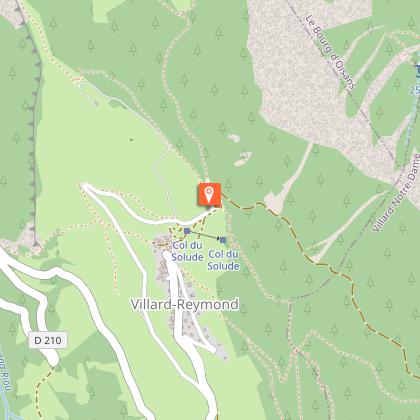
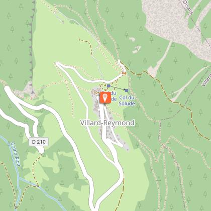
Departure : Villard Reymond - Col du Solude, 1680 m.
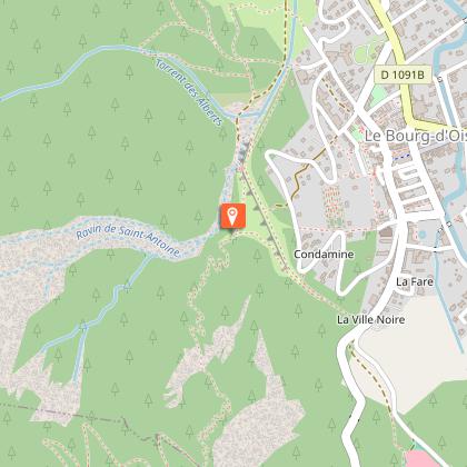
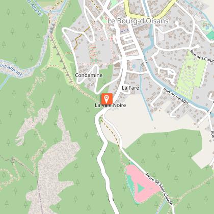
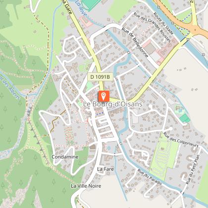
Arrival : Le Bourg-d'Oisans 720 m.
Length: 30 mins
Distance: 5 km
Highest point: 1 680 m
Lowest point: 720 m
Total height gain: 70 m
Total height loss: 970 m
Technique: 4/4
Endurance: 2/4

Map: Top 25 Bourg d'Oisans et l'Alpe d'Huez 3335 ET

ROUTE
> The path starts at the Col du Solude (1680 m) above Villard-Reymond and follows the GR 50 footpath. Keep your eyes open as at the top of the route, certain sections are separate for hikers and mountain-bikers, so make sure you follow the signs.
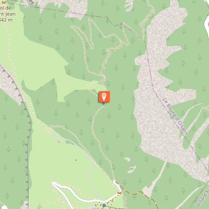
> Ride down 100 m from the Col on the road and take the path that carries straight on at the bend. This starts on a fast path, but you need to look out to the
right for a smaller path that winds between the trees. It’s a fun path, but you need to concentrate.
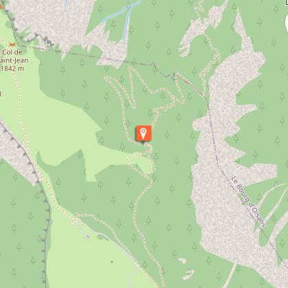
> Once back on the GR50, carry straight on to the path reserved for bikers, which gradually narrows until it becomes a series of switchbacks of varying technical difficulty. In all cases, BE CAREFUL as the cliff edge is never far away. There are no junctions, so no risk of getting lost.
> You arrive behind the Bourg-d’Oisans belvedere, which you go round to the right, following a small path as far as the road. This is in the «Ville Noire» district of Le Bourg-d’Oisans - turn left for the town centre.

Technical informations

This circuit was updated on: 13/04/2024
5 km
30 mn
max. 1684 m
min. 720 m
10 m
970 m

Accessibility

Style : Mountain
Public : Reserved for experts/confirmed

Altimetric profile

Starting point

Le Village , 38520 Villard-Reymond
Lat : 45.036095Lng : 6.019757

Points of interest

image du object

Village de Villard-Reymond

Villard Reymond Is a high mountain village in the heart of the Oisans massif, boasting a birds-eye view over Bourg d'Oisans. Located opposite the Grandes Rousses and Alpe d'Huez, it nestles at the foot of the Grand and Petit Renaud.The south-facing village dominates the small valley of Grand Riou and offers a magnificent view over the Taillefer. The area covered by the village starts at an altitude of 820 m on the right-hand bank of the fast-flowing Lignarre river and reaches up to the summit of the 2732 m Grand Renaud. With a village hall located at 1650 m, Villard Renaud is the highest village in Isère and the second highest in France. Located within the boundary of the Ecrins National Park, Villard Reymond is an unspoilt village with outstanding views over the Oisans mountain ranges. In this magnificent setting, life remains as peaceful as in the olden days, with locals offering a warm welcome. The road crosses over the Lignarre river and immediately starts to climb through the hamlet of Le Villaret, known for its slate quarry. The village lies at the end of a picturesque road, typical of the environment that characterises Villard Reymond, consisting of Alpine forests, rocky cliffs and pastures. Deer and chamois are regularly spotted and when out walking, it's not unusual to hear black woodpeckers and grey cuckoos, as well as seeing hazel grouse, rock partridge and black grouse. If you're lucky, you may come across wood orchids, but remember, look and don't touch! In the summer, there are a number of mountain-bike and hiking trails leading to places such as Le Prégentil, Le Clot de la Selle and the Col de Corbière. In winter time, visitors can choose from a wide range of snowshoeing and ski mountaineering trails. If the Mairie is closed, contact Bourg d'Oisans tourist office for more information.

- Oisans Tourisme -
Consulter

Date and time

  • From 01/06/2024 to 31/10/2024
  • From 01/06/2025 to 31/10/2025

Additional information

Updated by

Oisans Tourisme - 08/04/2024
www.oisans.com
Report a problem

Environments

Mountain location

Open period

From 01/06 to 31/10.

Subject to favorable snow and weather conditions.

Contact

Phone : 04 76 80 03 25

Email : info@oisans.com

Website : www.bike-oisans.com

Topo guides and map references

Topo guides references :
Route in the “MTB in Oisans” guide (Oisans Tourisme)

Map references :
Top 25 Bourg d'Oisans et l'Alpe d'Huez 3335 ET

Location complements

You can get to the Col du Solude from Bourg d'Oisans either by bike (around 2 hours) or by car (30 mins), if you have another car you can leave in Bourg d'Oisans.
2 routes:
- Via the road to Le Col d'Ornon (D526) then Villard-Reymond (D210)
- Via Villard-Notre-Dame (D219) then the 4WD track to the Col du Solude.

Data author

Image Oisans Tourisme
proposed by Oisans Tourisme
1 bis rue Humbert 38520 Le Bourg d'Oisans France

Ratings and reviews

To see around
See more
Open
Close
Show
Show
Show
Show
Show
Show
Show
Show
Show
Show
Show