This a varied route through pasture and woodland, descending gradually into the Eau d’Olle Valley. It switches between short descents and uphill sections, without any major technical difficulties, although a good level of fitness is required.
Route in the “MTB in Oisans” guide (Oisans Tourisme)
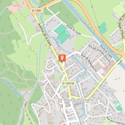
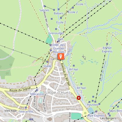
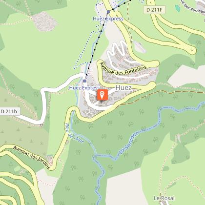
Departure: Alpe d'Huez ("Rond point des pistes" roundabout), 1 850 m
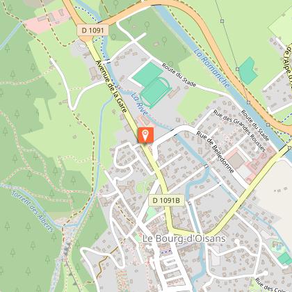
Arrival: Le Bourg-d'Oisans, 720 m
Time: 3 1/2 hours
Distance: 33 km
Highest point: 1 850 m
Lowest point: 712 m
Total ascent: 583 m
Total descent: -1 718 m
Technique: 2/4
Endurance: 3/4
Map: Top 25 Bourg d'Oisans et l'Alpe d'Huez 3335 ET
ROUTE
> The route follows the FFC signposting [XC 6] as far as Oz.
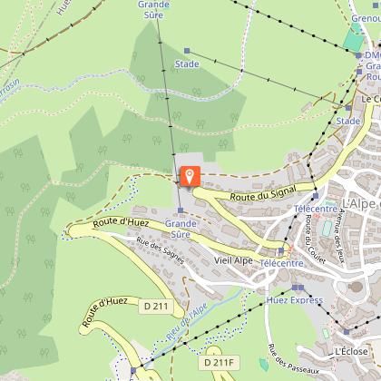
> Ride up to the very top of the resort, to the «Rond point des pistes» roundabout and on to the «Chemin panoramique » (on the left of the «Le Signal» chairlift), which goes round the Grande Sûre.
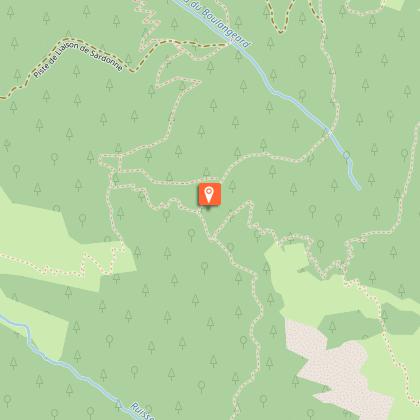
> Follow this panoramic and the Combe du Bras path. The first part is on earth switchbacks, whereas, lower down, the path becomes stonier and more technical.
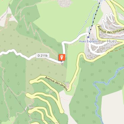
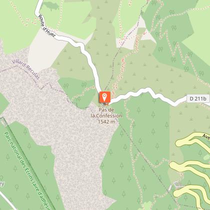
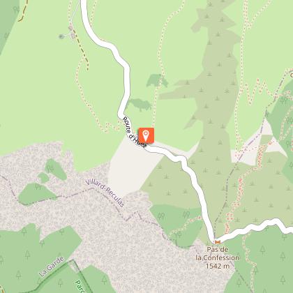
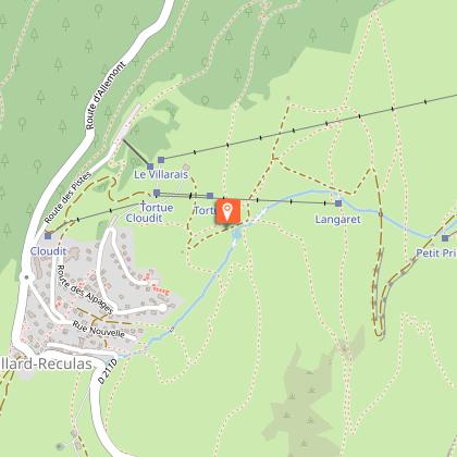
> When you arrive at the Huez - Villard-Reculas road, turn right for 3km to Villard-Reculas.
> Just before entering Villard-Reculas, follow the [XC 6] until Pré Reynaud.
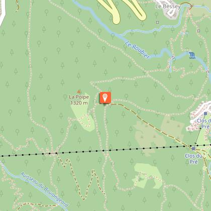
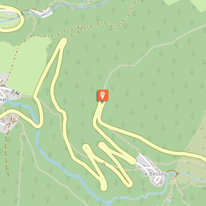
> At Pré Reynaud, turn left to Le Bessay. After crossing the ‘Pont du Gay’ bridge, go through Le Faubourg, with its old mountain barns.
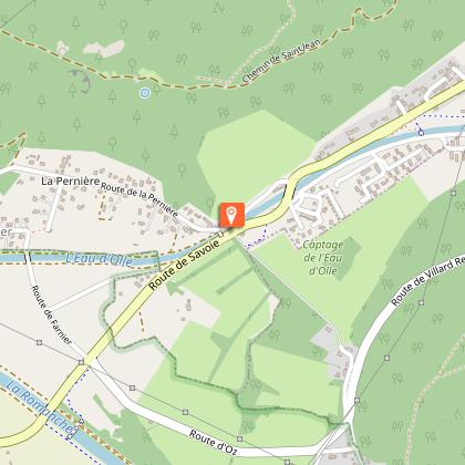
> From Le Bessay, ride up the road for about 500m to the hairpin bend and take the ‘Chemin de la Rompure’ towards Enversin-d’Oz.
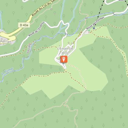
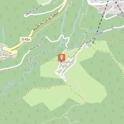
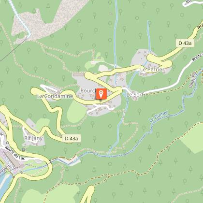
> In L’Enversin, turn down to the left, riding below the village. Around the last houses, don’t miss the small path down to the left, signposted Pourchery.
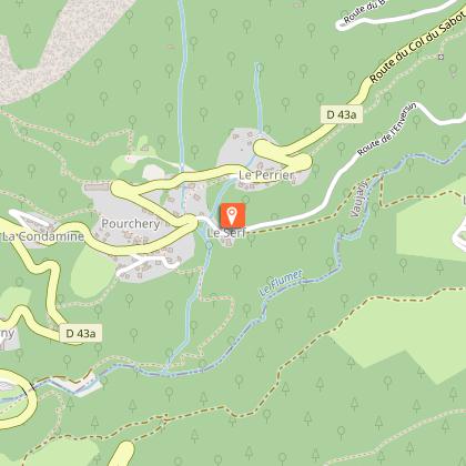
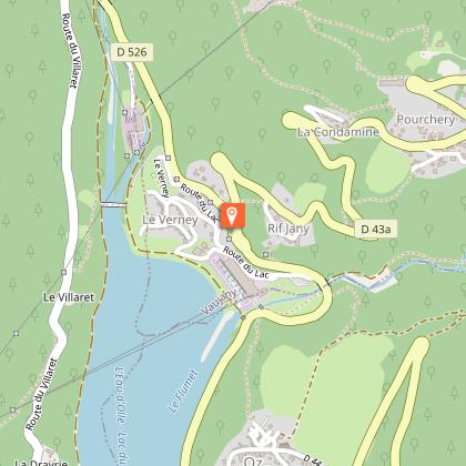
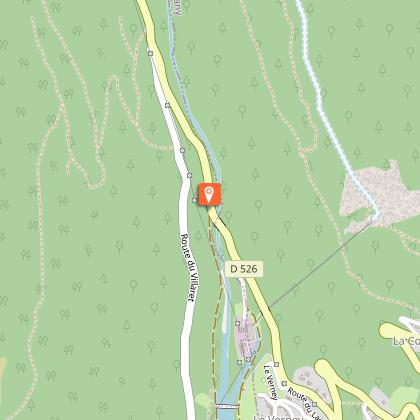
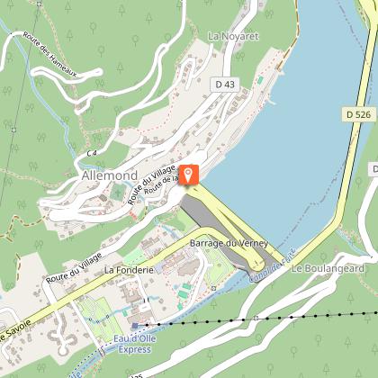
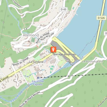
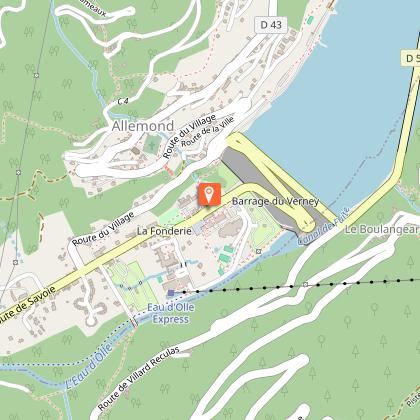
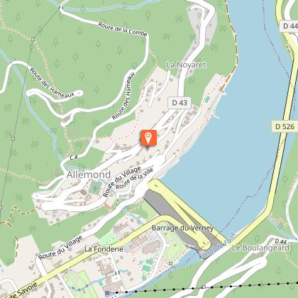
> In Pourchery, after the chalet called «Maitreya», turn left towards the Lac du Verney, following the FFC signs (XC 7). The path cuts across the road on several occasions. Cross the hamlet of Le Verney, then the Eau d’Olle river via the Himalayan footbridge and ride along the side of the lake back to Allemond.
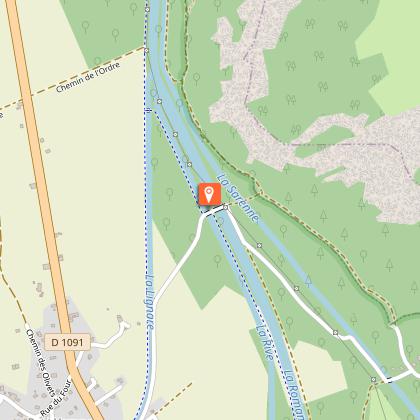
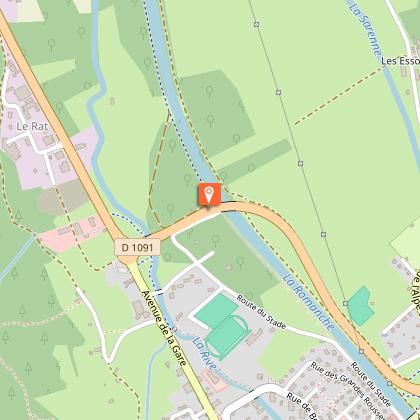
> It’s now a 10 km flat ride back to Bourg-d’Oisans. One option is to follow the dyke, via Le Raffour.
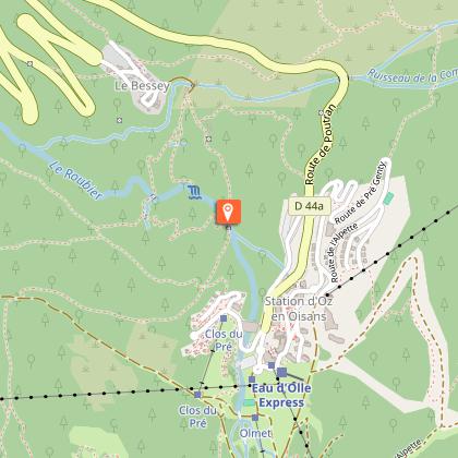
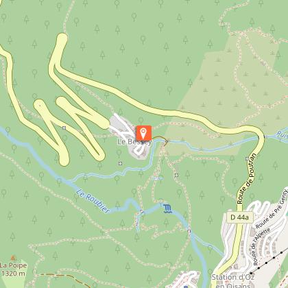
Or to go back to Alpe d'Huez in the summer, cross over the dam to Allemond to take the cable car up to Oz and then to Alpe d'Huez. Remember that you need a ticket to take the cable car.
33 km
|
max. 1861 m
min. 711 m
583 m
1718 m
| |||
Accessibility | ||||
Style : Mountain Public : Reserved for experts/confirmed |
Pour réaliser ce parcours vous pouvez emprunter le bus 3020 pour l'Alpe d'Huez.
The route starts at the ski-run roundabout at an altitude of 1860m. Ride until the start of the ski lifts. Take the path that start on the left of the chairlift "Le Signal".
This leads on to the wonderful panoramic balcony path, follow it until Villar-Reculas.
Continue on the path of "la Combe du Bras" on the left through the forest. You arrive on the road, take on the right to join Villard-Reculas on the "Confession" road. Then through the village, and join "La Bergerie" by the road of "Alpages". You will find our itinerary at the Langaret lake.
Arrivé sur la route prendre à droite.
Le point de vue sur la paine de Bourg d'Oisans est impessionnant. Pour la petite histoire le Pas de la Confession tiens son nom du fait qu’il valait mieux aborder ce terrible passage à pic la conscience tranquille, seules les âmes pures pouvaient se risquer sur cette route étroite, exposée aux chutes de pierres.
En arrivant un vue du village prendre sur la droite à travers les alpages vers le bassin du Langaret. Suivre le balisage XC 6.
After reaching a small lake (the Bassin du Langaret at 1626 m), go off to the north towards the forest, passing under the Villard-Reculas cable car just above the 3rd pylon.
The path enters the wood, becomes fast and pleasant, bordered by epilobium and redcurrant bushes.
Once at the signposted Sardonne – Chemin des Combes crossroads, follow the ‘Les Combes - Le Bessay’ path through a small beech wood. You can catch glimpses of the Eau d’Olle valley, dominated by the sharp Belledonne peaks.
At Pré Raynaud, turn left to Le Bessay and cross the picturesque ‘Pont du Gay’ bridge.
Traverser le pittoresque pont du Gay.
Go through Le Faubourg, with its old mountain barns, and through le Bessay. From Le Bessay, ride up the road for about 500m to the hairpin bend (1209m)
Take the ‘Chemin de la Rompure’ towards Enversin-d’Oz. Follow this path to the Vaujany road, taking care over the electric gates.
Turn left onto the road, ride past the gite ‘Chez Passoud’, carry on for another and turn off onto a narrow, signposted path to Pourchery.
At the end of the valley, cross a small footbridge. The path then goes up the mountainside – on your left, you can see the falls of shale, known as the ‘Abîme du Follet’.
Take the road on the left to join the Vaujany road in Pourchery.
In Pourchery, after the chalet called "Maitreya", take the path to Verney.
Carry on along the road to Pont Ratier.
Take the GR path back to Allemont.
Once on the dam, take the little road on the corner to join the parking.
In July and August, shuttle buses will bring you back to Oz (then take the cable car until Alpe d'Huez).
Il vous reste 10km de plat pour rejoindre votre véhicule à Bourg d'Oisans.
Peu après avoir dépassé le pond à la sortie d'Allemont et juste avant un arrêt de bus, prendre un petit sentier sur votre gauche pour rejoindre le Raffour.
Traverser le hameau et rejoindre la digue jusqu'à Bourg d'Oisans.
Suivre à nouveau la digue en rive gauche.
Passez sous la déviation de Bourg d'Oisans.
The history of Allemond has been marked by the mining industry and Alpine agriculture. Vieux Allemond, around the church and along the road leading to the Mairie, still has the traditional characteristics of Oisans villages.Allemond was known for its mining under Louis XIII and XIV, housing royal foundries (behind the tourist office), in which minerals mined around the village, mainly silver, lead and copper, were melted. For many years, the Hotel des Tilleuls (now closed) occupied some of the buildings of the former royal foundry. This hotel, featuring a superb walnut staircase, was bought in the 1920s by a former mayor of the village. His two daughters, Raymonde and Margarete, were well-known local characters who ran the hotel for many years. It was even rumoured that Napoleon III stayed there. Until the 1960s and 1970s, people lived very simple lives, nearly all as farmers. Then at the end of the 1970s, the Grand-Maison dam project was launched, providing a huge economic boost for the village and the region as a whole. The project lasted 10 years and brought many thousands of workers to the area. These days, the village lives mainly from tourism, both in summer and winter.
Villard-Reculas is in a location that is both difficult and ideal for a village. It is situated in a balcony above the valley, with fine pastureland and a south-facing exposure that is ideal for agriculture, but has always been difficult to access.There are several explanations of the origin of the name. "Reculas" from the French "reculé" meaning remote, or else "recula" as the village had to "retreat" following a major avalanche. In any case, once you're there it feels great, but you still have to get there! Oisans features a number of hard-to-reach places, but since 1980, access to Villard-Reculas has been along a good, well-maintained road. The village has undergone something of a revival following several years of rural exodus and, thanks to the welcoming inhabitants, tourism is flourishing. It has kept its traditional character with no large buildings being constructed and no concrete, but instead a farm, goats, chamois and a pretty little church with an interesting history. Indeed, the church was moved to make it easier to access in winter. As is often the case in Oisans, it was originally located just outside the village next to the cemetery, but was completely rebuilt in its current position and extended on the same occasion. The expression "village resort" takes on its full meaning here. Tin roofs, old farms made of slate (thanks to the nearby quarries), old-fashioned pastureland and an atmosphere that is unique to Oisans. Here's an interesting fact - this little village owes its water supply to a system...built by the Sarrazins in the sixth century! The "Canal des Sarrazins", which solved the crucial problem of supplying water to the village, is still working today and is THE monument in Villard-Reculas. Don't expect an aqueduct as the construction is modest but efficient, and has proved to be extremely resistant over time.
Oisans Tourisme - 29/04/2024
www.oisans.com
Report a problem
Mountain location
Mountain view
From 01/06 to 31/10.
Phone : 04 76 11 44 44
Email : info@oisans.com
Website : www.bike-oisans.com
Topo guides references :
Route in the “MTB in Oisans” guide (Oisans Tourisme)
Alpe d'Huez grand domaine VTT track map
Map references :
Top 25 Bourg d'Oisans et l'Alpe d'Huez 3335 ET
There are a number of options for getting to the start point in Alpe d'Huez.
If you have two cars, you can leave one in Bourg d'Oisans.
Or you can take the Bourg d'Oisans > Alpe d'Huez bus (line 3020).
In the summer, you can take advantage of the cable car "Eau d'Olle Express" between Allemond and Oz Station, and then to Alpe d'Huez (remember that you need a ticket to get to Alpe d'Huez on the ski lift).