Alert
Alerts
The Besse loop


IGN cards


Description
The climb up to the Emparis Plateau is gradual, on a mountain track, with a fabulous views. The descent to Besse on the GR 54 is a stimulating MTB downhill path and you should arrive at the bottom with a happy grin on your face!
Route in the “MTB in Oisans” guide (Oisans Tourisme)
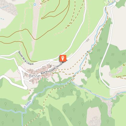
Departure / Arrival (loop): Besse-en-Oisans, 1550 m
Time: 2 h
Distance: 14 km
Highest point: 2 263 m
Lowest point: 1 550 m
Total ascent: + 700 m
Total descent: - 700 m
Technique: 2/4
Endurance: 3/4
Map: Top 25 Bourg d'Oisans et l'Alpe d'Huez 3335 ET
or Top 25 Meije Pelvoux 3436 ET
ROUTE
> Starting from the car park, carry on along the road towards the GR54 path, following sign to ‘Le Plateau d’Emparis’. Then take the paved track which goes off to the right from the entrance to the GR path. The climb is steady, on easy terrain, allowing you to enjoy the wonderful views.
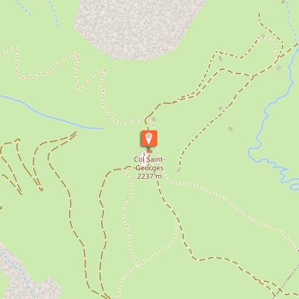
> Once on the plateau, turn to the left to the Col St-George, 100 m further on.
> Take the GR54 back down to Besse. This path offers an entertaining descent on shale ground with plenty of natural banking.
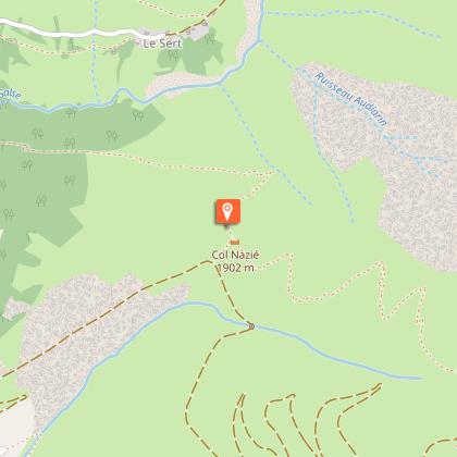
> After a thrilling series of hairpins, you arrive with a grin at the Col Nazié, but take care here as this is grazing ground for livestock.
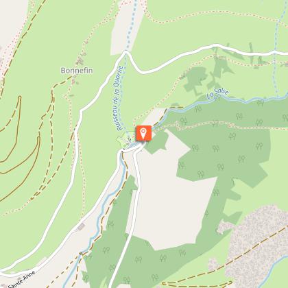
> Carry on downwards, as there are plenty more bends to enjoy, ending up back on the small road that leads to Besse.
WARNING
The mayor’s office in Besse-en-Oisans is questioning the overuse of this descent on the GR path. The frequent use of shuttle vehicles – often minibuses taking up a dozen mountain bikes – is creating problems regarding the number of bikes on the path. This is a style of mountain biking similar to that practiced in resorts and is not suited to the local environment. In addition, the Emparis plateau is a listed natural site and a Natura 2000 site – a fragile area that we need to respect. There are no prohibitions, but alarm bells are ringing as regards downhill-only mountain biking, which has its place in resorts, rather than in such an untamed environment.
Technical Information
Altimetric profile
Starting point
Steps
Additional information
Updated by
Oisans Tourisme - 21/11/2025
www.bike-oisans.com
Report a problem
Environments
Mountain location
Village centre
Tips
Buy some delicious bread for your picnic from the traditional bakery opposite the car park in Besse!
Open period
From 01/06 to 31/10.
Subject to favorable snow and weather conditions.
Topo guides and map references
Topo guides references :
Route in the “MTB in Oisans” guide (Oisans Tourisme)
Map references :
Top 25 Bourg d'Oisans et l'Alpe d'Huez 3335 ET
or Top 25 Meije Pelvoux 3436 ET
Contact
Phone : 04 76 80 00 85
Email : info@oisans.com
Website : https://www.bike-oisans.com
Location complements
Leave your car at the car park the other side of Besse, just below the traditional bakery.
Data author
