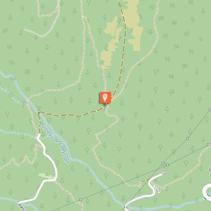
To see around
See more
Open
Close
Show
Show
Show
Show
Show
Show
Show
Show
Show
Show
Show

Oups... It would appear that Cirkwi does not have permission to use your location.

Description
Map
Steps
Points of interest
Ratings and reviews
See around

Coteyssart

Coteyssart
Coteyssart
Coteyssart
Coteyssart
Coteyssart

Description

This is one of the most accessible routes in the Massif de Belledone. After a gentle climb up by road, the fast-paced descent is thrilling. With a tried and tested technique, there's nothing to fear.

Itinerary from the “MTB in Oisans” guide (Oisans Tourisme)

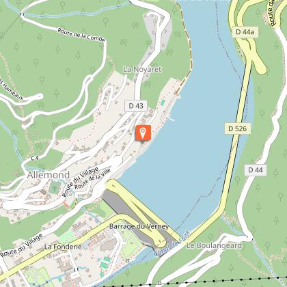
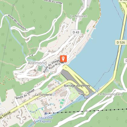
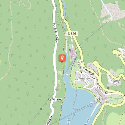
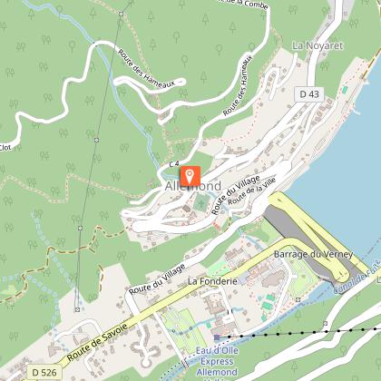
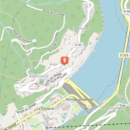
Departure/Arrival (loop) : Allemond (Lac du Verney) 770 m
Length: 1 1/2 hours
Distance: 13 km
Highest point: 1304 m
Lowest point: 770 m
Total height gain: + 550 m
Total height loss: - 550 m

Technique: 3/4
Endurance: 3/4

Map: Top 25 Bourg d'Oisans and l'Alpe d'Huez 3335 ET

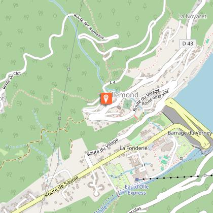
> From the Lac du Verney car park, retrace your steps and take a very small path leading up to the right to the Allemond-le-Haut road. Turn right and follow this road towards the church and then follow signs to La Rivoire, Le Clot and La Traverse. The road is little-used, leading up to the Coteyssart chalets (1304 m) in around an hour. The panoramic view over the Bourg-d’Oisans plain and Les Grandes Rousses will make the time fly by.
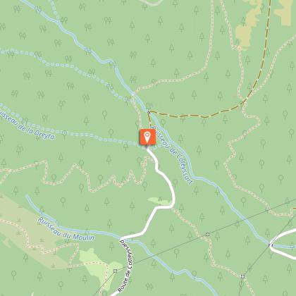
> Once at the chalets, the Coteyssart descent starts on the right, signposted «Allemond par la Combe», comprising a pleasant series of switchbacks, with some natural banking. It’s a fun, varied ride.
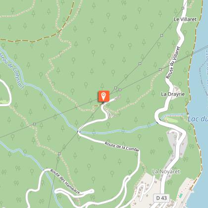
> At La Combe, cross the road and follow signs to Le Villaret (GR 549) opposite. This short path passes between gardens and houses (watch out for local residents), before leading down to the road (D43).
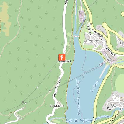
> On the road, turn left for 150m and go down to the right to join the path back down to the Lac du Verney.
> This path offers a pleasant ride alongside the right side of the lake to the car park.
> This single track is not too high and on the sunny side of the valley. It is therefore one of the first paths to open in Oisans in the spring (and the last to close in the autumn).

Technical informations

This circuit was updated on: 13/04/2024
13 km
1 h 30 mn
max. 1315 m
min. 768 m
550 m
550 m

Accessibility

Style : Mountain
Public : Reserved for experts/confirmed

Altimetric profile

Starting point

90 Chemin des Grands Champs , 38114 Allemond
Lat : 45.132566Lng : 6.043071

Steps

image du object
1

Allemont

From the car park of the watersports centre, ride to the church of Allemont.

90 Chemin des Grands Champs 38114 Allemond
- Oisans Tourisme -
Consulter
image du object
2

Route du village

Prendre à droite en continuer de monter par la route en direction de l'église d'Allemont.

1385-1421 Route du Village 38114 Allemond
- Oisans Tourisme -
Consulter
image du object
3

Allemont church

turn left towards La Rivoire, Le Clot and La Traverse, the last solitary hamlet on the steep foothills of the Belledonne. The road is narrow, steep, and little-used. Although paved, is completely in the MTB spirit.

90 Route des Hameaux 38114 Allemond
- Oisans Tourisme -
Consulter
image du object
4

Coteyssart

The end of the road turns into a track. 300m afterwards, on the right, a signpost points to ‘Les Chazeaux – Allemont par la Combe’.

2610-2614 Route de Cotteyssard 38114 Allemond
- Oisans Tourisme -
Consulter
image du object
5

GR 549 on the right

Follow : Chazeaux – Allemont par la Combe. Before following this, it’s worth taking a short detour 2km further along the original track to a beautiful view point over the Grandes Rousses massif. The ride down to Coteyssart is a pleasant series of switchbacks, with some natural banking, through a lovely forest.

2592-2724 Route de Cotteyssard 38114 Allemond
- Oisans Tourisme -
Consulter
image du object
6

La Combe

At La Combe, follow the narrow GR 549 to Le Villaret.

657-995 Route de la Combe 38114 Allemond
- Oisans Tourisme -
Consulter
image du object
7

Le Villaret

Arrivé sur la route prendre à gauche sur 150m puis prendre le premier sentier à droite qui vous emmènera jusqu'au Lac du Verney.

1720 Route du Villaret 38114 Allemond
- Oisans Tourisme -
Consulter
image du object
8

1720 Route du Villaret 38114 Allemond
- Oisans Tourisme -
Consulter
image du object
9

/!\ Attention /!\

Cette portion entre la Combe et le Villaret est fermé pour travaux jusqu'au XXX

893-1651 Route du Villaret 38114 Allemond
- Oisans Tourisme -
Consulter

Points of interest

image du object

Eglise d'Allemond

The church as it stands today celebrated its 100th anniversary in 1987. The former, smaller church however was renovated and extended in 1872, yet 10 years later, the building became was considered dangerous and needed to be rebuilt.The current church has undergone many changes, including a new bell tower, a large clock, a new bell-tower roof, outside walls and the replacement and protection of the stained-glass windows. In 2002, the bell tower was changed as a number of inhabitants wanted to read the clock face from afar and from all sides. The old clock was therefore replaced by an electric, automatic system with 4 huge luminous clock faces. The correct time can now be seen from all four points of the compass, both day and night!

375 route du village 38114 Allemond
- Oisans Tourisme -
Consulter
image du object

Village d'Allemond

The history of Allemond has been marked by the mining industry and Alpine agriculture. Vieux Allemond, around the church and along the road leading to the Mairie, still has the traditional characteristics of Oisans villages.Allemond was known for its mining under Louis XIII and XIV, housing royal foundries (behind the tourist office), in which minerals mined around the village, mainly silver, lead and copper, were melted. For many years, the Hotel des Tilleuls (now closed) occupied some of the buildings of the former royal foundry. This hotel, featuring a superb walnut staircase, was bought in the 1920s by a former mayor of the village. His two daughters, Raymonde and Margarete, were well-known local characters who ran the hotel for many years. It was even rumoured that Napoleon III stayed there. Until the 1960s and 1970s, people lived very simple lives, nearly all as farmers. Then at the end of the 1970s, the Grand-Maison dam project was launched, providing a huge economic boost for the village and the region as a whole. The project lasted 10 years and brought many thousands of workers to the area. These days, the village lives mainly from tourism, both in summer and winter.

- Oisans Tourisme -
Consulter

Date and time

  • From 01/05/2024 to 15/11/2024
  • From 01/05/2025 to 15/11/2025

Additional information

Updated by

Oisans Tourisme - 08/04/2024
www.oisans.com
Report a problem

Environments

Mountain view
Mountain location
Close to GR footpath

Open period

From 01/05 to 15/11.

Subject to favorable snow and weather conditions.

Contact

Phone : 04 76 80 71 60

Email : info@oisans.com

Website : www.bike-oisans.com

Topo guides and map references

Topo guides references :
Route in the "MTB in Oisans" guide (Oisans Tourisme)

Map references :
Top 25 Bourg d'Oisans and l'Alpe d'Huez 3335 ET

Location complements

Leave your car in Allemond, in the Lac du Verney car park (at the top of the dam).

Data author

Image Oisans Tourisme
proposed by Oisans Tourisme
1 bis rue Humbert 38520 Le Bourg d'Oisans France

Ratings and reviews

To see around
See more
Open
Close
Show
Show
Show
Show
Show
Show
Show
Show
Show
Show
Show