Balade de la Vallée de Wavre au Bois des Rêves
Description
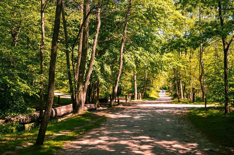
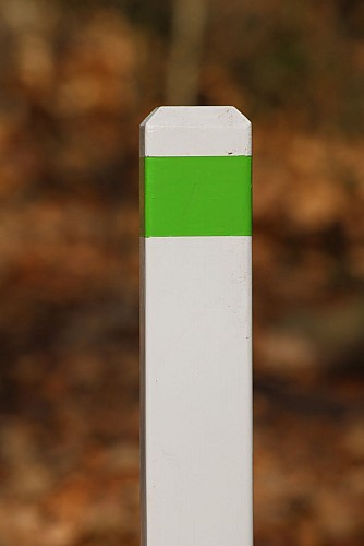
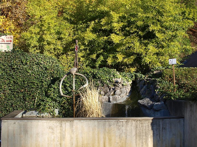
This 3km walk will allow you to discover the 67 hectares of the Bois des rêves. You will go along the “Basse aux Biches” (which was once a pond and which gave rise to a legend related by Adolphe Mortier). You will explore various very sandy paths, including that of the Wavre Valley. It takes you to the highest point on the estate (132 metres), with a 400-metre section that climbs 37 metres. It was the path taken by labourers of the Court-Saint-Étienne metal works on their way back to Wavre’s high ground, via Bauloy and Lauzelle wood (Bois de Lauzelle). This very old trail goes through a region where Neolithic items have been found. In the Chavée des Roitelets, keep your eye out for goldcrests and common firecrests. You will then take the Chemin du Lac, which sometimes follows route 55 of the nodal point network (Louvain-la-Neuve - Ottignies) or runs alongside the Ry Angon and Malaise streams. The Ry Angon starts in Mont-Saint-Guibert, at the Profondval farm. This stream runs through the hamlet of Ruchaux and the Bois des Rêves, where it receives water from the Malaise before flowing into the Dyle near the station in Mousty. Before returning towards the Bois des Rêves pond you will pass close to the dog area. This fenced area is open every day, allowing dogs to be let off the leash. All dogs are welcome, provided they are friendly, up to date with their vaccinations and micro-chipped. Dog owners must clean up after their dogs. This walking route is marked (green). It has a climb of 46 metres and a descent of 59 metres. The IBP index for walking this route is 16. The IBP index for running this route is 26. The IBP index is an automatic system for assessing the difficulty of a route for mountain biking, road biking, hiking or running. This index is very useful for finding out and comparing the difficulty of different trails. Further information on the IBP index can be found here: www.ibpindex.com/index.php/en/ The Bois des Rêves is accessible for people with reduced mobility, but the walk is difficult at points so they must be accompanied. The trails are sandy and gravelled, and certain weather conditions may cause them to become muddy or dusty. The Bois des Rêves also offers a playground, a fishing pond and a brasserie (depending on the current opening times). Wooden statues by woodcarver Dominique Gillis can be found at various points around the Bois des Rêves. Other activities are organised by the Water and Fountain Museum (Musée de l’eau et de la fontaine: +32 (0)470 67 20 55). The Bois des Rêves is also home to the Birds Bay centre (wild animal hospital: +32 (0)495 31 14 21).
Technical informations
3 km
|
min. 99999 m
68 m
| |||
Styles : BaladeDiscovery Public : FamilyOccasional hikersTeenagers Theme : Couples | ||||
Altimetric profile
Starting point
Additional information
Signalétique (EN)
No signage
Data author
