The Singuigneret loop
Description
A 7 km descent on a varied and technical path down steep valleys. Although quite long, the climb up is gradual.
Route in the “MTB in Oisans” guide (Oisans Tourisme)
Departure/Arrival (loop): Mizoën, 1190 m
Length: 4 hours
Distance: 24 km
Highest point: 2 310 m
Lowest point: 1 190 m
Total height gain: + 1 164 m
Total height loss: - 1 164 m
Technique : 3/4
Endurance : 4/4
Map: Top 25 Bourg d'Oisans et l'Alpe d'Huez 3335 ET
ROUTE
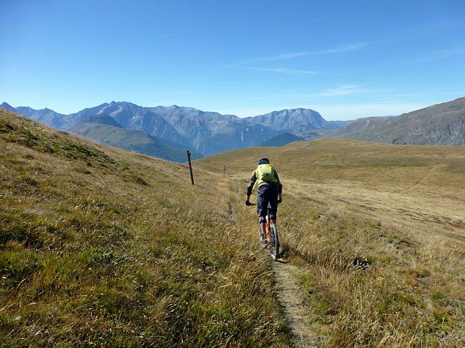
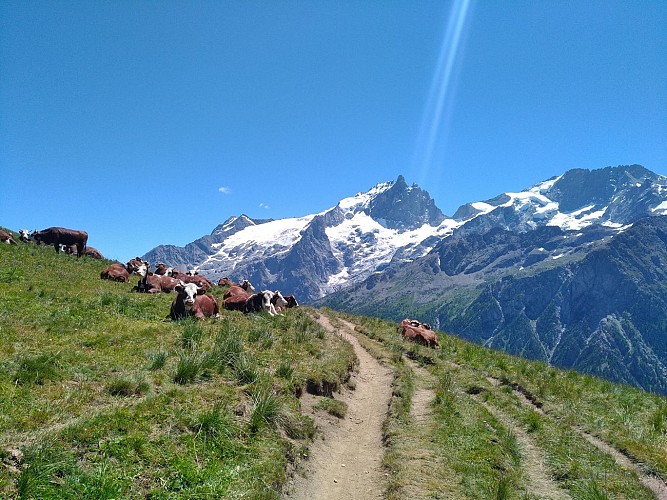
> From the center of Mizöen village, take the track road to Singuigneret. The climb should take about two hours, without hurrying, up to the Chalet du Fay. You have time to enjoy the views over the Romanche valley, Girose glacier and La Meije.
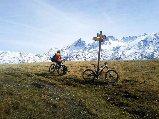
> Go round the Refuge du Fay to join up with the GR 50 which climbs gradually to the Chalets Girardet. Stay on the right-hand track up to «Sur Brèche» (2307 m).
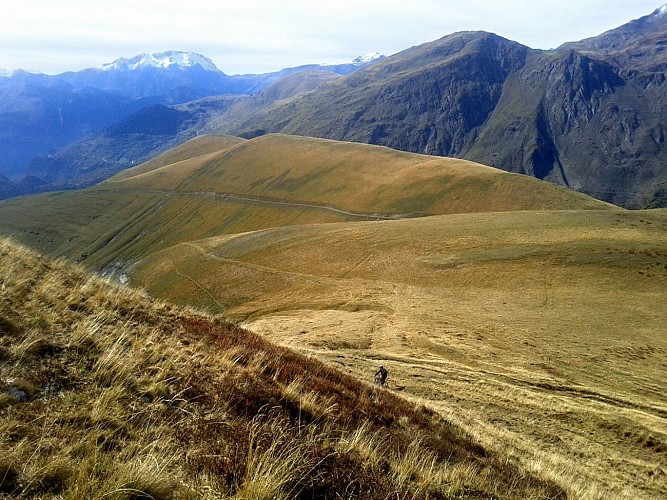
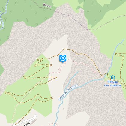
> This is the highest point of the ride. You can now enjoy the descent through the pastureland, following signs to the former Refuge des Chatons.
> The paths descends into a magnificent valley. At the bottom, cross over to the right-hand bank of the stream and continue to the Ruines de l’Alpe and then to the former Refuge des Chatons.
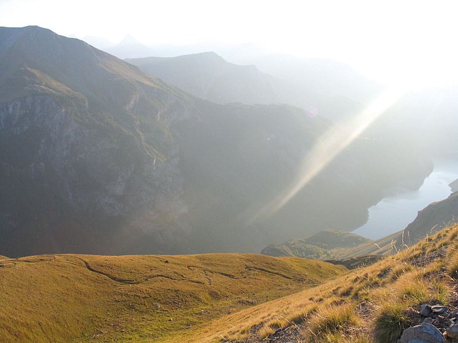
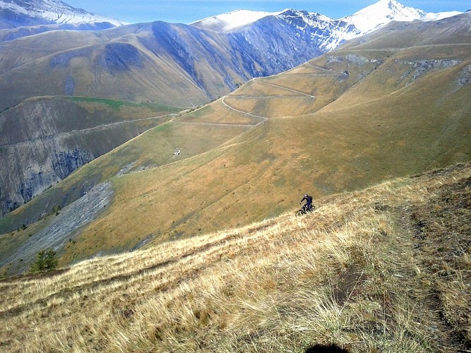
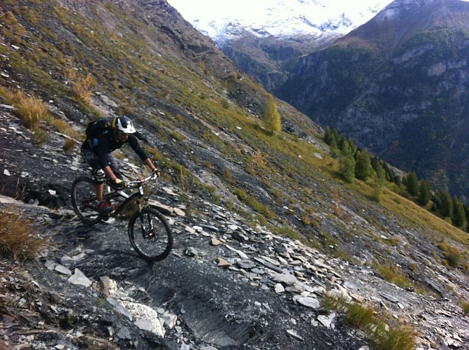
> Cross the track in front of the hut and take the path leading off downhill. This section crosses over a shale wall with a commanding view over the Lac du Chambon. This may sound challenging, but apart from the first two bends, there are no specific technical difficulties. Just make sure you don’t fall off.
> This path leads back to Singuigneret and then Mizoën, cutting over the track road on several occasions.
Technical informations
24 km
|
max. 2315 m
min. 1182 m
1164 m
1164 m
| |||
Style : Mountain Public : Sportsmen | ||||
Altimetric profile
Starting point
Steps
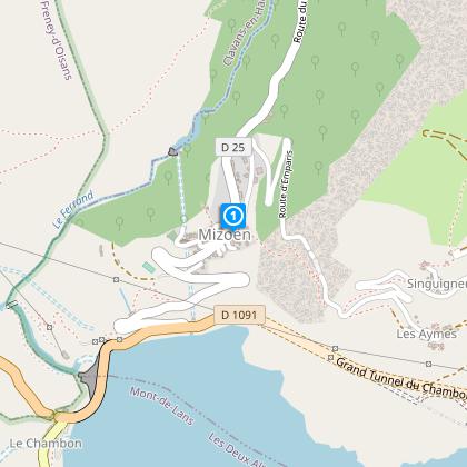
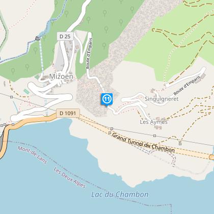
Mizoën
Starting at the car park at the end of the village of Mizoën, take the track road to Singuigneret. The climb should take about two hours, without hurrying,
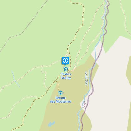
Chalet du Fay
The Chalet du Fay is not far from the track. Look for the GR 50 which climbs gradually through pastures to the Chalet Girardet, before descending sharply towards Mizoën.
Chalets Girardet
Downhill Start
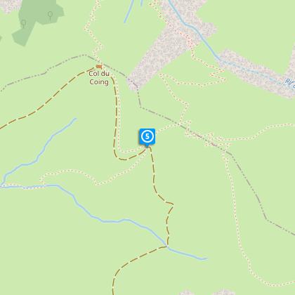
Cross the track
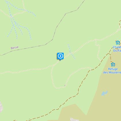
You then cross the track to enter into a very wide valley.
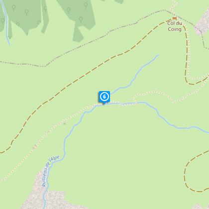
In the hollow of the valley
The path looks as if it climbs steeply but, fortunately this is just an optical illusion, as it in fact stays level.
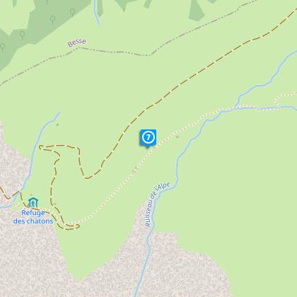
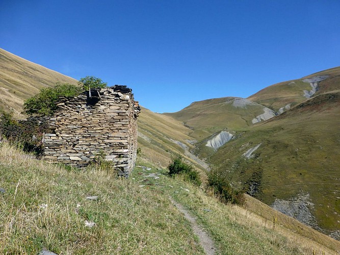
Ruins
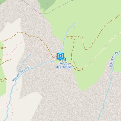
Refuge des Chatons
Pass just below the Refuge des Chatons that you passed on the way up.
Technical part
The descent here features some technical sections, switchbacks and steps on terrain that is sometimes slippery.
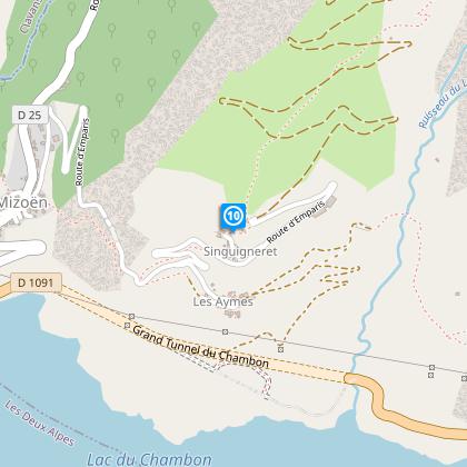
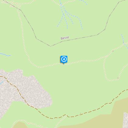
Singuigneret
Once at the peaceful hamlet of Singuigneret, follow the GR path back down to Mizoën.
Follow GR 50
Points of interest
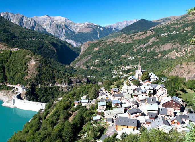
Mizoën
Sitting on a rocky peak, Mizoën is the front door of the Ferrand valley. This charming village of Oisans gives a beautiful and panoramic view on the Chambon lake, located below.Offers a beautiful view of the Meije mountain, the gorges of Romanche and the Taillefer summits. The village of Mizoën is shaped by history and legends (the Huguenots before the revocation of the Edict of Nantes, the history of the Chambon dam in 1920 – 1930,) shaped by the farmers' work, by transhumance, by its traditions and its old paths surrounded by oratories. You can also visit the museum in the Clots hamlet, located near a mountain hut, that will teach you about the life of farmers before. The village is also located in the middle of beautiful landscapes : the Clots, the Emparis plateau and its lakes. You will find in Mizoën a warm and friendly atmosphere where you will be able to rest, discover and contemplate.
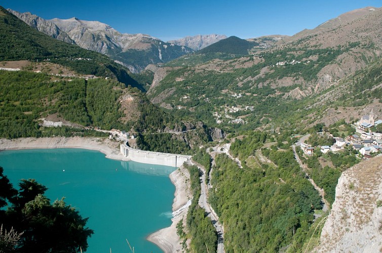
Barrage du Chambon
The Chambon dam was built between 1929 and 1935. In 1918, the industrialist Henri Frédet discovered the potential of this narrow, 75m long section of the Romanche river. It proved to be the ideal location for regulating the flow of the river.In 1921, studies showed that the presence of hard, cristallin schist in the soil provided a perfect seal for the water. The potential of hydroelectricity drew the attention of speculators during the 1920s stock exchange boom. Despite having to flood the villages of Le Chambon,Le Dauphine and Pariset, work began on the dam. During the construction period, a temporary cable car was set up over a 10.5 km stretch from Bourg d'Oisans to Le Chambon to supply the site with cement and other materials more rapidly. This cable car had 193 huge buckets that could each carry 250 km of cement. 62 metal pylons were built 900 m apart, some up to 40 m high, to bear the weight of the 22.5 km steel cable. The reservoir filled with water between 24 April and 9 October 1935. As early as May 1935, the turbines of the Sainte-Guilherme power plant were being driven by water and intake from the neighbouring Ferrand Valley was later added to boost the supply of water.
N°12 Romanche - Tour du Plateau d'Emparis
Boucle très sportive et techniqueAu départ du Chazelet, prendre la direction du vallon de la Buffe, traverser les villages des Rivets et suivre la piste rive gauche jusqu'au fond du vallon A la baraque de la Buffe, prendre à gauche, un sentier raide, qui nécessite, poussage et alternance de roulage pendant presque 1 heure. Une fois arrivé sur le plateau descendre le joli sentier qui s'offre à vous, traverser les prairies, puis rejoindre le col St-Georges. Suivre la piste pendant une centaine de mètres, puis couper à gauche, sur le GR qui descend. Monter en direction du col du Souchet, par le sentier. Au col du Souchet, prendre à droite, un sentier qui monte et fait le tour du lac Noir, et revient vers le lac Lérié Descente rapide par le très joli GR vers le sommet du téléski du plateau d'Emparis. Après avoir croisé le téléski, prendre à gauche une descente plus technique menant au Clot Raffin, puis rejoindre le Village du Chazelet par une dernière courte montée.
Date and time
- From 01/05/2024 to 31/10/2024
- From 01/05/2025 to 31/10/2025
Additional information
Location complements
Leave your vehicle in Mizoën.
Contact
Phone : 04 76 80 00 85
Email : info@oisans.com
Website : www.bike-oisans.com
Open period
From 01/05 to 31/10.
Subject to snow conditions.
Updated by
Oisans Tourisme - 31/01/2024
www.oisans.com
Report a problem
Data author
