Alert
Alerts
Hiking trail - La Salvetat
Description
Hiking trail "La Salvetat".
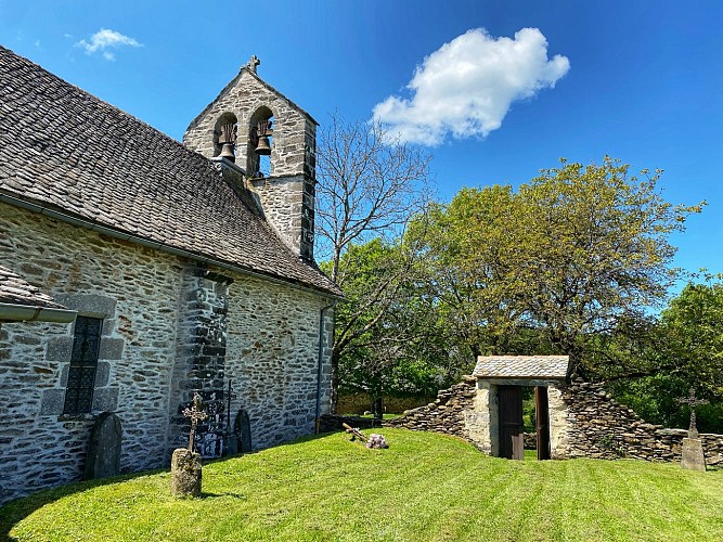
This circuit is situated at 750 m altitude on a wooded, semi-shaded plateau and offers a remarkable view. It is easy and has very little tarmac. You will walk along a coniferous wood and find a deciduous forest (beech, oak, birch). Halfway along the route, you will see the village of La Salvetat, with its restored houses, its church and its Commandery of the Order of Malta. In the keystone, you will notice the eight-pointed Cross of Malta.
This fact sheet is one of 55 available individually (€0.50) at each Visitors Bureau of the Châtaigneraie Cantalienne or to be downloaded from the Cantal Rando & Découverte app.
Technical Information
Altimetric profile
Starting point
Additional information
Environments
Mountain view
In the country
Village centre
Updated by
Office de Tourisme de la Châtaigneraie Cantalienne - 17/04/2026
www.chataigneraie-cantal.com
Report a problem
Open period
All year round.
Subject to favorable weather.
Contact
Phone : 04 71 46 94 82
Email : info@chataigneraie-cantal.com
Website : https://chataigneraie-cantal.com
Facebook : https://www.facebook.com/otchataigneraie.cantal
Type of land
Ground
Hard coating (tar, cement, flooring)
Animals
Yes
