Alert
Alerts
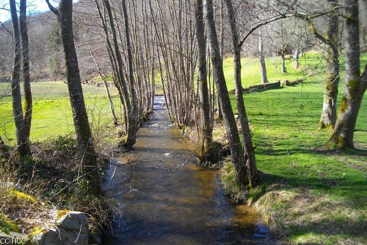
Along the Dejoune


Description
You will fall in love with this one-day hike as you discover a secret valley, the Dejoune river valley.
Departure from in front of the town hall. Set off for the opposite side of town heading towards Croze then Magnat.
Take the path before the cemetery. Go on alongside the meadows, and go through a wood. The path becomes a trail. Cross a stream and find a path that rises through a logging area.
Follow the road to the left for 800 m. Turn right at the next crossroads, and go through Pierrefite. Take the path on the right opposite the La Gane crossroads.
Go up into the woods. At the end of the meadow, turn left then right to find a path that goes up into a plantation. At the top, follow the path to the right. At the Y-junction, go straight ahead until you get to Lachaud.
Keep to the left in the village. After the water tower, take the path to the right. Continue for 300 m, then fork right onto the trail. Turn left at the next crossroads to cross a stream. 50 m. after this, on the right, take an inconspicuous trail that goes into the woods. Follow the markings carefully. Find a path that goes back to the road. Turn right to Queyriaud.
Keep to the left in the village. The road becomes a trail that you follow as far as La Somme.
Cross the road, follow the track for 1.2 km. In a bend, take the path on the right, continue to Le Moussard.
Turn left, then right, and then left in the village. At the last house, go up the trail returns to the road. Follow it to the right for 400 m. Follow the path to the left that runs alongside the road, joining a track that you take on the right. Take the road to the left and then, to the right, take a path that runs alongside the road again.
Before the gîte, turn to the right. At the crossroads, turn right. Follow the trail straight ahead past where the charcoal is burned. Shortly after logging area, turn left; the trail goes down to the road.
Follow it for 1 km. At the crossroads, turn left but stay on the abandoned road. The road becomes a path that goes uphill into the forest and then arrives at the Poussanges church. Go through the town to get back to the start.
Technical Information
Altimetric profile
Starting point
Points of interest


Additional information
Advised parking
Car park at the Town Hall, Poussanges
Advice
Shooting takes place regularly close to the military camp at La Courtine. Don't worry, it only happens inside the military compound. This circuit is a shorter version of a longer circuit (20 km) which is the subject of a special description sheet.
Access
As you leave Felletin heading towards Ussel, follow the D23 towards Poussanges. From Ussel, follow the D982 towards Felletin. 15 km beyond La Courtine, turn right, go through Clairavaux, then head towards Poussanges.
Ambiance
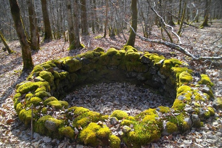
This hike goes up the Dejoune River to the sources of the many streams that make it up, bordering the La Courtine military camp. Walking on the high part of the valley, elements of traditional architecture, the history of the hamlets, and viewpoints follow one after another. The large municipal woodland forest offers a variety of forest environments. Deciduous trees take precedence with oaks, beeches, and various softwoods. On the way back, the church of St-Pierre/ St-Paul, dating from the 14th century, and the lime tree known as the "Sully" are inviting places to stop for a break.
Arrival
Car park at the Town Hall, Poussanges
Departure
Car park at the Town Hall, Poussanges
Data author
