Le Cernix / Mont-Lachat n°1
Description
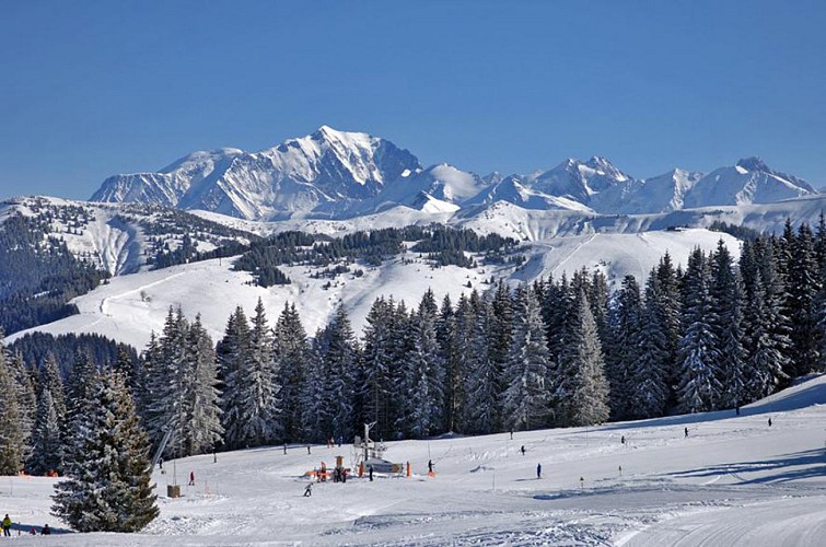
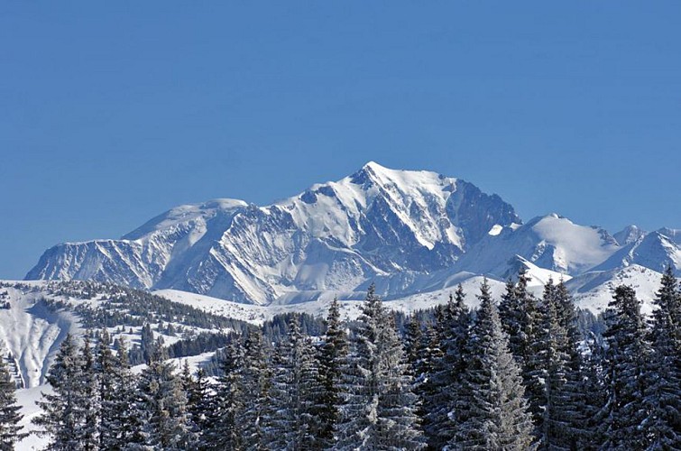
Between tracks and forests, an ideal route for discovery or initiation to ski touring. On arrival, a magnificent view of Mont-Blanc from the top of Mont Lachat!
Departing from the car park under the hilly reservoir (small artificial lake), the climb alternates between slightly steep sections and others that are sometimes steep. Go up to the edge of the forest to the left of the ski lift, follow the track on your left (slight descent) and go up towards the Ballevard chalet. You progress in an open environment on the edge of the ski area until you enter the forest for the final part of the route. Once in the forest, the slope is weaker, enjoy this special forest atmosphere. A steeper passage on a few bends marks the final part to exit on the edge of the alpine ski slopes at the top of Mont Lachat. It's over for the ascent and it's time for the descent!
Some technical difficulties on the climb: the progression in the forest and the necessary conversions in the steep parts. Take your time to perform the movements that are essential for climbing uphill.
PRACTICAL INFORMATION :
• Ski touring is ONLY authorized on the routes provided for this purpose. Downhill skiing is prohibited on the way up.
• Have the right equipment.
• Adapt your itinerary to your physical capacities, the weather conditions and the time available.
• You are responsible for your own safety and that of others.
• Never go alone and inform those around you of your itinerary.
• Respect nature and the tranquility of the place.
WARNING :
Outside opening hours, access to the ski area is strictly prohibited.
DANGER winch ramming (cable).
CF Municipal decrees (posted at the cash desks).
EMERGENCY NUMBERS:
112
Technical informations
2 km
|
max. 1587 m
min. 1248 m
334 m
334 m
| |||
Altimetric profile
Starting point
Additional information
Reception complements
Itinerary available free of charge at the Tourist Office or on the "Traces Alpines" application.
Contact
Phone : 04 79 31 62 57
Email : info@crestvoland-cohennoz.com
Open period
Subject to favorable snow and weather conditions.
Updated by
Office de Tourisme du Val d'Arly - 23/01/2024
www.valdarly-montblanc.com
Report a problem
