Alert
Alerts
The montagnettes of Planay
Description
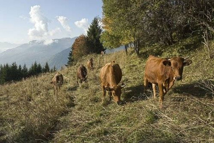
This easy route lets you delve into the past, to a time when the main activity of men in the high valleys was agriculture and livestock farming. Ÿou will discover the montagnettes, temporary dwellings used mainly in the off-season. Note the architecture of the houses, stables, barns and coladz, buildings that kept the milk cool, as well as the dry stone walls that line the old paths.
From the car park, go up to the left of the houses by a small path which crosses the road upstream of the houses, which then crosses north towards the hamlet of Mollard (1,564 m in altitude). Take the trail lined with a dry stone wall that rises above the winding road. Continue straight ahead at the boundary marker, joining an EDF track further up that leads to Pélapoët. Follow this track to the left until you reach the barn (1,614 m in altitude). Take the trail that rises to the Chalet de la Golle. Immediately upstream, leave the trail for the Tour du Merle, turning directly onto a track on the right which descends just before going up to the hamlet of Plan Fournier (1,723 m in altitude). Cross the hamlet, go up the road for a few dozen metres and take the trail on the left at a cross. This trail rises slightly up to a crossroads. Turn left onto the ascending path which plunges into the spruce forest and head north first, then go back south, slightly horizontally at first, to reach the top of the steepest part. Cross the clearing, then the forest that follows it. Then a succession of clearings leads to the Cave de Plan Fournier (or Plan Fournier Dessus) at 1,970 m in altitude. From the Cave de Plan Fournier, take the trail due south which rises towards the Gallinettes. Leave this trail after a hundred metres and go down to the right slightly after the grove. Go up a few dozen metres, still towards the south, and enter the spruce forest. The trail continues through the forest until it joins, at a near-level altitude, the Bois Blanc. At the crossroads, take the trail on the right leading down to the car park (1,805 m in altitude) of the Refuge du Grand Bec track. Go down the track as far as Plan Fournier. Cross the hamlet, but do not take the track used for the ascent. Take a small path downstream, which gœs straight down through the forest, to the Maison de Pélapoët, then again head straight as far as Mollard, where you will find the ascending path leading back to La Rochette.
Technical Information
Altimetric profile
Starting point
Points of interest


Additional information
Departure
La Rochette (alt. 1,500 m)
Arrival
La Rochette (1,500 m in altitude)
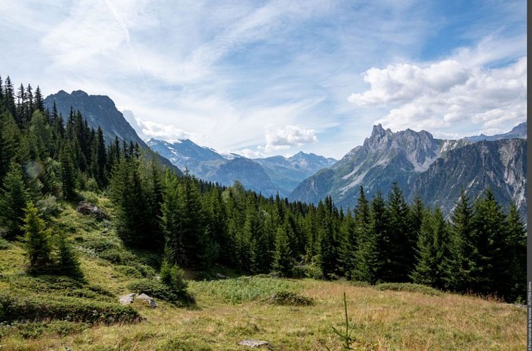
Ambiance
On this entirely sloping landscape, the mountain dweller had to adapt to the conditions. His way of life was born from the slope. At the return of summer, the herds left the bottom of the valley and headed back to the mountain pastures. A specific date was adopted, around Saint John. While waiting for the inevitable date, for the grass to grow at altitude, the cows are found at an intermediate bearing. They took their first step midway between the lower stables and those at altitude, in what are called the montagnettes. This relocation was called a “remue” (transhumance or summer quarters) From the French verb “remuer”, meaning to relocate In Planay, they are called “tramoués” in patois.
Access
Following the road from Bozel to Pralognan, head to Planay-en-Vanoise. Take the direction of Pralognan (D915), which you leave after 600m by turning left to reach the listed hamlet of Chambéranger. At the entrance to the village, turn right on to the narrow road that leads to La Rochette (1,500m), and park.
Advised parking
La Rochette
Public transport
"
Rail connection to Moûtiers. Information: www.voyages-sncf.com
Then transport by coach to Planay and/ro Pralognan. Information:www.transavoie.com
Also think about car-sharing with www.mobisavoie.fr
"
Advice
"
This walk can be done in half a day. Please note that the climb and descent between La Rochette and Plan Fournier run for a good part along the theme trail ""Man and the slope"". It is interspersed with reading tables, providing valuable information on life in and around the mountains in times gone by.
"
Data author
