Alert
Alerts
Loop of Roche Jaille

Description
A hike between Maurienne and Tarentaise facing the local giant, the Grand Perron des Encombres, a ridge that is as staggering as the beauty of the landscapes it embraces.
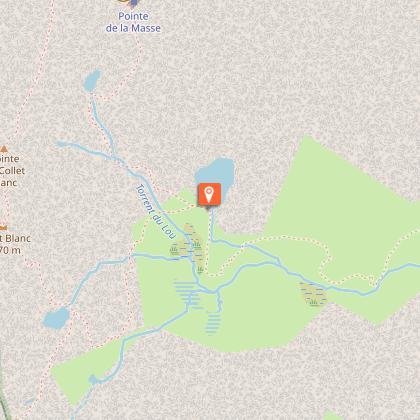
From the car park, take the path that rises to the balcony above the Plan de l´Eau and follow it to the Refuge du Lac du Lou (about 1 hour). Just after the refuge leave the trail that gœs around the lake and head towards Lac de Pierre Blanche then the pass of the same name (approximately 2hrs 30mins). From the pass, continue to the right on the wide convenient stop and walk easily from cairn to cairn to the Col de Montfiot, hill 2,652m on the map (about 1hr 30mins). Reach the Petit Lac de Montfiot visible below the pass, then turn off to the right and the marked path gœs back down to Lac du Lou and finally Bruyères car park (approximately 2 hrs).
Technical Information
Altimetric profile
Starting point
Points of interest


Additional information
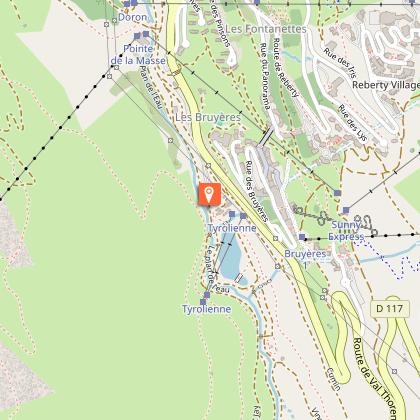
Advised parking
Plan de l'Eau des Bruyères car park
Public transport
Rail connection to Moûtiers. Information: www.voyages-sncf.com. Then transport by coach to Ménuires. Information: www.transavoie.com Free shuttle buses to the “Vallée des Belleville” Information: transdev Savoie. Departure for the hike approximately 1km from the village of Saint Marcel.
Advice
Particularly fragile environment, do not depart from the paths.
Accessibility infrastructure
Adapted toilet facilities, comfort walk accessible to those with reduced mobility around Lac des Bruyères
Access
From Moutiers take the D117 in the direction of the “Vallée des Belleville”. Pass Saint-Jean-de-Belleville, then Saint-Martin-de-Belleville. At the roundabout of Ménuires continue in the direction of Val Thorens. The Plan de l´Eau des Bruyères car park is located approximately 150 m after Lugeland and at the departure of the Bruyères track on the right.
Arrival
Plan de l'Eau des Bruyères car park
Ambiance
“Accompanied by Céline and Manon, I leave the Plan d´Eau des Bruyères going over the drop to leave the last traces of civilisation behind me. The Col de Pierre Blanche offers as a first reward an extensive landscape with an all-encompassing view that the greatest acrobatic skiers would approve of. All that remains is to stroll horizontally over the handy ridge which invites you to take your time, the world below can wait.” Franck Dorne, Vanoise National Park ranger
Departure
Plan de l'Eau des Bruyères car park
Data author
