Alert
Alerts
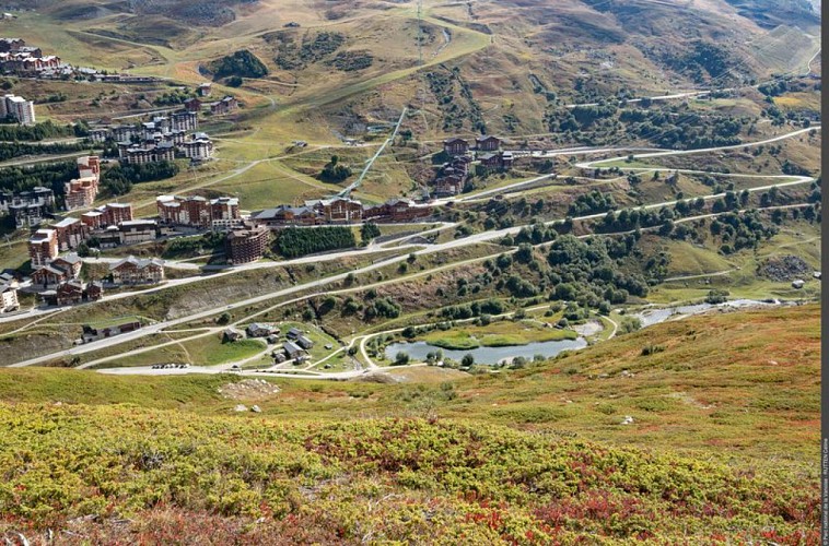
Family walk around the Plan de l'Eau des Bruyères
Description
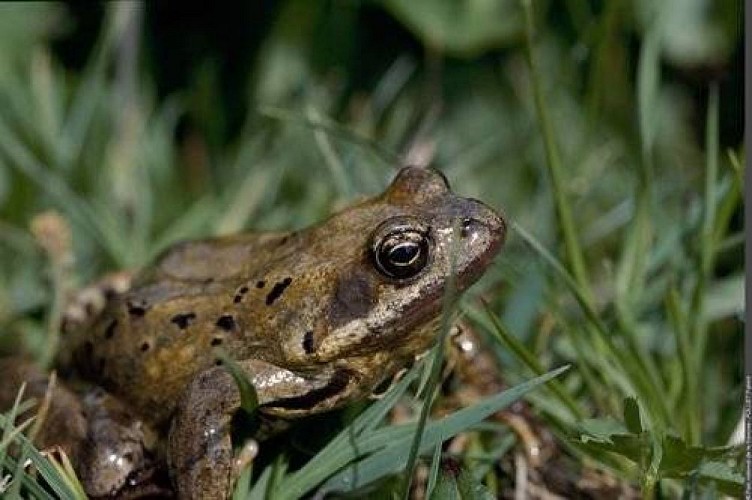
Accompanied by the wagtails in the streams or the dippers, let the sound of the torrent sooth you and take the time to look at the precious life sheltering in the wetlands.
Departing from Bruyères car park, set off on the comfort trail keeping the water body to your left. At the end of the water body, leave the comfort trail to take a path leading towards the bottom of the valley and quickly reach the main track. Go back up this track again still towards the bottom of the valley. Walk along the torrent to reach a bridge at the end of the plateau (1,770 m in altitude). Then return along a wide track overlooking the water body, in the direction of the entrance to the plateau. Reach a section of the track already taken. Ÿou will encounter the comfort trail again. The hike ends upon returning to Bruyères car park with the water body on your left.
Technical Information
Altimetric profile
Starting point
Points of interest


Additional information
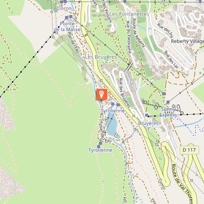
Departure
Plan de l'Eau des Bruyères car park - Les Ménuires
Arrival
Plan de l'Eau des Bruyères car park - Les Ménuires
Ambiance
"
""Imagine the valley 10,000 years ago when the entire valley was covered in ice. Then as the climate warmed up, the glaciers retreated giving way to wetland and peatland. Plants established there, with a procession of birds, amphibians and insects. It is this time difference that I like in this circuit of the Plan de l´Eau tour where you can see part of the largest ski area in the world, as well as plants that had established their presence at the time of the dinosaurs (those from the horsetail family).” Céline Rutten, Vanoise National Park ranger
"
Access
From Moutiers take the D117 in the direction of the “Vallée des Belleville”. Pass Saint-Jean-de-Belleville, then Saint-Martin-de-Belleville. At the roundabout of Ménuires continue in the direction of Val Thorens. The Plan de l´Eau des Bruyères car park is located approximately 150 m after Lugeland and at the departure of the Bruyères track on the right.
Accessibility infrastructure
Comfort trail accessible to those with reduced mobility with the possibility to complete just the first loop of the tour around Lac des Bruyères. Adapted toilet facilities.
Advised parking
Plan de l'Eau des Bruyères car park - Les Ménuires
Public transport
"
Rail connection to Moûtiers, information: www.voyages-sncf.com. Then transport by coach to Saint-Martin-de-Belleville, information: www.transavoie.com . Free shuttle buses between Val Thorens and Saint-Martin-de-Belleville, information: Transdev Savoie. Departure for the hike approximately 3 km from the village centre.
"
Advice
Particularly fragile environment, do not depart from the paths.
Data author
