Alert
Alerts
Hiking Trail: Walk from Arpenaz to Luzier

Description
From the Arpenaz waterfall to the hamlet of Luzier, a beautiful little contemplative walk combining the water, the forest, the village and its chapel. A beautiful Nature & Heritage discovery accessible to all.
Go hiking safely!
Walking time is approximate and does not take into account break times.
The topo/step-by-step description guides you generally but does not replace a 1/25,000 hiking map or other topoguides available in our tourist office!
In Sallanches, our Office of Guides & Leaders also offers a wide choice of outings accompanied by mountain professionals providing you with complete expertise on the environment and alpine nature, inquire at the tourist office to register.
Whatever your hike, check the weather before you go. Remember to take cereal bars, sufficient water, sunglasses, sunscreen, a cap or hat, a small first aid kit, as well as clothing suitable for your outing in your backpack. depending on the season and the forecast weather.
Technical Information
Altimetric profile
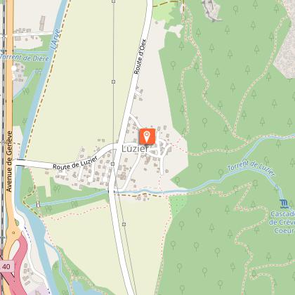
Starting point
Points of interest
Additional information
Environments
In the country
Lakeside or by stretch of water
Riverside
Forest location
Mountain view
Village -2 km away
Waterside
Waterfall view
Updated by
Office de Tourisme de Sallanches - 16/04/2026
www.sallanchesmontblanc.com
Report a problem
Open period
All year round daily.
Subject to favorable weather.
Type of land
Ground
Grit
Not suitable for strollers
Contact
Phone : 04 50 58 04 25
Email : tourisme@sallanches.com
Website : http://www.sallanchesmontblanc.com
Facebook : https://www.facebook.com/SallanchesMontBlanc
Reception complements
Go hiking safely!
Walking time is approximate and does not take into account break times.
The topo/step-by-step description guides you generally but does not replace a 1/25,000 hiking map or other topoguides available in our tourist office!
In Sallanches, our Office of Guides & Leaders also offers a wide choice of outings accompanied by mountain professionals providing you with complete expertise on the environment and alpine nature, inquire at the tourist office to register.
Whatever your hike, check the weather before you go. Remember to take cereal bars, sufficient water, sunglasses, sunscreen, a cap or hat, a small first aid kit, as well as clothing suitable for your outing in your backpack. depending on the season and the forecast weather.
Guidebook with maps/step-by-step
Departure: Cascade car park
1. Take the path in the car park which indicates the direction of Luzier. In the spring this trail is very fragrant with the smell of wild garlic which abounds in the area.
2. the path climbs a little in the undergrowth with a few roots and small pebbles to step over
3. then you arrive at a crossroads where you have to follow the one on the right towards Luzier.
4. the path is now flatter; in the fall you will be able to observe some wild cyclamen.
5. when you leave the undergrowth you cross the fields which descend to the hamlet of Luzier.
6. Arrived at the hamlet you go down the street on the right which passes in front of a large farm then in front of the chapel of Luzier (the chapel can be visited only on request, however you can have some explanations at the tourist office); you will also pass in front of beautiful, highly decorated village basins.
7. Then you will join the small road of Oëx to reach the starting point.
Animals
Yes
Data author
