Alert
Alerts
Tour of the Glières plateau in 3 days
Description
The Glieres Plateau at an altitude of 1450m is a pastoral setting, perfect for discovering animals and flowers. Chosen for a parachute landing ground by the allies, the plateau housed near to 500 resistance fighters from january to march 1944.
The first day of walking through forests and passes will lead you to the plateau des Auges, whose 360° view will allow you to admire the panoramas of the Pre-Alps and the Mont-Blanc chain.
The second day of the tour is perhaps the wildest of your itinerary. It is not uncommon to come across a few ibex at the Col de l'Ebat or under the Col du Cable.
While maintaining a duty of memory, man has been able to develop pastoral activities within the plateau. For your last day of itinerary, you will walk in the heart of the plateau, and will be able to visit the monument of Gigioli and to follow a part of the thematic path retracing the history of this place.
To complete your itinerary, a marked trail offers an overview of the events. Also worth visiting on the plateau is the work of the sculptor Gigioli, inaugurated by André Malraux in 1973. On the road leading to Thônes: the Nécropole Nationale des Glières, the departmental museum of the Resistance and Deportation.
Technical Information
Altimetric profile
Starting point
Points of interest


Date and time
- From 01/06/2026 to 30/09/2026
- From 01/06/2027 to 30/09/2027
Additional information
Open period
From 01/06 to 30/09.
Subject to favorable snow and weather conditions.
Updated by
Conseil Départemental de la Haute-Savoie - 23/02/2026
www.hautesavoiexperience.fr
Report a problem
Contact
Phone : 04 50 02 00 26
Email : infos@thonescoeurdesvallees.com
Website :
https://www.thonescoeurdesvallees.com
https://www.savoie-mont-blanc.com
Facebook : https://www.facebook.com/thonescoeurdesvallees
Location complements
Access (by car): From Annecy, take the D909 to Balme de Thuy, then leave the D909 shortly after the Nécropole de Morette for Thuy, parking at "Le Sapey".
Topo guides and map references
Map references :
TOP 25 IGN 3430 ET - LA CLUSAZ
Type of land
Not suitable for strollers
Environments
Mountain view
Mountain location
Guidebook with maps/step-by-step
1/ DAY 1: Parking du Crêt Sapey (986m) - Refuge des Mangeurs de Lune (1800m): 3H20. From Crêt du Sapey parking lot (986m) to Col de la Buffaz (1500m): 1H40. From Col de la Buffaz to Refuge des Mangeurs de Lune (1800m): 1H40.
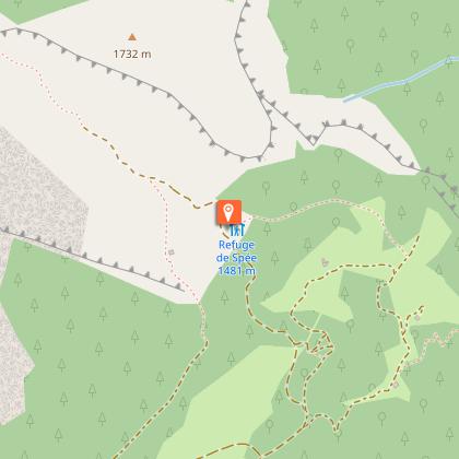
2/ DAY 2: Refuge des Mangeurs de Lune - Refuge de Spée (1369m): 5H. From Refuge des mangeurs de Lune (1800m) to Col des Glières (1425m): 1H15. From Col des Glières to trail junction (1488m): 1H30. From trail junction to Refuge de Spée (1369m): 2h15.
3/ DAY 3: Refuge de Spée - Parking du Crêt Sapey (986m): 4H20. From Refuge de Spée (1369m) to Monument du Plateau (1433 m): 1H20. From Monument du Plateau to Chalet de la Rosière (1200m): 1h40. Chalet de la Rosère to Parking du Crêt (986m): 1h20.
Animals
Yes. Pets allowed on leash only
Data author
