Alert
Alerts
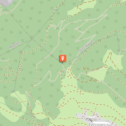
Feissons's cross loop
1 alert on this circuit
Visitor alert
This hike is accessible with a dog, but we advise you to keep your dog on a lead throughout the entire route. This helps to protect wildlife, preserve flora and ensure the peace and quiet of other hikers.


Description
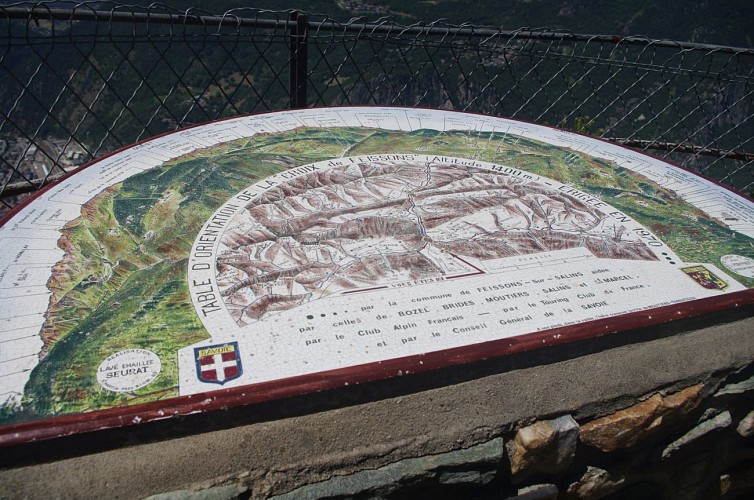
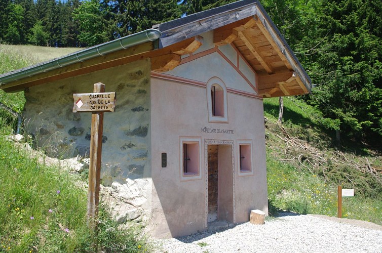
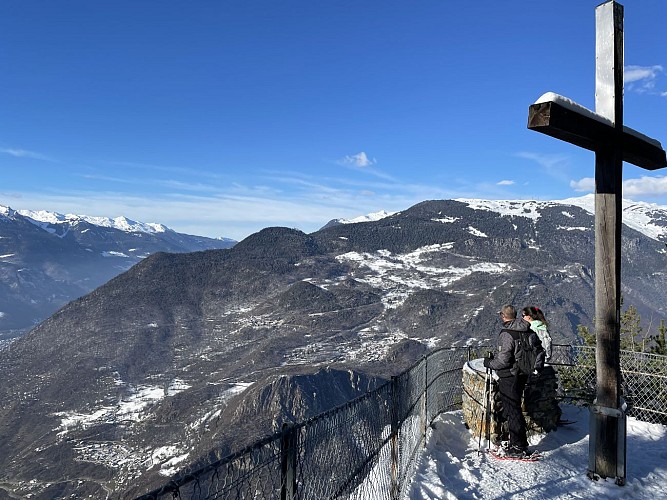
Discover a nice view point from the cross overhanging Moûtiers and the Chapel which is a patrimonial treasure.
From the parking, follow the trail of Feissons's cross that goes up through the meadow and arrive at the view point.
From there, go up for few metres (truck road) and take the path within the forest that will cross again the road.
At this crossroad, go down the road for few metres until the curve where you will see Notre Dame de la Salette Chapel, newly refurbished. Follow the route that goes down to Feissons.
Technical Information
Altimetric profile
Starting point
Points of interest

Additional information
Open period
All year round daily.
Hike possible to do with snowshoes in winter if the snow condition allow it.
Subject to snow conditions.
Updated by
Communauté de Communes Val Vanoise - Vallée de Bozel Tourisme - 19/02/2026
www.valleedebozel.com
Report a problem
Environments
Mountain view
Mountain location
Contact
Phone : 04 79 55 03 77
Email : info@valleedebozel.com
Website : http://www.valleedebozel.com
Facebook : https://fr-fr.facebook.com/ValleedeBozel/
Type of land
Ground
Not suitable for strollers
Location complements
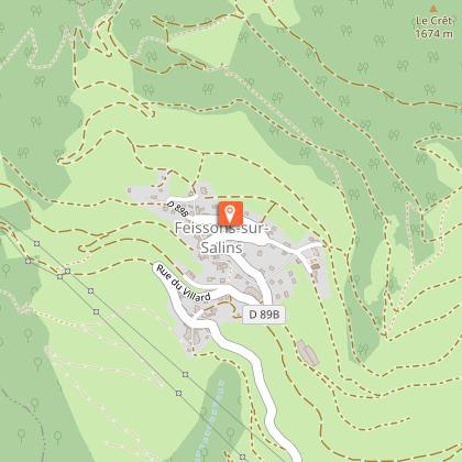
Park in the car park at the top of the village.
Topo guides and map references
Map references :
TOP 25 IGN 3532OTR
Reception complements
Security
Take the weather forecast before leaving.
Don’t forget to drink to eat and have a break.
Equipment
Equip yourself with good shoes and clothes well suited for mountains.
Carry IGN map. This map is provided for information purposes only.
Good behaviour
Stay on track.
Respect the environment .
Be careful with herds, keep your dog on leash.
Be careful with your waste, bring it back with you.
Guidebook with maps/step-by-step
Departure: From the car park at the top of the village.
1/ From the car park, head towards Croix de Feissons across the fields to reach the viewpoint.
2/ From there, climb a few metres (on a road suitable for vehicles), then take the path up through the woods to rejoin the road.
3/ Then walk down the road for a few hundred metres to the hairpin bend, where you will see the ND de la Salette chapel.
4/ Follow the route through the woods, which descends to Feissons.
Animals
Yes. This hike is accessible with a dog, but we advise you to keep your dog on a lead throughout the entire route. This helps to protect wildlife, preserve flora and ensure the peace and quiet of other hikers.
