Alert
Alerts
The shoreline trail


Description
A trail that lets you appreciate the different facets of Lake Vassivière!Start the hike at the car park in front of the Tourist Office in Lac de Vassivière. Walk alongside the beach at Auphelle and pass behind the hotel. Continue alongside the port of Auphelle and continue straight ahead.At the campsite turn right and continue straight ahead. Then pass between two stones and take the path through the forest. Continue through the Crozat Woods.Go back up onto the road, following it on the left, then 50 m further on take the trail to the left and, immediately, to the right. Cross the road and take the path opposite.When you reach the road, turn left and follow the road.Follow the path to the left along the lake. Go past a wooden pontoon and continue straight ahead.When you reach the road, turn left.When you arrive in Nergout, follow the trail to the left. Go down and then go up the stairs and along the beach. Go across the beach at Vauveix. Walk alongside the campsite and the pontoons.When you reach the road, follow the signs for Masgrangeas.After the snack bar, turn left and then right to go along a pontoon.After the pontoon turn left.At the road go towards Masgrangeas and turn left.Take the trail to the left.Take the path on the left just before the road.Turn right and do not miss the path on the left.At the road, turn left.Take the uphill path to the right.Once in the hamlet, at the road, turn left and go towards the path on the left.At the dike, take the road to the right.After the dike, take the trail immediately on the left.After the water ski base, turn to the left along the road to take the dam. After this, continue on the road.Do not miss the uphill path into the forest on the right.At the road, turn right.
Technical Information
Altimetric profile
Starting point
Steps
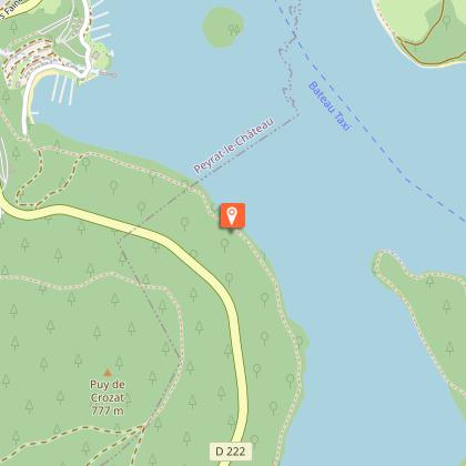
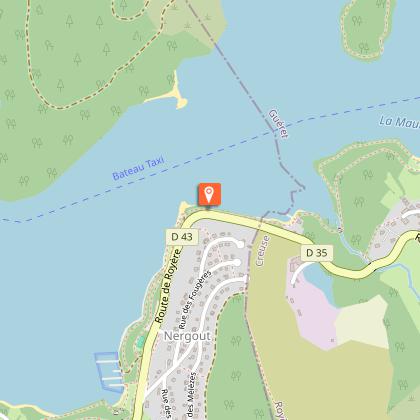
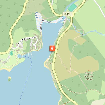
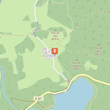
Points of interest


Additional information
Advice
From Auphelle, you can make the circuit of the lake from the south, towards "Plage de'Auphelle". It is possible to start the circuit at Broussas beach, heading towards the taxi boat pontoon.
Is in the midst of the park
The national park is an unrestricted natural area but subjected to regulations which must be known by all visitors.
Advised parking
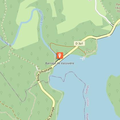
Parking in front of the Tourist Office at Lac de Vassivière, Auphelle
Access
65 km from Limoges, follow the D979, the D43 then the D222. 18 km from Eymoutiers, follow the D43. Then, 12 km from Royère-de-Vassivière, follow the D3 then the D3A2.
Arrival
Parking in front of the Tourist Office at Lac de Vassivière, Auphelle
Ambiance
Partez pour une aventure de 30 km sur le sentier de rives autour du lac : un parcours vallonné entre bois et landes, rives et sommets, passerelles sur pilotis, digue à fleur d’eau et ponts en planche de granit.
Departure
Parking in front of the Tourist Office at Lac de Vassivière, Auphelle
Data author
