Alert
Alerts
The waterfalls and mills of the Deiro


IGN cards


Description
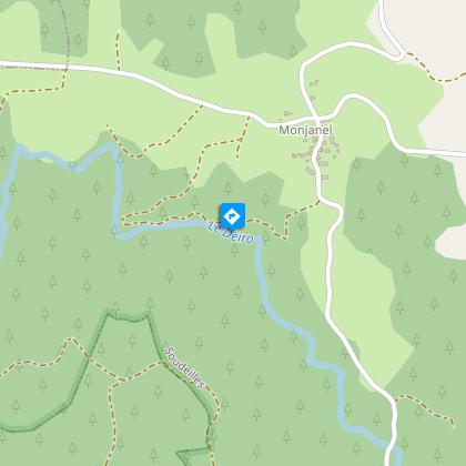
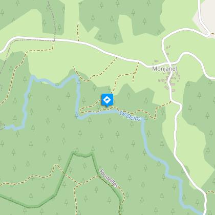
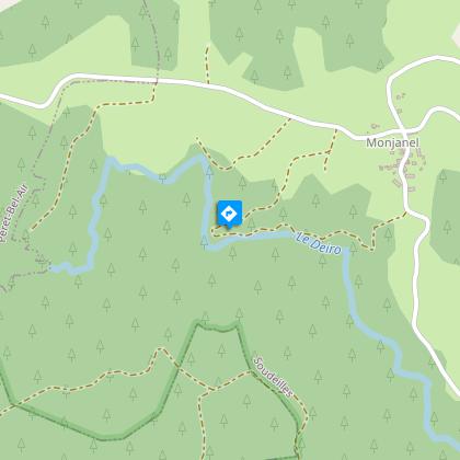
In a cool, green environment, the waters of the Deiro flow in cascades between the granite outcrops, with an energy once exploited by two mills that used to grind rye and buckwheat.To the rhythm of the Deiro waterfalls, a discovery trail for the whole family, where the story of the renovated mills is told.From the car park, go up by road for 30 m and, on the left of the information panel, go down by the path along the edge of the field. Continue into the beech woods, cross the stream and descend to the river, the Deiro.At the mill at Lafon, turn right, pass the sign (on the diversion of the watercourse) and continue upstream. After the first waterfall, climb the stairway to the next waterfall.At the Contensousas mill (exterior panel explaining how it works: push the door to discover the old mechanism), continue along the path that runs alongside the old dam on the right, then take the broader path on the right. It rises through the undergrowth and then in the fields. Go up by road to the right to Monjanel and, at the crossroads, go down to the hamlet on the right (1693 building with a large "bassière" which used to be used as a place of worship) before reaching the starting point again.
Technical Information
Altimetric profile
Starting point
Steps

Additional information
Advised parking
South of the hamlet of Monjanel, 50 m from the last barn
Access
8 km north of Egletons by the D165 (in the direction of Davignac), D119 (towards Péret-Bel-Air) and after the A89 the route de la Braute and du Monjanel on the left.
Ambiance
In a cool, green environment, the waters of the Deiro flow in cascades between the granite outcrops, with an energy once exploited by two mills that used to grind rye and buckwheat.
Arrival
South of the hamlet of Monjanel, 50 m from the last barn
Departure
South of the hamlet of Monjanel, 50 m from the last barn
