Alert
Alerts
From the site of Les Cars to Longeyroux

Description
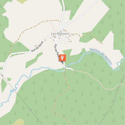
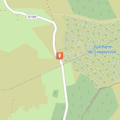
Discovering two unmissable attractions of the Plateau de Millevaches: the Gallo-Roman remains of Les Cars and the Longeyroux peat bogDepart from the war memorial; head in the direction of Les Cars.At the crossroads after the bridge over the Vézère, a path rises 30 metres in front between the houses. At the height of the small barn, take the path on the right between two low walls. It extends into a track through the undergrowth that climbs and then descends to the left towards the road.Follow this road on the right; then turn left at the next crossroads to Les Rioux. In the village, the path on the right that passes above a thatched property leads to the Les Cars site (40 mn round trip).Continue on the road to Les Maisons. Go down into the village; a track passes in front of the restored mill. At the crossroads, turn left onto a track that climbs into the woods. Follow it for 600 metres and then take a path on the left that crosses a heather moor. At the end of the plot, continue straight ahead, the path runs alongside a meadow. At the bottom of the valley, this path becomes a stream: go up onto the bank; two small bridges allow you to cross it. A wide track leads you to the village of Celle.Go through it. 200 m after you leave the village, a short path on the left joins a road. Follow it on the left to reach the reception area for the Longeyroux peat bog (off the circuit: it is possible to go down the interpretation trail - 30-minute circuit).Continue on this road for 500 m; in a bend, take the track which goes straight ahead.Where the tracks cross, continue straight on the path that rises and then enters the forest. Go along the fence to go through the wetland. The path continues in the woods. When you get up to a meadow, fork left to join the Borde.Continue by the small road. Turn left at the next crossroads to reach St-Merd.
Technical Information
Altimetric profile
Starting point
Steps
Points of interest


Additional information
Advice
Allow two more hours to visit the sites of Les Cars and Le Longeyroux (these two sites are open freely all year round)Attention: provide suitable shoes in case of heavy rain and, on the way back, do not hesitate to climb on the right side of the path to bypass the puddles
Is in the midst of the park
The national park is an unrestricted natural area but subjected to regulations which must be known by all visitors.
Advised parking
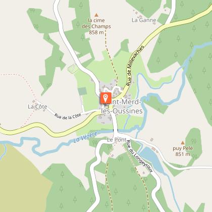
War Memorial, Saint-Merd les Oussines
Access
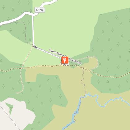
12 km from the tourist information office in Bugeat. From Bugeat, follow the D979 towards Meymac. As you leave of the village, turn left onto the D979E1 then the D164 towards St-Merd.
Arrival
War Memorial, Saint-Merd les Oussines
Ambiance
One of the iconic trails of the Plateau de Millevaches which allows you to discover the variety of its landscapes: softwood and hardwood forests, peat bogs and wetlands, meadows and villages of granite. Explore them in all the four seasons, as the atmosphere changes throughout the year. A favourite is the month of August when the heather is in flower.
Departure
War Memorial, Saint-Merd les Oussines
Data author
