To see around
See more
Open
Close
Show
Show
Show
Show
Show
Show
Show
Show
Show
Show
Show

Oups... It would appear that Cirkwi does not have permission to use your location.

Description
Map
Steps
Points of interest
Ratings and reviews
See around

The Perrière Trail

Point de vue sur Bourganeuf
La Chapelle du Puy
La Chapelle du Puy
Credit : J.DAMASE / PSC

Description

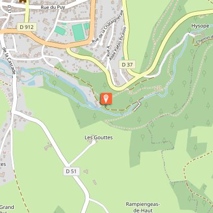
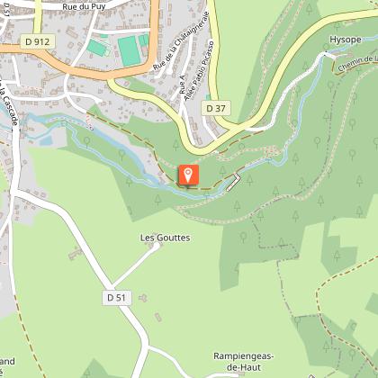
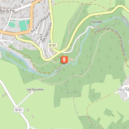
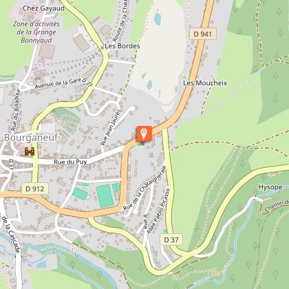
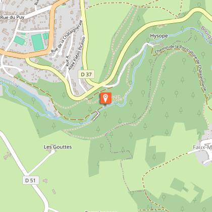
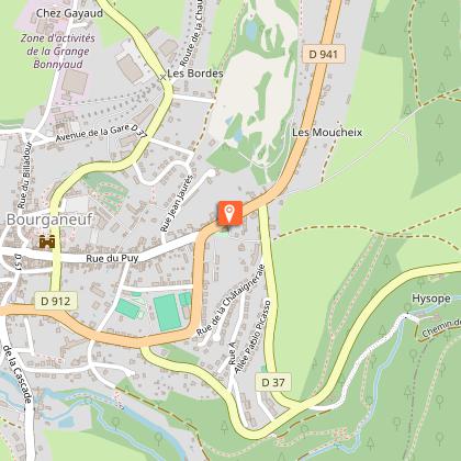
Hiking on the heights of BourganeufDepart from the Martin Nadaud school car park. Follow the sign for the Gorges du Verger at the the car park exit, in the direction of Clermont-Ferrand.Take the path that says 'No entry', and continue along the oak-lined pathway. Pass the wooden fences and continue on the main path along a dry stone wall. Walk alongside the waterfalls.At the crow's foot, turn left towards the hairpin bends.At the end of the hairpin bends, turn sharply to the right in front of the sign. Below the old Bourganeuf slaughterhouse, turn left.Cross the road and take the trail that goes up ahead. At the next crossing, follow the left-hand path and cross the meadow. At the end of the wood, follow the path on the right.At the crossing, turn left along the meadow. Follow the yellow markings and continue straight ahead.At the edge of the scrubland, take the left-hand path. Leave this path when it turns to the right to follow the broom hedge on the left, and continue following the edge of the wood, observing a slight curve on the left.At the crossing, take the right-hand path. Continue straight ahead.When you reach the tarmac road, take the abandoned road on the left. Cross the D941. Follow the markings for 50 m and then take a small steep path on the right.At the crossroads, cross the D940, and continue opposite in the direction of Mas Guillard. Go through the village and follow a stony track. At the first intersection, continue on the left-hand path until you reach a tarmac road. Turn left.You have reached the hamlet of La Petite Chaume. At the end of the village, at the foot of the wooden shed, turn left towards the golf course and continue alongside itCross the D941 and follow the pavement on the left. Take the first road on the left. 100 meters after crossing the road to take the steps that lead to the Chapelle du Puy.Follow the pavement on the left. Cross the road in front of the gendarmerie and continue on pavement on the right. Turn right into the street and turn left at the bottom.Join the D941 road, cross it on the right and return to the car park where you started.

Technical Information

Walking
Difficulty
Very easy
Duration
2h
Dist.
8.8 km
Show more

Altimetric profile

Starting point

Lat : 45.951288Lng : 1.758531

Steps

image du object
1

La Roche de la Mariée

La Roche de la Mariée est un roche saillant près du moulin, dans les gorges du Verger.Tout en haut de ce rocher, vous apercevez une petite cavité : lancez –y un petit caillou, s’il y reste la légende dit que vous vous marierez dans l’année.

- Syndicat mixte d'aménagement et de gestion du Parc naturel Régional de Mlillevaches en Limousin -
Consulter
image du object
2

Les gorges du Verger

Premier site classé en Limousin, au titre de la protection des sites et des monuments naturels à caractère artistique. Au centre de l'activité industrielle de la commune aux XVIIIème et XIXème siècles, il permettra par ses eaux vives, l'alimentation d'une des premières installations de production hydroélectrique, qui éclaira Bourganeuf en mai 1886. C'est aujourd'hui un lieu de promenade magique en toutes saisons où vous pourrez croiser les "Spirits Houses" (maison de l'esprit) placées à proximité du chemin de promenade, commémorant le centenaire de la mort de Martin Nadaud et invitant à la méditation et à la contemplation.

- Syndicat mixte d'aménagement et de gestion du Parc naturel Régional de Mlillevaches en Limousin -
Consulter
image du object
3

La truite fario

Présente dans le ruisseau du Verger, la truite Fario est l'espèce autochtone de nos rivières. Elle ne peut survivre que dans des eaux vives et oxygénées. Carnivore, elle se nourrit principalement d'invertébrés et de petits poissons. La reproduction a lieu en hiver, sur les zones en amont des ruisseaux. La femelle aménage alors une dépression dans les graviers pour y pondre ses œufs qu'elle recouvrira grossièrement.

- Syndicat mixte d'aménagement et de gestion du Parc naturel Régional de Mlillevaches en Limousin -
Consulter
image du object
4

La chapelle du Puy

Un seigneur du Puy en Velay, reconnaissant envers le Grand Maître des Chevaliers pour l’avoir libéré des mains des Musulmans fit don à ces derniers d’une statue de la Sainte Vierge réputée miraculeuse. La chapelle fut construite entre 1859 et 1863. Profanée sous la Révolution, la statue échappa à la destruction grâce à une femme qui l’abrita dans sa maison. L’abbé Tixier, archéologue Limousin, éleva les plans de construction de la chapelle et y a sa sépulture. Vous noterez les couleurs remarquables des  voûtes intérieures ainsi que les tourelles  extérieures.

- Syndicat mixte d'aménagement et de gestion du Parc naturel Régional de Mlillevaches en Limousin -
Consulter

Additional information

Advised parking

Car park, Martin Nadaud School, Bourganeuf

Advice

Be careful when crossing the B-road.

Access

30 km from Ahun, take the D13 then the D941.

Ambiance

Hiking on the Perrière hill overlooking Bourganeuf, passing through the Gorges du Verger, a peaceful and relaxing place.

Arrival

Car park at the Martin Nadaud school, Bourganeuf

Departure

Car park at the Martin Nadaud school, Bourganeuf

Ratings and reviews

To see around
See more
Open
Close
Show
Show
Show
Show
Show
Show
Show
Show
Show
Show
Show
Caution!
We have no information on the difficulty of this circuit. You may encounter some surprises along the way. Before you go, please feel free to inquire more and take all necessary precautions. Have a good trip! 🌳🥾