Alert
Alerts
Circuit of the Lac de Faux

Description
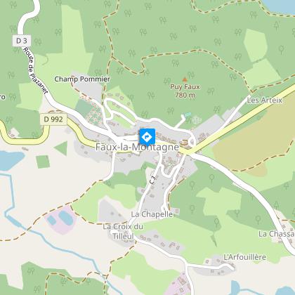
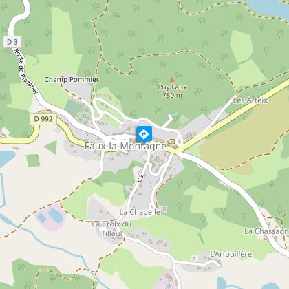
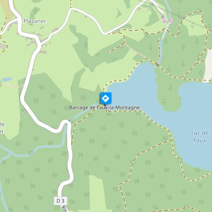
Landscapes of moors, grasslands and wetlands have given way to 45 hectares of water for electricity production.From the Place de Faux-la-Montagne, opposite the 12th-century church, with the covered laundry on the right below, follow the road to Gentioux (D992) for 300 m until you reach the fountain at the edge of the village.Take the "Chemin de la Fontaine-Pouilleuse" on the left of the fountain, leave the ascending path on the left and carry on to the Traluamont crossroads near Lake Faux.Turn left onto the path that runs alongside the lake in a hardwood forest. About 700 m further on, go up the path on the left: it leads away from the lake and reaches a crossroads.Go down to the right on the trail, until you reach a clearing with lots of broom and find the shore of the lake.At the intersection, go down to the right behind the Dorat dam. This multi-arch dam is of a type rare in France. Go back up then continue to the right on the trail beside the lake until you reach a path under the trees. Turn right and take it, cross the bridge over the La Maulde River and continue until you reach a crossroads.Continue straight ahead until you reach a new intersection.Turn right and take the path that goes down through the undergrowth towards the lake. Go along it until you reach the D992.Follow the D992 on the right (in the direction of Faux-la-Montagne), cross the dam (viewpoint on both sides) and fork right just after it to find the trail to follow.Then turn left to reach Faux-la-Montagne.
Technical Information
Altimetric profile
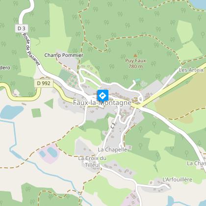
Starting point
Steps
Points of interest


Additional information
Advised parking
Square in front of the church, Faux-la-Montagne
Public transport
Public transport >> www.aubusson-felletin-tourisme.com
Access
35 km from Felletin, take the D992.
Ambiance
Come and discover this dam built between 1947 and 1951. Its elegant form, where the simplicity, refinement and minimalism of the construction are sufficient to fulfil the functions assigned to them, has lines which are still fully in harmony with the landscape. There are only two examples of this work of art in Europe.
Arrival
The square in front of the church, Faux-la-Montagne
Departure
Square in front of the church, Faux-la-Montagne
Data author
