Alert
Alerts
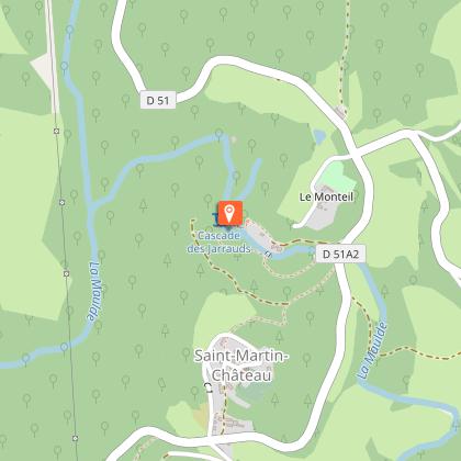
The Jarrauds waterfall discovery trail

Description
The Jarrauds waterfall, the third listed site in the Creuse department, was protected in 1939 for its scenic beauty.From the car park, head towards the main road. Take it on the left and cross the bridge.Just after the bridge, on the left, a stone staircase leads down to the embankment. At the bottom, turn left on the wide paved pathway. Follow it straight until you get to the houses.At the end of the wide path, when you reach the last house, a continuous path runs alongside a low stone wall. Take it and go up a few steps until you reach the top of a stone staircase.Go down the steps to the river.Cross the canal on the footbridge, then turn right and continue along the canal to a barrier.Take the metal staircase on the left that leads down the slope, then continue on the path that goes to the right.A last narrow step, which forks to the left, provides access to a platform. From the platform, you can enjoy the view of the waterfall. It is possible to go down to the river by continuing along the path for a few metres. For safety and to respect private property, do not deviate from the landscaped path. Return to the car park by the same path.
Technical Information
Altimetric profile
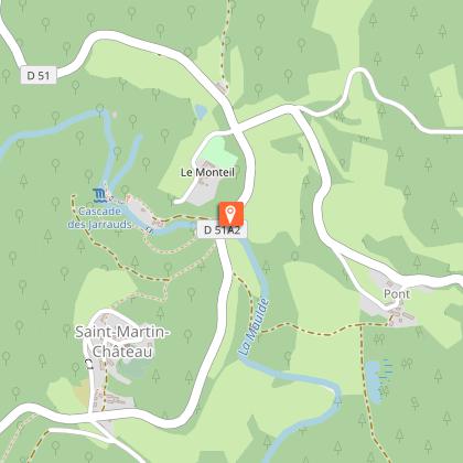
Starting point
Steps
Additional information
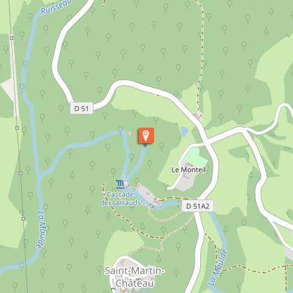
Advised parking
Car park for the Jarrauds waterfall, D512A, Saint-Martin-Château
Access
From Bourganeuf, follow the D51.
Ambiance
In a lush, green setting, covering an area of 51 ha, the Maulde meanders between the massive granite blocks it shapes as it passes, and then falls 15 m into a noisy waterfall. This waterfall is not only aesthetically pleasing; it is also associated with an amazing story: the first local experiments in electricity production and transmission to Bourganeuf, the "Town of Light".
Arrival
Car park for the Jarrauds waterfall, D512A, Saint-Martin-Château
Departure
Car park for the Jarrauds waterfall, D512A, Saint-Martin-Château
