Alert
Alerts
By the Puys


IGN cards


Description
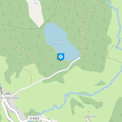
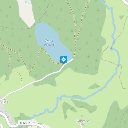
Between the puys and the Doustre plain, you will need a picnic break at the Etang de Gros.From the church, take the street on the right heading towards Seugnac, leave the road on the right, continue on the D142.Go up left into the forest by the track, pass the summit of Puy Guzard and continue straight ahead. Cross the road (old Roman road) and continue opposite on the path between forest and meadow. Leave the path on the right and arrive at Le Bessard. Take the road on the left and use the "boviduc" on the right which passes under the N89. Cross the railway and enter the forest of tall Douglas fir ahead of you. Descend into a trough, cross a stream and reach a crossroads where four paths meet.Continue to the left alongside the field. At the crossing of Le Puy de l'Homme, turn right and, at the crow's foot, stay on the left. Cross the D66, take the track in front, continue straight ahead, then turn left to join the tail of the pond, L'etang de Gros. Walk alongside the pond on the right.Walk along the pond dam to the left (at the weir, look out for signs of the presence of the otter: scales, droppings) and continue along the path in the extension. Leave the path to the picnic area on the left.Turn off on the path to the left. It goes through a remarkable grove of oaks. Take the D142E1 on the left, then the small path on the left in a coppice and turn right. Take the D66 to the right, pass Saint-Roch, cross the railway, follow the N89 to the left, then turn right to reach the church.
Technical Information
Altimetric profile
Starting point
Steps

Additional information
Advised parking
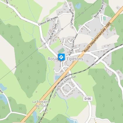
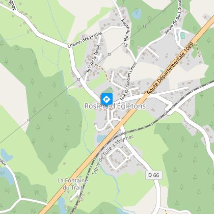
Church, Rosiers-d'Egletons
Access
5 km southwest of Egletons by the N89.
Ambiance
Around Rosiers-d'égletons, the paths set out for the puys, the real sentinel of the Millevaches plateau, before reaching the Doustre plain, guarded by the Etang de Gros.
Arrival
Church, Rosiers-d'Egletons
Departure
Church, Rosiers-d'Egletons
