Mysterious fountains
Description
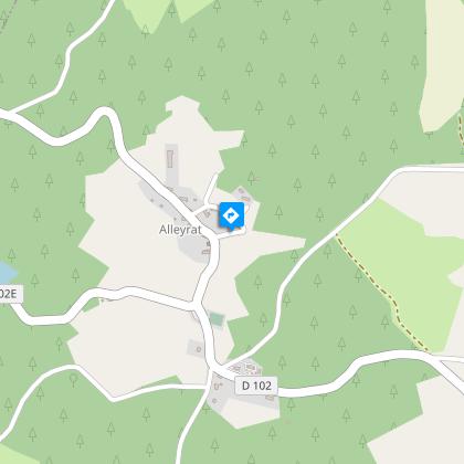
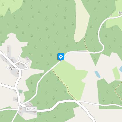
A family walk on the foothills of the Plateau de Millevaches.Depart from the church square. Take the small road in front of the church; you can see the St-Pierre fountain in the meadow.In the bend, leave the road to go straight ahead. At the next crossroads, continue left on the road to the village of Enclise.In the village, go down to the right. When you reach the house, take a short round trip to the fountain. Continue on the path that runs alongside the meadows; go back up to the forest track.Follow it to the right. At the end of this track, take the road to the right. At the next crossroads (cross on your right), take the track on the right to join the roadTake this road to the left (the portion you took on the outward journey) then the path to the right to reach the starting point.
Technical informations
4.6 km
|
max. 784 m
min. 723 m
| |||
Altimetric profile
Starting point
Steps
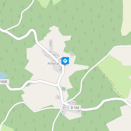
Le bourg d'Alleyrat
Regroupé autour de l’église, le bourg d’Alleyrat est vraisemblablement situé sur un site gallo-romain comme en témoigne le cippe (ancien couvercle d’une urne cinéraire d’un défunt) à proximité de l’église. Cette dernière est typique des églises de Haute-Corrèze avec sa nef unique et son clocher-mur. Remarquez en façade le sillon creusé par la corde qui jadis actionnait la cloche.
La fontaine du village
Au cœur du village, sur l’ancien couderc (ancienne place), la fontaine est source de vie ; c’est autour d’elle que le village s’est progressivement organisé. Point stratégique pour s’alimenter en eau mais pas seulement : faire une pause sur la route, s’informer des nouvelles, régler les affaires communes…
Le Massif du Sancy
Cette randonnée vous offrira un point de vue remarquable sur le plus haut volcan de France métropolitaine, le Puy de Sancy. Du haut de ses 1885 mètres d’altitude, ce sommet est le point culminant du Massif Central. Les deux ruisseaux, la Dore et la Dogne, y prennent naissance et leur confluence forme la Dordogne.
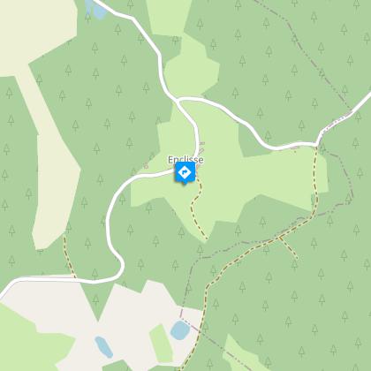
La fontaine-abreuvoir d’Enclisse
Perdue dans un étroit chemin, à l’abri des regards, cette fontaine-abreuvoir rappelle celle du bourg d’Alleyrat avec ses usages multiples à partir d’une seule source.
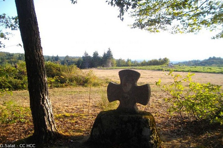
La croix dite Saint-Jean
Cette croix bi-face de style populaire aux extrémités épatées porte sur une face une représentation du Christ en croix et sur l’autre vraisemblablement un ecce homo, représentation du Christ portant une couronne d’épines. A l’origine, elle devait être élevée sur un fût. A la croisée des chemins, il s’agit probablement d’une croix de carrefour qui avait pour fonction de protéger le voyageur à une époque où l’insécurité était omniprésente.
Points of interest
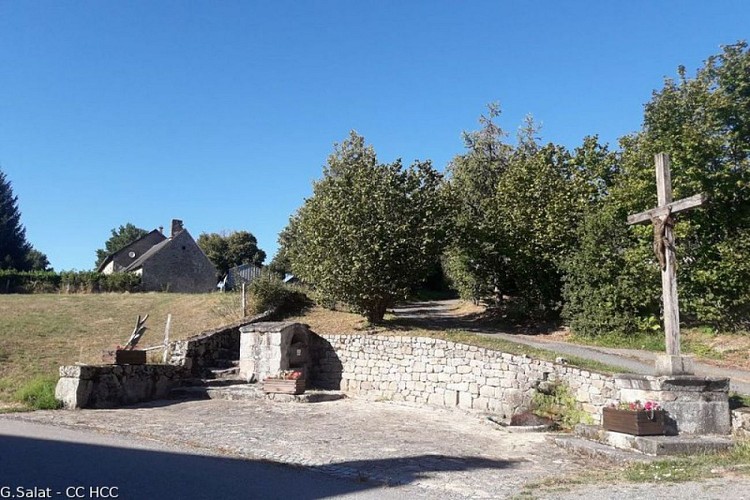
The village fountain
In the heart of the village, on the old “couderc” (the old square), the fountain is a source of life; it was around this point that the village gradually arranged itself. A strategic point for water supply but not only that: to take a break on the road, catch up on the news, sort the world out...
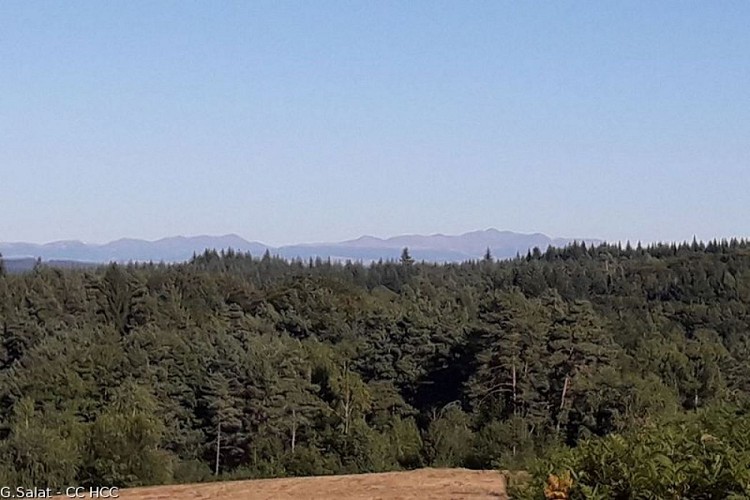
Le Massif du Sancy
This hike will offer you a remarkable view of the highest volcano in metropolitan France, the Puy de Sancy. At 1885 metres above sea level, this summit is the highest point of the Massif Central. The two streams, the Dore and the Dogne, originate there, and their confluence forms the Dordogne.
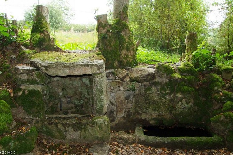
The drinking fountain in Enclisse
Lost in a narrow path, out of sight, this drinking fountain reminds us of the one in the village of Alleyrat with its multiple uses from a single source.
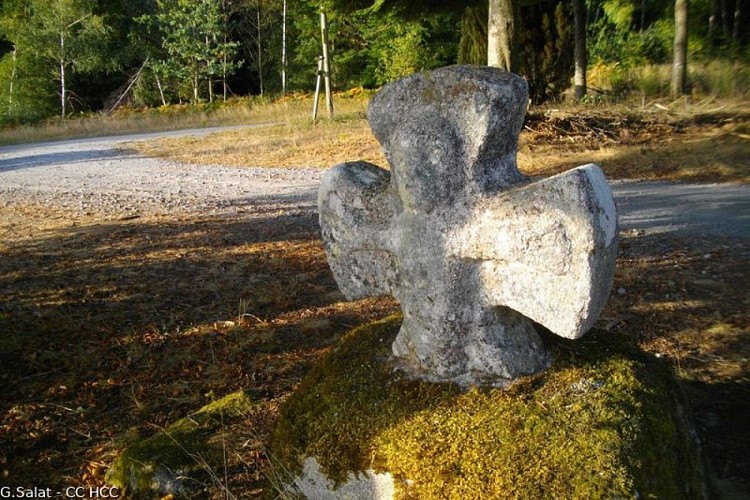
The cross is known as Saint John
This two-sided cross in the popular style with its flattened ends bears, on one side, a representation of Christ on the cross and on the other side, probably, an ecce homo, a representation of Christ wearing a crown of thorns. Originally, it was to be raised on a barrel. At the crossroads, it is probably a cross that was meant to protect the traveller at a time when insecurity was omnipresent.
Additional information
Advised parking
Church car park, Alleyrat
Access
From Meymac, take the D30 towards Sornac. After 7 km, turn right towards Alleyrat.
Ambiance
A very pleasant walk from the pretty village of Alleyrat. The variety of landscapes and the many examples of traditional village architecture all contribute to the charm of this walk. Explore them in all the four seasons as the atmosphere changes throughout the year.
Arrival
Church car park, Alleyrat
Departure
Church car park, Alleyrat
