To see around
See more
Open
Close
Show
Show
Show
Show
Show
Show
Show
Show
Show
Show
Show

Oups... It would appear that Cirkwi does not have permission to use your location.

Description
Map
Steps
Points of interest
Ratings and reviews
See around

Steeples and ponds circuit

Quartier du Pont et église Saint-Martial
Chemin à la Pronche
Point de vue à la Croix de Peyret
Quartier du Pont de Noblat
Village de Chenour
Village de Chigot
Credit : Office de tourisme de Noblat

Description

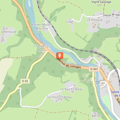
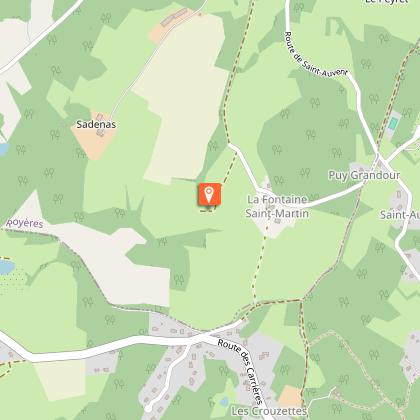
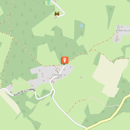
A hike for lovers of local architectural heritage, along the water and rolling landscapes.Follow the path along the Vienne river and head towards the village of Noblat. Pass between the gardens (Place des Chambonnauds) and continue to the right using the small passages between the houses, then to the left. You will arrive at the bridge.Go across it. At the D7bis, turn right. Arriving at the D941, follow it on the left using the pavement, passing in front of the mills of Noblat on the banks of the Vienne.At the first crossroads, turn left. At the end of the porcelain factory, continue up a steep slope and follow the path that climbs to Chigot.At the top of the hill, at the crossing of five paths, at the cross, take the second path on the right. Possible variant.At the crossing, continue straight ahead for 10 mins and then follow the path on the right. In the woods, turn left following the GR 654.At the crossroads, turn left onto the hairpin path.Once you reach a wide path, turn right and then turn left at the next crossing, leaving the farm path to the right. Leave the GR654 on the right and continue straight ahead. At the "y" crossroads, turn right, go past the pond, cross the stream and climb up to the village of Chenour.Pass behind the houses, go left at the last one and follow the small road on the right. Turn around to admire the village.At the crossroads, turn left towards Surzol, and then, 30 mins later, follow the path on the right. Continue and follow the road to the left. Round trip to the Saint-Martin fountain.At the next crossroads in a "T" shape, turn right and continue until the next crossroads with the RD. Continue opposite in the direction of Surzol.Go through the village and follow the pathway that leads to the pond: go along it. Then turn right when you reach the roadway. At the crossroads, turn left until you reach the La Pronche road.Turn left and, after the climb, follow the ridge path to the right. In Beaubiat, turn left. Just before the hamlet of Bel Air, follow the grassy path on the right, going down the small road. At the D7bis, turn left, follow it for 300 metres. In front of the church, turn left, cross the stone bridge and follow the same path as on the way to the starting point.

Technical informations

This circuit was updated on: 19/04/2024
15 km
3 h
max. 476 m
min. 257 m

Altimetric profile

Starting point

Lat : 45.8301Lng : 1.479744

Steps

image du object
1

Site Natura 2000 de la Haute-Vallée de la Vienne

La Vienne est reconnue comme une des dernières rivières de France à très forte naturalité et présentant des caractéristiques écologiques remarquables. Au départ de Saint-Léonard, le cours d’eau trace son lit entre gorges boisées, landes et tourbières jusqu’au Plateau de Millevaches. Un écosystème d’importance au regard de la préservation des milieux et de la conservation des espèces rares en Europe. On peut y rencontrer la Moule Perlière, l’Écrevisse à Pieds Blancs, six espèces de chauves-souris, le Grand Capricorne ou encore le Sonneur à Ventre Jaune...

- Syndicat mixte d'aménagement et de gestion du Parc naturel Régional de Mlillevaches en Limousin -
Consulter
image du object
2

Le Pont de Noblat

D’abord traversée par un passage à gué, la Vienne est surmontée vers le milieu du Moyen-Âge par un pont en bois. Ce pont en pierre le remplace en 1270, reliant la ville haute au site fortifié de Noblat et accueillant un flux important de pèlerins vers Compostelle et sur le tombeau de Saint-Léonard. Le pont est supporté par 4 arches en arc brisé. Ses avant-becs triangulaires en forme d’amande, typique des ponts médiévaux limousins, permettent de briser le courant limitant l’altération des piles.

- Syndicat mixte d'aménagement et de gestion du Parc naturel Régional de Mlillevaches en Limousin -
Consulter
image du object
3

L’Église Saint-Martial

L’église Saint-Martial fût bâtie par les habitants du quartier de Noblat entre 1870 et 1880 dans un style néo-gothique très en vogue à cette époque. Elle remplace l’ancienne église paroissiale vendue à la Révolution et utilisée comme salle de bal avant d’être détruite. Contrairement à la plupart des églises, elle n’est pas orientée, son chevet regarde vers le nord, particularité due à la topographie du site. Très lumineuse, elle est érigée en calcaire et percée de 18 baies-vitraux.

- Syndicat mixte d'aménagement et de gestion du Parc naturel Régional de Mlillevaches en Limousin -
Consulter
image du object
4

Les moulins de Noblat

Ces moulins sont attestés dès le XIIème siècle. La digue se termine par un rocher proue et l’eau est guidée par un canal dans les coursiers accueillant les roues à aubes. Les moulins sont construits par ceux qui les exploitent, et s’adaptent aux techniques et matériaux locaux et à leur usage ; fondations très solides pour résister à l’eau et à la pression, étages en pans de bois et torchis (terre, chaux et foin ou brique). En 2009, l’entreprise de porcelaine J.L. Coquet établit dans le grand moulin, un espace expo vente.

- Syndicat mixte d'aménagement et de gestion du Parc naturel Régional de Mlillevaches en Limousin -
Consulter
image du object
5

La Croix de Chigot

Datée du XVIIème siècle, elle s’élève de 3 mètres sur un emmarchement en granit surmonté d’un fût monolithe. Sur l’une des faces du socle, on distingue un écu orné d’entraves de prisonnier, attributs de Saint-Léonard, et deux masques de part et d’autre du fût. En 1980, la croix est à l’état de vestiges ; le croisillon a disparu et le fût penche, sur un emmarchement en partie démoli. Elle est alors restaurée et ornée d’un nouveau croisillon simple en métal. À voir : le lavoir en traversant le village.

- Syndicat mixte d'aménagement et de gestion du Parc naturel Régional de Mlillevaches en Limousin -
Consulter
image du object
6

Le Château de la Chapelle

Le château initial (fin XVIIème s.), fût entièrement remanié fin XIXème et a récemment connu des travaux de restauration. Il présente un corps de logis rectangulaire avec une tour carrée sur angle sud-est. La porte d’entrée est un vestige de l’ancien château. L’ensemble est couvert d’ardoises avec des motifs géométriques discrets sur les pans de la tour. Deux épis de faîtage en métal ornent les arrêtes du toit de fins bouquets de fleurs. Propriété privée.

- Syndicat mixte d'aménagement et de gestion du Parc naturel Régional de Mlillevaches en Limousin -
Consulter
image du object
7

Fontaine Saint-Martin

Elle était à l’origine un puit signalé par une croix en bois, dont l’eau était réputée pour soigner les rhumatismes. Une chapelle fut édifiée plus récemment à cet emplacement ; petite construction de plan carré ouverte sur un pan par un arc en anse de panier surplombé d’une petite croix en granit en clef de voûte. À l’intérieur, quelques objets témoignent du passage ancien de pèlerins : tasse en porcelaine, ex-voto, chandelier… Au fond de l’édifice, une niche abrite plusieurs statues de saints.

- Syndicat mixte d'aménagement et de gestion du Parc naturel Régional de Mlillevaches en Limousin -
Consulter

Points of interest

image du object

Natura 2000 site in the Haute-Vallée de la Vienne

The Vienne is recognised as one of the last rivers in France to retain so many of its remarkable natural ecological characteristics. From Saint-Léonard, the river flows through wooded gorges, moors and peat bogs to the Plateau de Millevaches. An important ecosystem for the preservation of environments and the conservation of rare species in Europe. You can encounter the Freshwater Pearl Mussel, the White-clawed Crayfish, six species of bats, the Great Capricorn beetle and  the Yellow-bellied toad...

- Syndicat mixte d'aménagement et de gestion du Parc naturel Régional de Mlillevaches en Limousin -
Consulter
image du object

The Chigot Cross

Dating from the 17th century, it rises 3 metres above a granite plinth topped by a monolithic shaft. On one side of the base, there is a shield decorated with prisoner's shackles, attributes of Saint-Léonard, and two masks on either side of the shaft. In 1980, the cross was in a ruinous state; the crosspiece had disappeared, and the shaft leaned over on a partially demolished plinth. It was then restored and decorated with a new simple metal crosspiece. Don't miss: the lavoir when you go through the village.

- Syndicat mixte d'aménagement et de gestion du Parc naturel Régional de Mlillevaches en Limousin -
Consulter
image du object

Saint-Martin fountain

This was originally a well, marked by a wooden cross; the water was famous for treating rheumatism. A chapel was built more recently on this site; small square plan construction opened on one side by a basket-handle arch surmounted by a small granite cross as a keystone. Inside are some objects bearing witness to the passage of pilgrims through the ages: porcelain cup, votive, candlestick... At the rear of the building, a niche houses several statues of saints.

- Syndicat mixte d'aménagement et de gestion du Parc naturel Régional de Mlillevaches en Limousin -
Consulter

Additional information

Advised parking

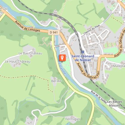
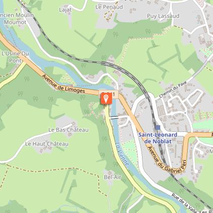
Fitness trail car park, Quartier du Pont de Noblat, Saint-Léonard-de-Noblat

Advice

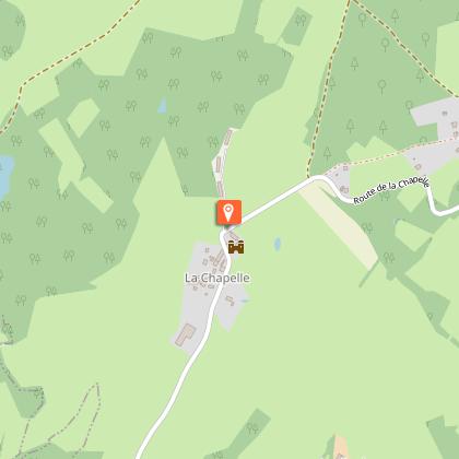
Variante du point 4 : traverser le village de Chigot. Prendre à droite la rue à l’angle du lavoir. Poursuivre, la route se transforme en chemin de terre. A la route, tourner à gauche, traverser le village de la Chapelle. Poursuivre sur la route et au croisement, continuer en face à gauche de la croix. Arrivé avant le Peyret, suivre en face le sentier en terre qui s’enfonce dans le bois. A la route tourner à gauche et reprendre le descriptif au point 10.

Access

25 km from Limoges in the direction of Clermont-Ferrand, via the D941. From the town centre of Saint-Léonard de Noblat, take the D41 towards Limoges then, after crossing the railway, turn left, Rue de la Vallée on the D39A.

Ambiance

Starting from the old quarter of Le Pont de Noblat, on the banks of the Vienne river and after crossing the medieval bridge, the trail gradually leads up through the countryside, revealing beautiful panoramas of the historic city of Saint-Léonard de Noblat (Plus Beaux Détours de France, an outstanding heritage site). The path goes through the villages of Chigot, Chenour, La Chapelle, and Le Surzol between traditional local buildings, peaceful ponds and lively watercourses.

Arrival

Fitness trail car park, Saint-Léonard-de-Noblat

Departure

Fitness trail car park, Saint-Léonard-de-Noblat

Ratings and reviews

To see around
See more
Open
Close
Show
Show
Show
Show
Show
Show
Show
Show
Show
Show
Show