Through the villages
Description
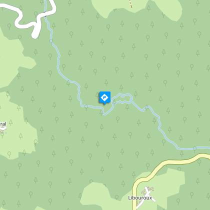
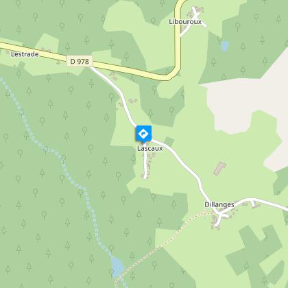
La Rongère, Coiral, Le Grolier, Libouroux, Lascaux, so many hamlets woven into the countryside and inviting to you discover their local heritage.From the former schoolhouse, go down the D60. At the town hall, turn right, then take the road on the right. At the houses, take the path on the right below the trees, pass a pond and continue. Take the D978 to the left and then the road to the right.Take the path on the right. Before La Rongère, fork right onto the path in a dip, then take the D98 to the left. Leave Rongère on the left.Take the path on the left. It goes down into a wet area. Go up the path, which is bordered by low walls. Cross the cattle grids (grids fixed in the ground), arrive at Coiral, leave the road, and then follow the road to the right.Before the last house on the left, take the path on the left. Cross the Sombre on the footbridge and go up by a rather wet path. At the left fork, continue alongside the field, then turn right between the meadows. Continue along the edge of the field, and you will arrive at Chassang (house with bread oven). Take the road on the right and, at Le Grolier, the D98 on the right, then the track on the left. Leave the left-hand track and continue straight ahead.At the five-way crossroads in the paths, take the second path on the right. Cross the Sombre (Royal Fern) and continue along the path. Take the D978 to the right.In the bend, take the left-hand path. In Lascaux, continue opposite, go through the hamlet (view of the gorges of the Dordogne and the Xaintrie) and continue by the descending path. Cross a damp area at the bottom, leave the path on the left and go up between coppice and plantations. Take the road on the left, the path on the right for 75 m, then the path on the right, between the trees. Take the D978 on the left, the D98 on the left and the path on the right to return to the Maison du Patrimoine.
Technical informations
12 km
|
max. 596 m
min. 497 m
| |||
Altimetric profile
Starting point
Steps
Classe d'antan
La Maison du patrimoine est une ancienne école reconvertie aujourd’hui en gîte d’étape pour les randonneurs et salle des fêtes.Elle abrite une ancienne classe, conservée à l’identique, avec ses pupitres, son tableau noir ses cartes et autres supports pédagogique des années 1930.Visite payante sur rendez-vous auprès des Amis de la Maison du Patrimoine
Grange
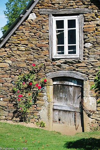
Les fermes traditionnelles sont plutôt basses, recouverte par une massive toiture d’ardoise ou de lauze. Les murs sont généralement faits de pierres de granit ou de gneiss non taillées. L’unique décoration se résume à un linteau gravé des initialesdu propriétaire et parfois de signe protecteur. Logis et bâtiments d’exploitation pouvaient cohabiter sous le même toit, constituant ce qu’on appelait un « bloc à terre » ou être indépendant. On trouve dans ce secteur deux types de granges-étables : l’auvergnate et la limousine.
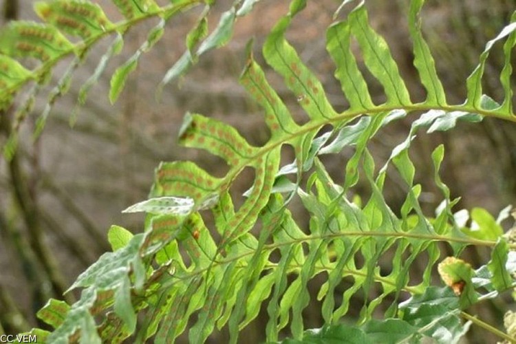
Osmonde Royale
L’osmonde royale (osmunda ragalis ) est une très grande fougère qui porte bien son nom de "royale". Souche épaisse, fronde en touffe, son feuillage caduc rosâtre puis vert clair vire au roux à l’automne. Deux sortes de frondes longuement pétiolées, les plus "courtes" aux marges légèrement dentelées sont stériles ; les frondes fertiles plus longues sont porteuses des sporanges parfaitement visibles en été (juillet à septembre) formant des sortes de barrettes vertes virant au brun rouille.
Additional information
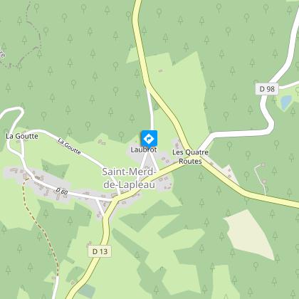
Advised parking
The Maison du Patrimoine, Saint-Merd-de-Lapleau
Access
At the entrance to the village of Saint Merd-de-Lapleau arriving by the D978 from Marcillac la Croisille.
Ambiance
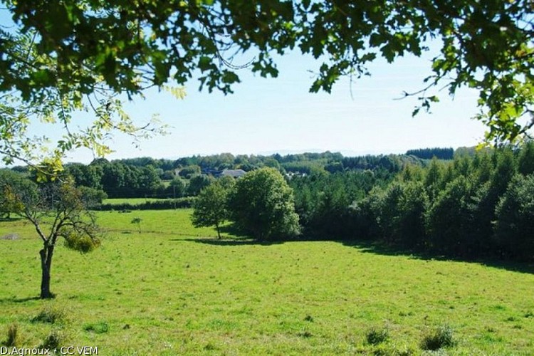
This circular walk through the villages is your invitation to discover the networks of paths that once allowed you to move freely between all these places: a real link between the inhabitants of the communes. Through the villages, you are also discovering local heritage and architecture.
Arrival
The Maison du Patrimoine, Saint-Merd-de-Lapleau
Departure
The Maison du Patrimoine, Saint-Merd-de-Lapleau
