Alert
Alerts
Giro del Marguareis


IGN cards


Description
Circuit route, all on easy paths. Some orientation problems in the case of poor visibility: but apart from this drawback, the path is suitable for all those who want to do a uncomplicated trek.
The official route of the Marguareis tour includes five stages. But one of the merits of this ring is the number of paths that connect the stopping places: you can organise the route at will, reducing it to a quick tour around Marguareis in a couple of days, or extending it to five days taking in Mongioie .Even departure is at your choice: usually Pian delle Gorre, in Valle Pesio, but it is equally good to start from Carnino in the upper Tanaro Valley.All stopping places are in managed refuges that provideaccomodation and, on request, packed lunches.The ideal period for hiking is July to September. In the years with little snow even June and sometimes the beginning of October (you should check accommodation opening). August is not a problem, if you take into account the probability of a little heat and clouds that tend to form from lunchtime on.
Technical Information
Altimetric profile
Starting point
Points of interest
Additional information
Departure
Rifugio Pian delle Gorre (1032 m)
Arrival
Rifugio Pian delle Gorre (1032 m)
Ambiance
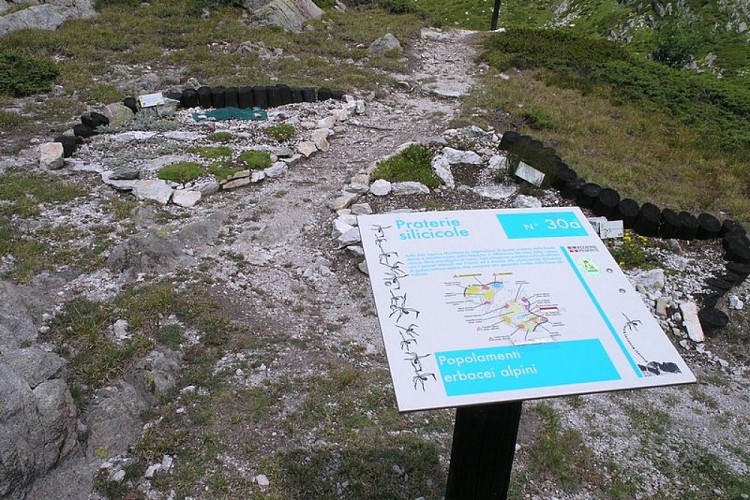
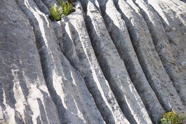
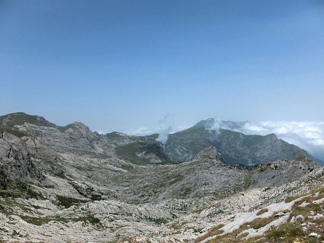
You could define this circuit as being in the kingdom of karst, where the pasture as far as the eye can see, interspersed with vertical limestone walls are the principal features. And then dolines, limestone pavements and expanses of white rocks. The lakes are missing, as karst terrain absorbs water at high altitude; but there is no shortage of waterfalls, especially in mid-valley areas, where underground water courses come to light with spectacular results.
Access
From Chiusa di Pesio go up the valley to the Charterhouse (Certosa) here follow the narrow tarmac road to Pian delle Gorre. Pay parking in summer.
Advised parking
Rifugio Pian delle Gorre (1032 m)
Public transport
Autolinee Valle Pesio S.r.l. - Via Cav. G. Avena, 41/43 - 12013 Chiusa di Pesio (CN) +39 0171-735756 - vallepesio@savgroup.ithttps://www.savgroup.it/linee/43.pdfsncf line TER Provence Alpes-Côte d'Azur For travel in the PACA region and towards Cuneo www.ter-sncf.com/pactrenitalia for travel in the Piedmont region www.trenitalia.com/it.html
Data author
