Alert
Alerts
On the Ligurian Alta Via - The Mont Torrage circuit


IGN cards


Description
On superb raised paths carved into the rock, this itinerary allows your eyes to devour the lower Roya valley, Le Marguareis and the entire Nervia valley all the way to the Mediterranean.
Technical Information
Altimetric profile
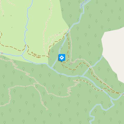
Starting point
Points of interest


Additional information
Departure
Saorge
Arrival
Saorge
Ambiance
On the Italian side and on the border ridge, Mont Torrage (with its peak at 2000m) is the mountain resembling a dolomitic summit which is closest to the shores of the Mediterranean.
Access
Menton on the A8 (Exit 59) or Menton SNCF railway station.
Advised parking
Parking spaces in Saorge
Advice
This itinerary takes place along high-valley Alpine paths. The accommodation sites listed are the only ones which are available along this route.
Before heading off on a hike, ensure that you have studied the safety advice.
If you are setting off on this hike in the early part of the season, you will need to take particular care as patches of snow can still be present in higher areas.
Data author
