Alert
Alerts
Le hameau de la Colle


IGN cards


Description
Explore mountain life as it was in the last century thanks to the small hamlet of La Colle. Its inhabitants were arable farmers, sheep and goat farmers and the richer ones were small-scale dairy farmers…
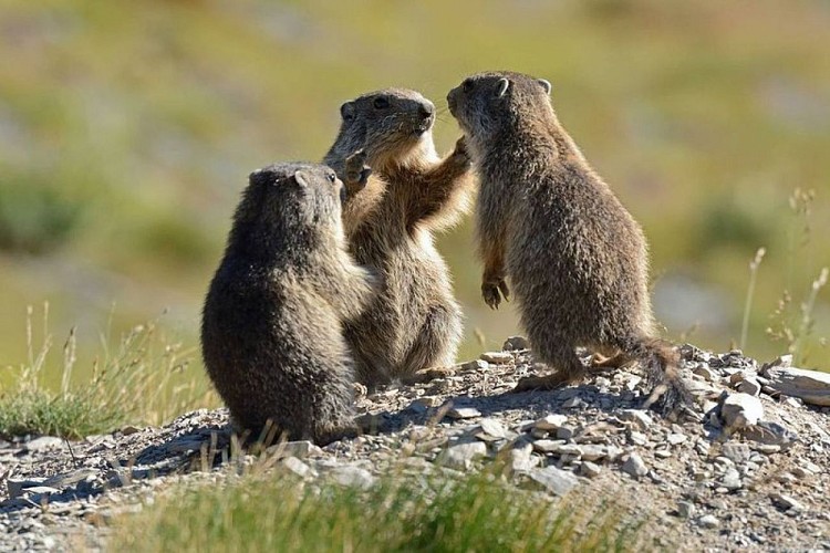
From the Col de l'Espaul, leave the Bois Garnier forest and the Lac de Beuil on your right. At the park signs, follow the dirt track which leads to the hamlet of La Colle.After the first houses, at marker 8 (directional arrow), take the Mont Mounier route which goes around the houses alongside the drinking trough and then the old sheep dips (dipping is a way of removing parasites).A wide path climbs upwards, touching upon agricultural terraces still covered in pasture. This is a very good area for seeing marmots.At marker 44, a delightful panorama over Beuil and Valberg opens up to you. At this marker, head down towards Beuil until you reach the sheep pens.Go pack up the path to get back to the hamlet of La Colle and the Col de d'Espaul, watching the delightful passerines such as shrikes or hoopoes. Migrating from Africa, this bird comes here to nest, setting a record for altitude!
Technical Information
Altimetric profile
Starting point
Points of interest
Additional information
Departure
Col de l'Espaul at Valberg (Commune of Péone)
Arrival
Col de l'Espaul at Valberg (Commune of Péone)
Ambiance
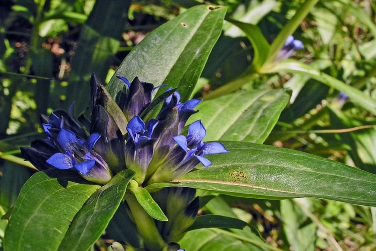
When you reach an altitude of 2000m, the lavender and broom of the Mediterranean will give way to a lunar, desert-like landscape, illuminated by brightly coloured Alpine flowers. Maybe you will be lucky enough to spot the mountain Alcon blue, quite a rare butterfly which owes its French name to the star gentian in which it lays its eggs.
Access
Go to Valberg, near to Beuil. In Valberg, opposite the chapel of Notre-Dame des Neiges, turn left onto the Route des Huerris, which rises via Avenue Jean Ray until you reach the Centre de l'Equipement.Then turn right on the Colle road and you will reach the Col de l'Espaul (1748m) carpark 3km further along.
Accessibility infrastructure
Free loan of “la Joëlette” off-road wheelchairs:
Valberg Tourism OfficeTel.: 00 33 (0)4 93 23 24 25Mercantour National Park House at ValbergTel.: 00 33 (0)4 93 02 58 23Work for adapting access at Col de l'Espaul is programmed for 2015.
Advised parking
Col de l'Espaul carpark
Public transport
No buses to Col de l'Espaul. The nearest public transport service stops at Valberg.
Lignes d’Azur - Alpes-Maritimes network Number 770 Vallée du Haut-Cians (July/August only)reservations possible at www.lignesdazur.com/ Randobus sectionTel.: 08 1006 1006
Data author
