Alert
Alerts
Lakes circuit

IGN cards


Description
A panoramic walk through the Alpine grasses, with exploration of the high mountains, including the stunning Lac d'Allos.
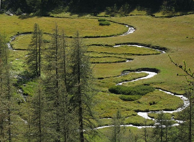
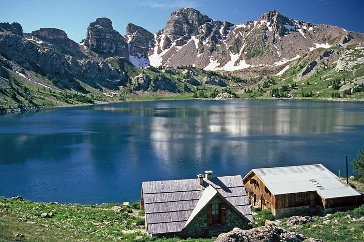
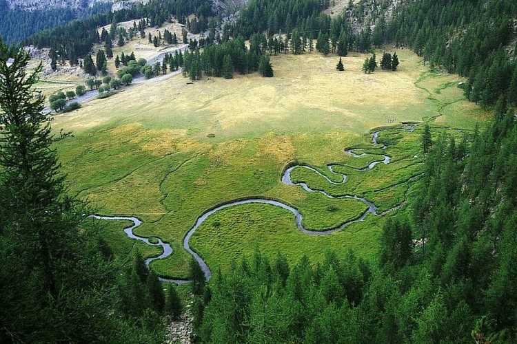
Take the path which leads to Lac d'Allos. Just after the wetland area of the Laus plateau, a fork on the left shows the way to the Col de la petite Cayolle. The path rises gently, lightly shaded by a larch forest, whose trees are bent at their base due to the weight of the blanket of snow they often wear.The path leads to the pastures of the Méouilles plateau and then continues in a series of zigzags before reaching the Lac de la Petite Cayolle.At the col of the same name, turn right, remaining on the Verdon hillside and reaching Lac des Garrets, which is nestled in rocky surroundings. Go around the lake in a westerly direction and reach the crest of the Lausson summit (2645m), the dividing line between the Var and the Verdon basins. Follow this crest until you reach the Pas du Lausson (2602m).The path then heads down on the Allos side and then joins the Méouilles plateau via a footpath cut into the rock face on a slope which has no vegetation. The plateau, in contrasting fashion, appears as a haven of peace, a large prairie across which a stream flows and which is scattered with a few larch trees.Then take the path towards the Lac d'Allos. On its banks, the refuge/hotel is an excellent place to take a break. The lakes sandstone towers provide a delightful backdrop. Follow the path which heads back to the carpark, overlooking the Laus plateau.
Technical Information
Altimetric profile
Starting point
Points of interest


Additional information
Departure
Carpark at Laus, Allos
Arrival
Carpark at Laus, Allos
Ambiance
Audacious plants grow here, where land meets sky, adorned with bright colours, such as the intense blue of the gentians, which illuminates the grey desert of the rocks which have crumbled under the effects of freezing weather, the sun and the wind. The lakes are dappled with light, azure or turquoise depending on the season, and they are nestled within an immense plateau, revealing themselves only at the last moment.
Access
At Allos, take the RD226 towards Lac d'Allos. The road comes to an end at the carpark, where you can leave your vehicle.More information on access and parking: www.valdallos.com/lac-d-allos.html
Advised parking
Carpark at Laus, Allos
Public transport
Free minibus service in Val d'Allos (Transports Haut-Verdon Voyages):ete.valdallos.com/tel: 04 92 83 95 81
LER PACA lines to reach Digne-les-Bains, Barcelonnette and NiceTel.: 00 33 (0) 821 202 203www.info-ler.fr
Departmental bus services in Alpes-de-Haute-Provence Regular/weekly services Digne-les-Bains, Barcelonnette, Larche and Digne-les-Bains, Colmars, Allos, Regional Council Transport ServiceTel: 00 33 (0)4 92 30 08 00www.cg04.fr
Chemins de Fer de Provence from Nice to Digne-les-BainsTel.: 00 33 (0) 4 97 03 80 80www.trainprovence.com
Advice
Parking payant et minibus payant.
Is in the midst of the park
The national park is an unrestricted natural area but subjected to regulations which must be known by all visitors.
Data author
