Alert
Alerts
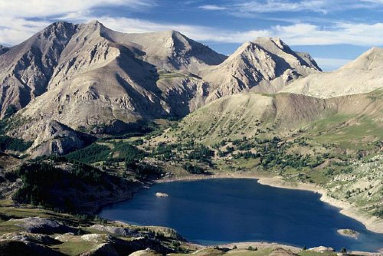
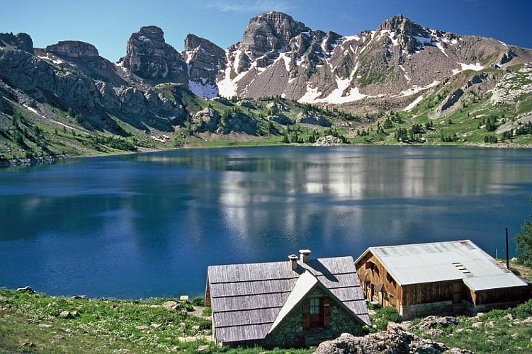
Lac d'Allos
Description
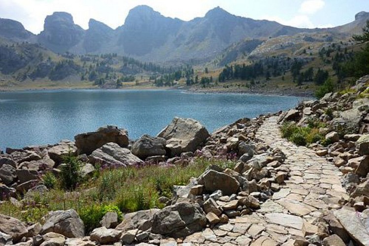
Accessible for people with physical handicaps (“Joëlette” off-road wheelchairs), the interpretation trail provides an opportunity to explore this exceptional and fragile site. Lac d'Allos is an essential site, one of the most emblematic ones in Mercantour National Park.
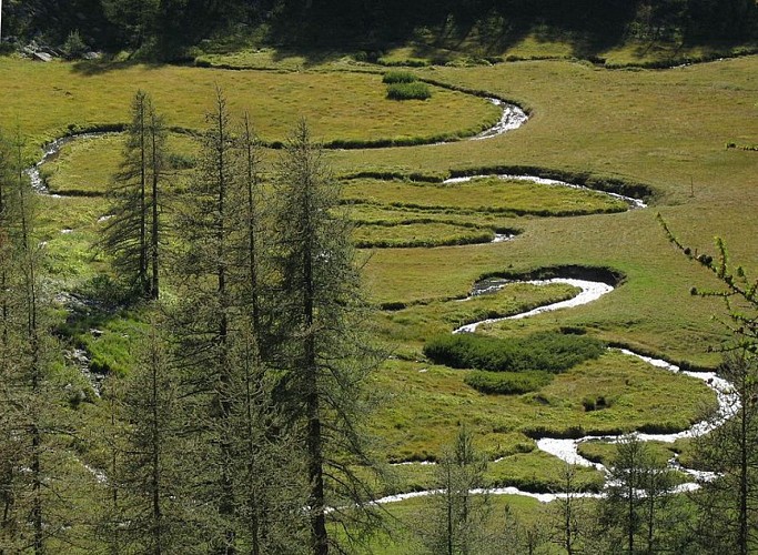
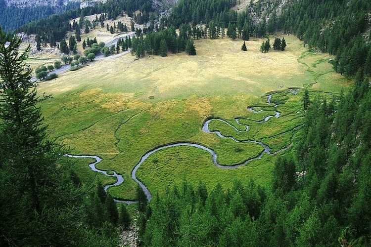
From Laus carpark, you will begin the hike via three sets of steps cut into the sandstone. For Joëlette off-road wheelchairs, take the tarmacked road which leads to the forest hut. After the forest house, follow the track (GR white and red markers) which heads into the larch forest.
Let the GR head off to the left and bear right on the interpretation trail (GR yellow and red markers). Admire the landscape which spreads out below the lake spring, which is the source of the Chadoulin river. Now leave the GR to head off to the right and go towards the lake until you reach La Chapelle Notre Dame des Monts. Once you get to the refuge, begin the circuit of the lake on your left.Enjoy the magnificent scenery, observing the marmots and chamois on the surrounding green slopes. From the refuge, use the same itinerary to get back to the departure point.
Technical Information
Altimetric profile
Starting point
Points of interest


Additional information
Departure
Laus carpark
Arrival
Laus carpark
Ambiance
Lac d’Allos is the biggest natural high-altitude lake in Europe. Situated at an altitude of 2225m, it is 48 metres deep and spreads over 54 hectares. Its main water supply is from melting snow.
Access
From the village of Allos (Department 04), located on the RD908, follow directions for Lac d'Allos.
Le Laus carpark- Restricted access:
The road is open from 26th May to 15th October (according to a municipal bylaw) up to Laus carpark
- Pay and display carpark from 30th June to 26th August from 8.30am to 5.00pm (6€ per car and 2€ for motorbikes/scooter, approx. 180 parking spaces)
- free access before 8.30am and after 5.00pm
Accessibility infrastructure
Free loan of "joelette" off-road wheelchairs:
Allos Tourism Office Tel.: 00 33 (0)4 92 83 02 81www.valdallos.commercantour National Park at AllosTel: 00 33 (0)4 92 83 04 18www.mercantour.eu Laus Chalet (summer)Tel.: 00 33 (0)6 32 90 80 24
Advised parking
Laus carpark
Public transport
Free bus service in Val d'Allos (Transports Haut-Verdon Voyages): ete.valdallos.com/tel.:04 92 83 95 81
LER PACA lines to reach Digne-les-Bains, Barcelonnette and NiceTel.: 00 33 (0) 821 202 203www.info-ler.fr
Departmental services in Alpes-de-Haute Provence Regular/weekly services Digne-les-Bains, Barcelonnette, Larche and Digne-les-Bains, Colmars, Allos, Conseil Général Transport ServiceTel.: 00 33 (0)4 92 30 08 00www.cg04.fr
Chemins de Fer de Provence from Nice to Digne-les-BainsTel.: 00 33 (0) 4 97 03 80 80www.trainprovence.com
SNCF's Accès Plus service for handicapped peopleTél.: 00 33 (0)890 640 650 then press 1or Tel.: 36 35 then say "Accès Plus"www.accesplus.sncf.comaccesplus@sncf.fr
Advice
For those who wish to, you can start from the summer carpark at Lla Cluite by following the GR56B. This will add 1 hour 30 minutes to the time required for this hike (this section is unfortunately not accessible for off-road wheel chairs).
Is in the midst of the park
The national park is an unrestricted natural area but subjected to regulations which must be known by all visitors.
Data author
